Built in 762-767, the Round City was designed by the caliph al-Mansur to be the administrative center of the ‘Abbasid Caliphate. Named Madinat al-Salam ‘the City of Peace’, it was situated on the west bank of the Tigris, surrounded by a double wall said to be 2 km in diameter, and divided into quarters, with the caliphal palace at the exact center of the circle, topped with a green dome surmounted by the revolving figure of a horseman pointing a spear in all directions. Each of the four quarters had a gate in the center. The circular design, built by Persian architects, was apparently inspired by round cities of the Sassanid period in Persia, like 3rd-century Firuzabad whose round shape can still be seen in aerial photographs.
Nothing remains today of the city of al-Mansur’s time. All information that I can find suggests that the walls and all traces of the Round City were obliterated during the later Middle Ages as the city grew into an urban agglomeration. Anyway, the city was destroyed by the Mongols in 1258.
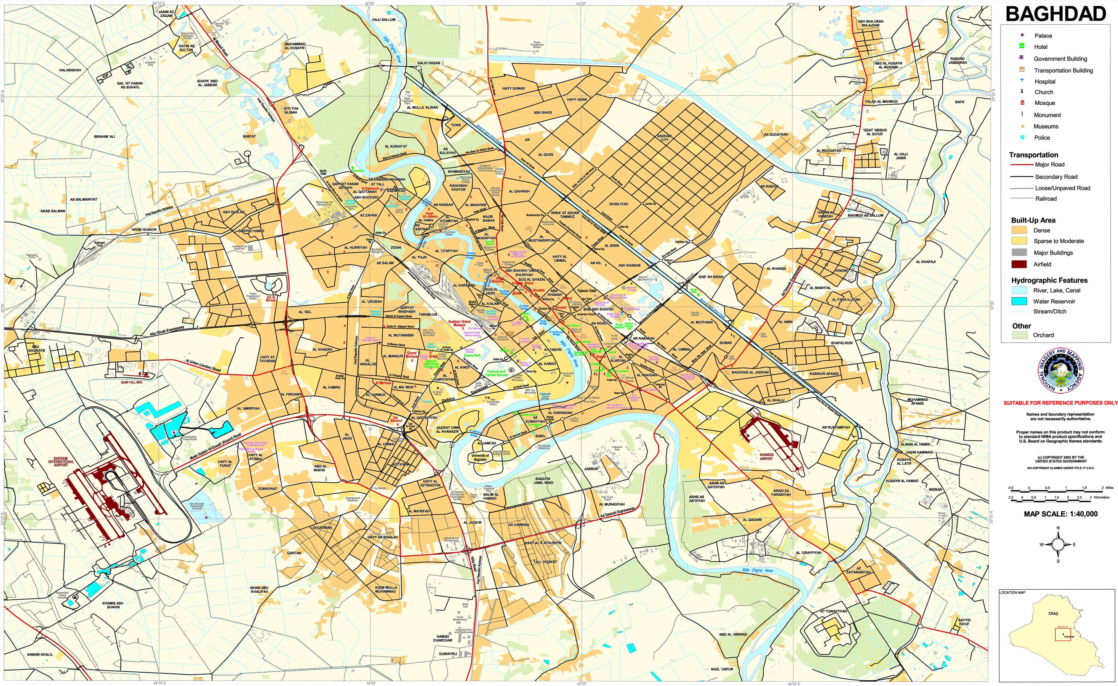
On the map of modern Baghdad, I am trying to find out exactly where the Round City was located. The Green Zone occupies much of the old quarter of the city called al-Karkh, which was founded by al-Mansur as a suburb to get the markets out of the Round City. The book Baghdad During the Abbasid Caliphate by Guy Le Strange, some of which is available on Google Books, includes a map showing the Round City about 3 miles to the northwest of al-Karkh. The same area on the modern map has been named al-Salam after al-Mansur’s original name for the city. It has a railroad yard, a bus garage, machinery workshops, a pediatric hospital, and Ba‘ath Party headquarters. This map locates the Round City site a little farther from the river than Le Strange did, but in the same general area.
Le Strange and the other historical sources I looked up situated the Round City at the intersection of the Tigris with the Sarat Canal, which does not exist today, the Mongols destroyed the irrigation system. Le Strange’s book has a wealth of geographical details from this period of Baghdad’s history, but most of it is not available in Google Books, or I would have found more of the information I was looking for.
The core of the Green Zone is Saddam’s Republican Palace complex, and I wondered if the seat of government power being situated there could be traced back to the origin of Baghdad. Instead, it was originally a suburban area of the Round City. Now the district of al-Karkh has expanded north to cover the original site of the capital, which does not appear to be a very posh area any more. Since the American invasion, it has been the site of suicide bombings.
Mesopotamia is a land of disappearing cities. The entire civilization of Sumer vanished from history for thousands of years until dug up by archaeologists. The city of Wasit, once the seat of Umayyad power in Iraq, also disappeared in the Middle Ages and its site was lost. Like the Round City, these were built of sun-dried brick, which does not endure through the centuries.