The Mississippi River make a very impressive boundary.
Indeed so. I’ve mentioned how Tennessee and Missouri share the distinction of bordering the most states. They “border” each other, but only by virtue of the Mississippi. That barely counts since one must drive considerable distances to find a bridge that gets you from one state to the other. Unless there are new ways of crossing since my latest maps, there’s the bridge on I-155 near Dyersburg and Caruthersville and nothing else actually connecting those two states.
Memphis may feel more kinship with Arkansas because of a nearby bridge, but the rest of the western portion of Tennessee is sort of isolated from Arkansas and Missouri.
Not just that, but the Mississippi is constantly readjusting its path and whatever map one refers to is probably out of date as to just where the river’s path is this week. Seeing how many islands and mud bars there are along the TM/Mo border just illustrates the way the river does its thing and anybody living in those lowlands is probably wondering which state they are in today.
I can usually tell when I’m crossing a border, what with the minefields and armored Humvees and electrified fences and the people on the other side who want to kill me and all.
Another thing that bugs me is how the weather people refer to the “Mississippi Valley” or the “Ohio Valley” or the “Tennessee Valley” as a kind of shorthand to refer to some vague geographical area. The “Gulf Coast states” makes more sense in a way because it’s pretty obvious which states have a border on the Gulf. But all one must do is to drive inland maybe 100 miles and the relationship to the Gulf is way less noticeable unless it’s hurricane season and storms still pack a big punch that far inland – and more.
But when it comes to these various “valleys” to the big rivers in the Mid-South I never can tell just what area is under discussion. Take the Tennessee as an example. After being formed near Knoxville by the confluence of the Holston and French Broad, it meanders more-or-less east to west for a while in East Tennessee, then north to south into North Alabama, then east to west across North Alabama, then south to north across Tennessee (forming a natural boundary between West and Middle Tennessee) and on across Kentucky to the Ohio at Paducah. There are all the TVA (Tennessee Valley Authority) dams and lakes along its course so that the “river” per se is sort of hard to find as distinct from those other bodies of water almost anywhere along it. And there are indeed some obvious valleys associated with the river at various places along its course. But the notion of a valley that accompanies the river is just hard to envision. There are places along the West/Middle Tennessee boundary where there are still larger and more significant valleys between the hills a mile or less from the river. Surely the river is at most incidental to their origin anf formation.
What’s this “valley” shorthand supposed to connote?
The border between Iraq and Kuwait has this no man’s land. You’ve left one country, but haven’t entered the other. There are houses and people living in this zone, I don’t know what their nationalities is.
Same thing between Kosovo and Macedonia, but there are just some cafes and stores on the zone.
Also, when you head north from Baghdad to the northern part of Iraq, the Kurds have a border that looks like an international border with troops and a blocked roadway. My friend thought we had hit the Turkish border.
Obviously, any river or mountain-crest border is going to be a clear defining point. My impression is that the OP is looking for line-on-the-map borders that correspond to some distinct difference.
A few notes: It’s been decades since I crossed the New York-New Jersey border in the Rockland-Orange County area, where you drive across a line on land, but I distinctly remember there being a clear difference in the “built geography” ambience between the two states. Likewise going south on I-81 from New York into Pennsylvania, there is an actual sense of difference which is hard to define but definitely present. First, the humidity in PA seems higher, more inclined to mist; second, there is a real difference in landforms, as the New York side is geomorphologically the western foothills of the Appalachians (equivalent to east-central Tennessee and Kentucky) while one is plunged into the mountains proper a short way into Pennsylvania.
In the heart of the winter, the Virginia-North Carolina border is obvious, because through a coincidental quirk of nature, the line between “normally with snow in the winter” and not follows the state border, arcing north to make the Tidewater Metro complex snow-free and south to include the Blue Ridge and Great Smokies in the snowy area, but for the majority of the arbitrary straight-line border, it happens to define the “we get snow for a bit most winters” break point.
Likewise, the Georgia-Tennessee line on I-75 seems to fall at the point where one leaves the Appalachians proper and enter rolling foothills country, though that may be just a misperception on my part.
While I have never been there in person, I’ve formed the impression that the border between Michigan’s Upper Peninsula and neighboring Wisconsin also corresponds to a significant socio-economic break, with the UP being a mix of quasi-wild and small-town mining communities and Wisconsin a more populated agricultural-rural character more typical of the Midwest in general. I may be wrong on this, though.
Ah. Michigan to Ohio, then?

I wouldn’t call it a “tri-state” area the way the teeny tiny northeastern states are a tri state area.
Oh, and the other border you can cross into, you definitely notice because of the border guards, signs saying “Arret,” and kph markers everywhere.
Crossing from New South Wales into Queensland is weird, IMHO. The northern part of NSW is very Queensland-esque in appearance. It’s all banana plantations and such, and looks decidedly sub-tropical. And the bit of Queensland immediately across the border is more like NSW, there’s just a half-arsed sort of eucalyptus vibe happening, so it feels like you’re crossing the border backwards. Also, I didn’t notice any sign at the border, so I was driving for a few minutes unsure of which state I was driving in.
Crossing into Victoria is hard to miss because, not only are there signs, but the border is a big river. Even without signs or the river, you’d know anyway because the road surface suddenly improves a zillion per cent.
Crossing the border from New South Wales into the Australian Capital Territory always used to be obvious (apart from the big sign) because the road immediately became better: better maintenance, better line markings etc.
I-90 along the souh shore of Lake Erie, it’s easy to tell what state you’re in after you’ve driven it a few times.
Ohio: wide median with a consistent width, few billboards.
Pennsylvania: very straight, narrow median and right-of-way, many billboards (though not as much as you would see in Southern states), an Appalachia-like feel (lots of mobile homes, run-down properties, etc visible from the road).
New York: gently curving parkway-like feel with an extremely wide median of variable width and a wide and right-of-way, billboards only on the Seneca reservation, much shorter trees than in PA or Ohio.
The start of billboard clutter is a very good indicator of where a state line is.
I-25: Colorado - no billboards; Wyoming - everywhere
I-25: New Mexico - some billboards; Texas - yee-haw!
Missouri - billboards absolutely everywhere; Iowa, Illinois, Kansas - much less common
Ohio - not many billboards; Michigan - everywhere
Similarly, going from NY to PA on I-15 you leave the “Southern Tier” and get into Pennsylvania’s real mountains (even though this doesn’t happen right at the border.)
And the housing layout in Pennsylvania’s small towns seems different. There doesn’t seem to be as much of a front lawn in most small towns in Pennsylvania: you can almost tell you’re in NY when there is a front lawn even when the house is on a hill.
I can always tell when I pass from PA into Ohio. The roads instantly become smoother. Yay Penndot! Not!
I was going to say the same thing.
On the NY side of the border, roads seem wider, houses in villages and towns are on larger lots, and there’s a feeling of spaciousness. In PA, villages and towns seem more crowded, and roads seem much narrower and cramped. Houses are much closer to the road. In small PA villages and towns, rowhouses are more common; on the NY side of the border, they’re rare.
The PA side of the border also seems more Appalachia-like and “rugged.” Huge “YEAR ROUND HUNTING” billboards greet those driving into PA at many crossings. There’s more “rugged” businesses on the PA side - truck dealers, gun shops, chainsaw dealers, and the like. Mobile homes are more common on the PA side.
Sorry for the immediate followup.
The other PA thing I’ve noticed; in rural areas, along state roads, there’s large-ish wooden shelters with ads posted on the side, spaced about a mile or so apart. The shelters look the same everywhere in the state; there’s almost no variation in design. I’ve never seen such shelters in other states. When I see those shelters, I know for sure I’m in PA.
One of those things that helps to recognize the change from Alabama to Tennessee is how the pines of Alabama give way to the cedars of Tennessee. Not that there aren’t both varieties in both states, it’s just that the dominant conifer shifts almost at the state line. Seeing a big stand of pines in Tennessee, especially in Middle Tennessee, gives me the impression that they were planted and didn’t come up naturally.
In the Deep South states as one nears the coast it’s Spanish Moss and Live Oaks, but this rarely helps to define a border area.
Surely you’ve seen those maps that indicate the range of a tree, a plant, a bird, or some wild animal like wolves, coyotes, armadillos, etc. I have wanted to find the borders of those zones and start exploring to see if the item in question actually quits appearing beyond those points. There are even maps like that for soil types and rocks. I guess one could use those maps to chop down a tree that had grown up illegally in the out-of-range zone? Or even better if you try to transplant a “foreign” tree in the out-of-range zone, it would just die on its own.
If an out-of-range bird flies out of its range, it just dies and falls to the ground. I suppose that would be a way to locate the boundary: just look around for a line of dead birds.
Maybe they should modify those range maps for things like possums, coons, and other frequent roadkill, by indicating that they don’t live near roadways. But I guess that would be too finicky.
I always thought that driving I-75 south, the geography changes markedly at the Ohio-Kentucky border and again at the Kentucky-Tennessee border. The flatness of Ohio starts to give way to hills as you approach Cincinnati, then the hills of Kentucky eventually give way to the rock formations of Tennessee. Then when you hit Geogia, that red clay is very much evident everywhere.
Even within a state, when one crosses the Mackinac Bridge and enters Michigan’s UP, the difference in geology is striking.
Similarly from PA into MD. Those Maryland roads are smooth, smooth, smooth. The difference between the NY and PA road surface is less distinct, but there’s a noticeable lack of constant road work on the NY side.
Hee! You can always tell when you cross from Maryland into PA via Rt. 15 (the road to Gettysburg), because the road starts rattling your bones all of a sudden. PA roads have to be the worst I’ve ever seen (and I say that with love, since that’s my home state).
Now I live in Montana, and I can tell when I pass into Wyoming going south to Sheridan or Gillette – the Wyoming back roads are red and/or have a different quality of black-top. Also, and I could be just imagining this, the terrain and plant life seem a little different: Wyoming seems to have sage brush that grows in larger clumps.
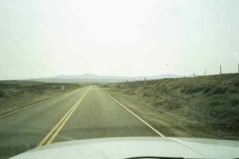
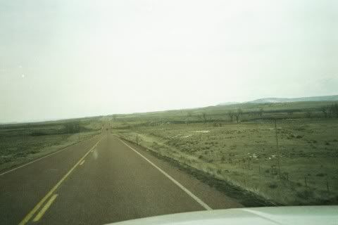
I have to share these pictures I took last year on the way from my town in southeastern Montana to Gillette, WY (very northeastern part of the state):
Desolation in Montana vs. Desolation in Wyoming
Notice any difference? laughs the maniacal laughter of the Extremely Isolated
Seriously, though, there is a difference in terrain. Terrain in northern Wyoming. Terrain in southeastern Montana.
I live on the Minnesota-Wisconsin border and there isn’t an obvious difference in topography between the states. MN is more developed since it is so close to the Twin Cities. WI is not far behind, with this area of the state being among the fastest growing.
However, I went on a road trip this last week and here is what I encountered on the interstates:
Wisconsin: free
Illinois: pay
Indiana: pay
Ohio: pay
Obviously I could tell the difference there. I prefer the toll free Interstates of MN/WI.