I am also inclined to agree with the OP. Part of the explanation might be that the boundaries of the American states haven’t changed at all once they were defined. Compare that to, for instance, Germany, were the internal borders have changed radically over the centuries. Some of the states (“Länder”) that make up modern-day Germany were even created, you might say: artificially, fairly recently, after 1945.
Or they were. In recent years the iconic shapes of several major have been changed—I would be hard pressed to identify the current shaped of Bihar, Uttar Pradesh, Madhya Pradesh, and, soon, Andhra Pradesh. These are all large states whose former shapes were just as iconic as any U.S. state.
The Australian States are far more iconic than the American ones, helped by
a) There being only 6 states and 2 territories
b) All the states and territories bar the ACT (The Australian equivalent of DC) adjacent to an ocean, meaning no boxy square states.
c) All states bar Tasmania sharing a straight land border with another state, making land an ocean boundaries easy to distinguish by shape.
Additionally, I would argue the provinces of China are all very easy to distinguish from each other and people identify strongly on which province they are from/live in. However, I will admit that the lack of straight line borders seem to make memorizing shapes much harder. Straight lines allow you to reduce a state’s mental description to a more easily digestible form.
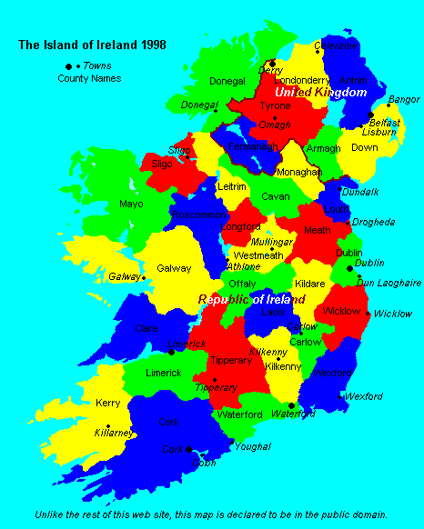
The Irish counties would be pretty recognisable to anyone from Ireland, even out of context, and you’d certainly recognise your own even if you didn’t recognise the others.
I can’t promise I’d be able to recognize each of the 50 Spanish provinces, but at least 40 and that’s with a blinding migraine. Being asked “which province is this” would be easier than being asked “what is this blob”, too - Cuenca for example is very distinctive as a province but not as a blob, whereas Álava/Araba, Saragossa or the Islands are all very distinctive blobs. I would recognize all the Autonomous Regions.
Do I expect a foreigner to recognize them? … the general shape of the country yes; the big archipelagos, yes but not so much (I’d be very surprised if someone from the UK told me he didn’t, not so much someone from Ghana or Nepal). To know that the Canary Islands are two provinces and that the Balearics are one, no, there’s no reason why they would.
Perhaps an interesting question would be “In what other countries are the shapes of sub-national entities used as icons as they are in the United States?”
I think what’s different about the shape of US states is that most of them are based on a combination of straight lines and natural features. Like, my home state of Ohio has straight lines on the east and west, a southern border made up of a river, and a northern border made up of a combination of a lake and another straight line. The natural features save them from all being just boxes, and the straight lines save them from all being just blobs.
I lived in Auvergne, and yes, I can’t tell it apart. Same with Limousin, Ile-de-France and Brittany where I lived. I couldn’t recognize Champagne-Ardenne (where I never lived) from its shape, though.
However, the shape of regions is rarely used or displayed in France (except on regional TV), and regions have much less significance for a French citizen than a state has for an American. Presumably, Germans would be more aware of their landers, or Swiss of their cantons, since they’re federal states.
That said, even though French regions indeed look like amorphous blobs, I really don’t find American states silouhettes appealing, and let alone “unique” with their boring straight lines : “Hmm…a kind of big square/rectangle? Must be an American state”.
Going back to that “Britons trying to identify American states” thing, I’ve lived here for 20 years now and I can basically only do the South, the eastern seaboard up to Virginia and bits of the Midwest and the West Coast. I am totally lost on the West and Northeast, to my wife’s neverending amusement.
Well, maybe not in all of them, but there are (or at least were until quite recently) certainly strong sectarian divisions between Maharashtra and Gujarat.
Yes, most state boundaries being a combination of straight lines and natural features does make them easier to recognize.
Looking at the states this way is a good test: http://i.imgur.com/KfIhxkf.jpg, thanks to Leo. I got hung up on S. Dakota, and on CO & WY. It’s tricky.
I also think we Americans identify with the state we are from because historically there has been a (conflict? too strong a word) push/pull between state laws and federal laws, maybe more so than in other countries…?
Oh yeah and we also make fun of neighboring states too, like when I grew up as a kid in Upstate NY and all the women of NJ being cows, and all that. There are some good (as in humorous) state-to-state rivalries out there.
Am also surprised nobody has mentioned How the States Got Their Shapes yet. A good show at first but then later episodes got boring.
There are only three: Colorado, Utah, Wyoming. And even then Utah’s northeast corner makes it instantly recognizable.
And, okay, North and South Dakota are somewhat similar and easy to trip you up.
Not really the case in France. Following the revolution, the country was divided in “départements” (the equivalent of a county) whose borders were deliberatly drawn in such a way that they wouldn’t follow the borders of the former provinces (that had a variety of different statutes, customs, privileges, courts, taxes, etc…) in order to create an unitary state.
During the 70s, they created a “région” level above the départements. Most were given the names of (some) of the ancien régime provinces that roughly corresponded. For instance, the modern “Limousin” région mostly covers the ancien régime provinces of “Limousin” and “La Marche” minus some parts to the north and west plus other parts to the east and south. Very soon, the number of regions will be drastically reduced and as the result the dozen of regions left will have even less to do with historical provinces.
Note that even though their exact shape is probably unknown to mostly everybody, the name and general location of the former provinces are generally known. For instance, most people could tell you where are Anjou or Perigord, or might mention they went in vacations there even though they don’t correspond to any modern administrative division.
Hmmm… I disagree. They might have funny corners or something, but apart from the East coast, states mostly all look roughly like rectangles.
Canada’s are all pretty distinct, and some do involve straight lines. Saskatchewan, like Colorado and Wyoming, is almost a … whatever you call that shape. It’s not a true rectangle. (The eastern border has a few jinks, but you wouldn’t notice unless you looked at it very closely.)
Wyoming appears to be a perfect rectangle, other than the jinky northwestern border that runs through the Shoshone National Park.
Oh that’s interesting, I never knew it did that. I wonder why? And I don’t think Colorado’s border takes any turns, does it?
Okay, I understand what you’re saying and I don’t disagree. Maybe I’m being too literal, but hey this is GQ right?
No clue. If you zoom in on the area in Google Maps it looks essentially random. There are elevation changes in the area but the border doesn’t track them at all.
As a non American I can clearly see the difference between Colorado, Wyoming :smack:
And that square shape looks really iconic - NOT!!!
The only state shape recognizable would be Texas - the rest looks like they are just random lines and individual states are unrecognizable for anyone outside of the US…and I bet even US Americans will have problems distinguishing which square is Colorado or Wyoming.
Texas I recognise from a childhood of using TI electronic components. I think that’s maybe the only national subdivision I would instantly recognise - so you win on that one.
Wyoming I would recognise if I knew that the shape I was looking at represented a geographic area, otherwise i would assume I was looking at some other category of rectangle.
Florida I might get.
The rest, probably not, but I guess that’s still a win, as I could probably not recognise the shape of any of the subdivisions of other countries, including the UK, including the county I live in (Hampshire) without labels.
But I wonder how much of that is because US states are a bit of a different, bigger, more divisive thing compared the subdivisions elsewhere. I identify my location as ‘Botley’, which is ‘near Southampton’, but then it’s ‘on the south coast of England’. I hardly ever have much reason to mention the county I live in (this thread being the exception).
I might be going out on a limb here, but I think for most people outside of the US, the shape of their country as a whole is the iconic thing.