The city of Chicago has a grid numbering system for streets, with the “zero point” being the corner of State Street and Madison Street in the Loop. Some suburbs follow the Chicago numbering system, while others don’t.
There is a street, about four blocks from where I live, which serves as the border between two suburbs; one of those towns (the one in which I live) uses the Chicago system, while the other town uses its own protocol. Due to this, as you drive north on that street, the houses on the the right (east) side of the street have house numbers with 30xx, 29xx, etc., with the house numbers getting smaller as you go north. On the left (west) side of the street, houses are numbered 11xx, 12xx, etc., with the numbers getting larger as you go north.
In Chicago, all odd numbered buildings are on the east side or south side of the street. West/North are even. Does that scheme stay the same?
Put another way if this is easier for some to picture:
Imagine a square. In Chicago all odd numbered addresses are on the bottom and right side of the square. All even numbered buildings are on the left side and top of the square.
It may seem a small thing but if you know this you are not looking left and right for the place you want to be. The address will tell you which side of the street it is on.
ETA:
Always seemed a bit odd to me. Do you know why that was chosen? I mean, there is almost no “east” of that place (a little but not much).
If you’re asking about my example: yes, it does. Even numbers on the west side of that street, odd on the east side.
I think that the town that’s on the west side of that street has, as its numbering scheme, a zero point that’s at (or very near) the town’s southwest corner. They don’t have East/West or North/South demarcations on their streets; street numbers there ascend as you go east or north from the SW corner of the town.
Unclear to me, based on a bit of googling; I might suspect that it was chosen, not because it was the center of the city (because it clearly wasn’t), but because it was at, or close to, the center of the downtown district.
Odd numbers one side, even on the other is standard in US and Canada, AFAIK. What I am asking if there are instances of numbers actually out of order as here 815, 865, 845 as you go down the street. Delivery people are confused,
The would be, traditionally (if that’s the right word), 37th and Honore, where there’s a marker in front of the church there (St. Andrew Lutheran.) However, the true center, according to WBEZ, is just south of 31st and Western in the S&S canal. I think the annexation of O’Hare pushed it out there.
They started with named blocks instead of with named streets.
It used to be an example for Electrical Engineering students: you can reference point voltages, or connection currents. Tokyo choose a different reference system than Rome.
Montreal has some streets with house numbers beginning with “0” (zero). This dates back to a massive renumbering which took place mostly in the 1920s. E/W streets are numbered increasing from 1 east and west of St-Laurent (St Lawrence) Blvd, with numbers lining up so that 4000 on street “x” is directly north (or south) of 4000 on street “y”. N/S streets are numbered increasing from 1 at the St Lawrence river.
The exception is/was streets with the same name on both sides of the Lachine canal (a short distance north of the river). North side - they increase from 1 starting at the canal. However - south side numbers increase from 01 at the river (the lowest number today appears to be 0621; the highest 01364). Due to renaming of streets on both sides of the canal, I think only one street still uses this numbering (to avoid duplications); at least one other still has the “0” numbers on some buildings, but it’s not necessary due to the recent renaming of the south half of the street.
That’s a fairly large exaggeration you were told. In the major cities you can find police boxes (kōban) at major intersections, and/or near train stations. There are a lot of them (6000 in the entire country), but not nearly as many as “every couple blocks.” I don’t have much experience with smaller cities and towns, but I suspect the spacing is even further apart. They also serve a lot more purposes than giving directions, as the major backbone of community policing.
When I was living in Japan in 1980, I missed the last train segment on the train ride home one Friday night, around midnight. it was only 3 stops away, about 6 km, and I was young and healthy, I didn’t have cabfare (which doubles after the trains stop) and in those days the only ATMs they had closed at midnight, so I thought I would walk it. But I didn’t have my map with me, and I got hopelessly lost. After 3 hours or so, I happened upon a local kōban that was open (maybe they are all open 24/7, I don’t know) and they pointed me in the right general direction, but their local map didn’t go that far. It took me another 3 hours to get home, and I must have walked around 30 km.
By the way, kōban are bigger than just a booth. The one I saw had two rooms, one in front and one in back, and even at that hour there were 2 officers manning it.
Then there’s Todd Loop in White Rock (Los Alamos) NM. It’s not so much that the numbers are “out of order”, it’s more “waitaminnit, this was your idea of ‘order’, seriously??”
Our street originated as a country road with widely spaced 1900s villas at intervals down one side, and cow pastures on the other side. Over the years the wide spaces got infilled with newer houses, usually numbered a,b etc to keep the numbering scheme regular. When the New Town got built in the 1950s over the cow pastures the even numbered side of the street came into existence, often very out of step with the numbers on the other side. For some reason the block of apartments next to me is numbered in the same sequence even though the entrance is round the corner in the intersecting street. Even policemen knock on the door wanting to know where a number is. The next highest after ours is right down the other end of the street on the other side. We were primed to answer this question correctly as children as so many delivery drivers and mailmen came asking it.
I used to deliver pizzas and knew of at least one house, possibly two (memory is imperfect), in my delivery area whose street number was out of order. I also knew of a street, a short one, only one or two blocks long, where the numbers were on the wrong side of the street. That is, normally in this metro area, the even numbers are on the S and E sides, odd numbers on the N and W. But this street, a N-S one, had odd numbers on the east and even numbers on the west.
Now such an inversion can happen if a street is basically a U-shape. Part of that street is going to have the numbers on the “wrong” side and also increasing in the “wrong” direction. But this street was straight, so someone got things wrong when they numbered the houses.
The numbers on our road seem to be out of order if you go by the ends of the driveways. From south to north on this side, you’ll pass the driveways for #31, then #41, then #35. But if you go by the positions of the houses, the numbers make sense, because #41 has a long L-shaped driveway and the house is actually a little farther north than #35.
My son lives in Redmond, WA. Now in the entire Seattle area, maybe in all of King’s County, houses are numbered according to their relation to an arbitrary point in downtown Seattle. Thus, his house number is 96xx 174th place NE, which means that he is 96 “blocks” (by some arbitrary measure) north and 174 blocks east of that arbitrary point. His street bends a bit and his next door neighbor has an address something like 173xx 96th Ave. EN because it is more east than north. 'Tis an odd system, but it mostly works.
The numbers in my small town was the distance from the main road to the house (dropping the final digit). This made sense, since not every lot would have a house, but if the fire department had 3615 as the address, they knew it was 36150 feet from the main road.
The numbering system is used in all of Japan, not just Tokyo.
The number by order of when they were built was a joke told by ex-pats that became an urban legend. It goes way back, I heard it first in 1981. It’s good to see that the urban legend still has wings.
Traditionally, plots of land were just given the owner’s name. The first systematic numbering system dates to the Meiji Era when Japan started modernizing, including a starting a national postal system. This was started in the 1870s.
Neighborhoods or small areas are named and these are often divided into sub-areas, called 丁 cho, usually between three to five, but can be more or less. When numbered they become chome.
Each block in a cho is numbered. There can be any number of blocks but often between 10 to 25.
The house numbers run around each block.
A typical address would be somewhere like Sakamoto 3 chome 13-2, or abbreviated to Sakamoto 3-13-2.
Just as knowing that you are in Irvine, for example, won’t help you Huntington Beach unless you know the area or have a map, knowing which neighborhood won’t intrinsically help you find another.
They generally don’t post the names of the neighborhoods, the cho, or blocks. Knowing the address of a particular house doesn’t necessarily tell you the address of the house across the street. It could be a different cho or even a different neighborhood.
GPS and smart phones has made navigating so much easier.
As it happens, I was at a similar address last night. Kind of confusing, because it’s so rare in this city. Residential street with a string of T intersections all down one side.
The "other* side counts up even numbers as expected, but on the intersection side, there are no counted houses. All of the houses are numbered for the intersecting streets: they are all big corner lots, 1 and 2 on those streets.
So when we get to the end of the street, we are on 46-48-50 on one side, and suddenly, out of nowhere, 9,11,13,15 on the other side.
When I was at university, 2 buddies and I rented a place with the street address 241 ½ D. The lot was divided back to front, and then the owner of the back half built a four apartment row block, with each apartment given a letter.
Venice is another famous example of a city with an opaque numbering system for houses. That’s because the house numbers are not allocated by street; rather, within each of the city’s six districts (sestieri), buildings were numbered counting from 1 upwards. Here is a map of Venice with house numbers overlaid.
Friend of mine related the story of how his wife who worked for the phone company, was trying to set up a phone move for someone on a native reserve in northern Canada. (Many years ago…) The conversation went in circles…
“What is your current address?”
“57 Smith Street”
“Where are you moving to?”
“57 Smith Street.”
“The same house?”
“No it’s the house across the street and down a ways.”
“What’s the address for the new house, then?”
“57 Smith Street.”
After going in circles for a few times, she finally figured out the situation - to simplify things like mail delivery, they were just taking the numbers off their old house and putting them on the new house. It was a small enough community that anyone living there would not be confused by this. Tying a number to a specific plot of land was not a familiar concept.
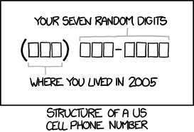
Which mindset is echoed now in telephone number portability. My phone number is my “address” within the worldwide phone system.
But now I take it with me whenever I move household. I’ve moved states once, area codes twice, and carriers about 5 times since I got the number that identifies “me” as me. I just pry the digits off my old location and attach them to my new location.
The very term “area code” is obsolete. But like the term “dialing” for entering the destination phone number to start a call, that term will far outlast its literal real-world meaning.