Mountains? Similar dark patches are just West of Denver, extending North from Salt Lake City along the “back” of Wyoming along various mountain ranges, and extending up into Montana above Billings where Glacier Park is.
I don’t know whether the angles of the mountains deflects moonlight, (like Radar being deflected from the angled facets of an F-117), or whether the mountains have denser conifer forests that reflect moonlight less well.
The darker patches do match some of the more rugged terrain.
I’m always intrigued to look at these images and note whcih cities aren’t as bigm, or are the shape, as I expect. You’d never guess from this that Los Angeles is the second biggest metropolitan area in America, would you? It looks smaller than Chicago, though we know it is not. But that’s because it’s hemmed in by mountains and desert, I suppose, while Chicago is spread out. Miami looks really compressed. Toronto appears to be smaller than Atlanta, though it’s certainly not. The Jersey side looks as big as New York City. Boston is strangely UN-concentrated. Again, most of these are explainable by the geography of the areas, but it’s cool.
Yes, that’s a result of the territorial settlement plans (starting with the Northwest Ordinance), where the federal government began to exercise dominion over territories that had not yet been settled (by whites, obv.). Since there wasn’t much there, the national government considered itself free to define counties by metes and bounds instead of anything relating to political or geographical features. It goes down much smaller than the county level too. Political maps of the various incorporated and unincorporated suburbs around any Midwestern city aren’t as regularly rectangular, but they’re all defined in parallel lines and right angles. Quite a contrast to similar maps in the East, where it’s pretty much always based on rivers.
I like the way SD’ers will just slip technical stuff in under the wire.
Beating the bounds sounds pretty weird, how you could whack young’uns every foot of the way around the perimeter so they’d remember it the rest of their life.
Now we just perambulate. And in parts of US it’s still the law, forever. Wiki, in typical stupidity, gives the follow not specifying whether Massachusetts or New Hampshire:
TITLE III
TOWNS, CITIES, VILLAGE DISTRICTS, AND UNINCORPORATED PLACES
CHAPTER 51
TOWN LINES AND PERAMBULATION OF BOUNDARIES
Section 51:2
51:2 Perambulation of Town Lines. – The lines between the towns in this state shall be perambulated, and the marks and bounds renewed, once in every 7 years forever, by the selectmen of the towns, or by such persons as they shall in writing appoint for that purpose.
Source. RS 37:2. CS 39:2. GS 47:2. GL 51:2. PS 52:2. PL 56:2. RL 69:6.
Hmmm. Well, I suppose there’s the germ of understanding hiding in there somewhere, but it doesn’t fight ignorance very vigorously.
The only thing the federal government did was to survey all the new territories into rectangles. That made it easy for settlers to purchase the land and eliminated the metes-and-bounds system that had proven so contentious and litigious in the trans-Appalacian West.
As the states organized, the square townships proved an easy way (for the states, not the federal government) to define the new counties. In some states, individual townships themselves became units of local government. These townships sometimes incorporated as municipalities or were annexed by nearby municipalities, giving Midwestern and Western cities rectilinear borders. Others became rectilinear as particular landholdings—themselves quarter-sections or sections—were developed and annexed.
Exactly. If you fly over the US, any agricultural area especially, it’s pretty obvious. Squares? That’s “township and range.” Irregular shapes? That’s “metes and bounds.”
Recently I was flying over Ohio, which because it was part of the Northwest Territories, I assumed was all “township and range” – i.e., square. But then I noticed a distinct area of (irregularly shaped) “metes and bounds,” somewhere WSW of Columbus, I think.
Sure enough, turns out this was an area where the US government doled out land to Revolutionary War vets, just BEFORE the Northwest Ordinance (when no one really knew what was out there, BTW.)
See? Flyover country isn’t always so boring, if you care about historical geography (or biogeography, or geomorphology…but those are different stories…)
The Virginia Military District, which was an area of great contention through the better part of the 19th century because it was not part of the Public Land Survey and titles were often unclear or under dispute.
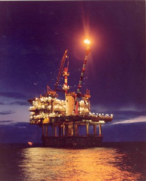
I am not convinced it is necessarily flares. I would think the rig lights may be just as bright at the flares. Do oil rigs have a flare going most of the time?
re: flying over the country:
Many years ago I had a young man in my 7th grade science class. Whatever we were discussing prompted me to pull down the map of the U.S. The conversation focused on flying over Nebraska, as I remember, and as we were all looking at it, Noel asked, “When you’re in an airplane, can you see the letters?”
Via the comments on that I found this - a map of the USA consisting solely of streets. Amazing how detailed a picture it gives you of the geography and terrain considering it is nothing but black lines showing each road.
The night photo really illustrates something I asked about in this thread about US population density and that apparently line down the centre of the country.
Without looking, I think I remember discussing in that thread how the drier/wetter boundary line roughly connecting San Antonio with Minneapolis is there partly because the region east of this line is north of the Gulf of Mexico, where a lot of the atmospheric moisture that falls there is generated.
So is the consensus here that those strings of evenly spaced lights all over the map, and particularly in the midwest, are evenly spaced towns that developed around watering stops on railroads and that also became convenient spots for farmers to travel to, hence - towns and cities?
For an urban design studio class I took years ago in a Bay Area university, the assignment was to come up with a plan and design for that very abandoned-interstate-right-of-way in San Francisco. I remember my design tried to create this sort of curvy, Romantic-English-Olmsted park in that linear zone. My idea seems silly to me now, but the instructor liked it for some reason. At the time, most of the right-of-way was being used for parking lots – which (in areas where there is a demand for parking) is a typical use for places with no short-term destiny, but which will probably be redeveloped eventually with more permanent structures.
Not quite. As others have mentioned, the railroads generally went on diagonals. The more grid-like pattern you see owes at least as much, if not more, to the spread of motorized vehicles since about 1915. Most of towns you see were founded during the railroad era (some of them even before then, e.g. in Ohio), but the population hierarchy you see today has evolved since then, more or less following some of the predictions of Christaller’s Central Place Theory.
I’m afraid your link didn’t work for me, and I’d love to read this! Maybe you could give us the author and title or something - thanks!
Sounds like you might enjoy a book I read this year: Andro Linklater’s Measuring America: How an Untamed Wilderness Shaped the United States and Fulfilled the Promise of Democracy.
That’s it! What a mess. Good little Wikipedia article. Interesting how Ohio State University is the third-largest in the country partly because it so aggressively claimed title to legally ambiguous parcels in the Virginia Military District.
Like I say, you never know what you can see from an airplane until you start digging…or start Doping!
P.S. To CC: Your synopsis of this thread does give the basic permise (one of them, anyway) of Central Place Theory, so right on.
Never mind – found it. Good observation – that in the US, we gernerally parceled the farmlands first, and then figured out how to get the transportation to work around that – part of the reason we were relatively quick to all but abandon railroads (for transporting people, at least).