This was on an episode of the BBC programme “Coast”. Originally, the fort was built a large distance away from the coast. The sea there is particularly wild, and they showed boulders that had been thrown hundreds of metres by waves.
I seem to recall from the same programme? that they weren’t forts as such but livestock enclosures but I could be wrong.
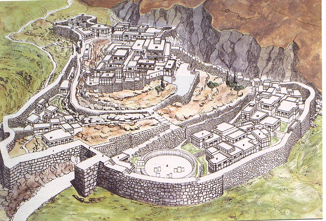
No. That map is confusing. Mycenae is on top of a hill.
That is an exceptionally confusing map. Here is another version which looks to be the same exact drawing. What the hell? It clearly depicts a huge cliff looming over the citadel. I’ve been looking around for another, more lucid reconstruction of Mycenae, but that appears to be the most popular one.
Note to the people of Mycenae: your citadel has been in ruins for millenia. You don’t need to distribute false and confusing maps that feature made-up terrain. You are annoying potential tourists. Schliemann is dead too; he’s not going to steal any more of your stuff.
On a practical matter, no cities would use any such arrangement. Cliffs restrict movement and movement == trade, which the cities need to survive. C’est la vie. Town, maybe. Fortress, sure. City, no.
It’s definitely a confusing map, but I don’t think deliberately so. What you’re taking as a cliff, is in fact a representation of a ravine, which is indeed what is there (see this comparison).
Please don’t be put off! Mycenae is a fantastic site in a beautiful setting. There’s now an excellent museum their as well, where you can see (amongst other things) reproductions of the gold grave goods Schliemann found. The originals are in Athens - Schliemann didn’t steal anything.