Can someone point me to the right kind of site to find the answer to my question about the Dead Sea?
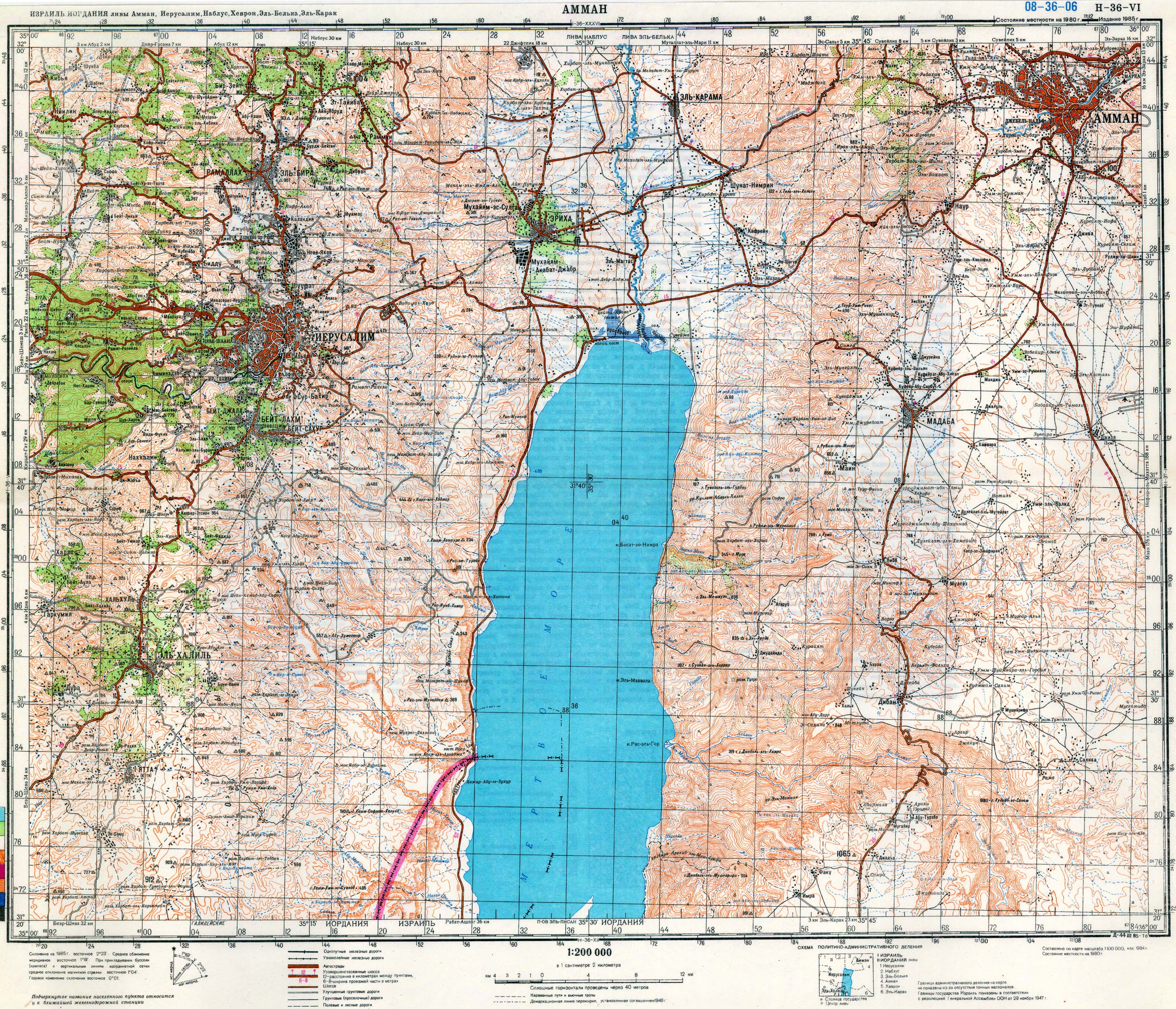
It’s supposed to be about 1300 feet below sea level. What I’m curious about, is how far away would you have to travel to reach sea level itself. Are there geology sites that would have this kind of information?
You would “reach sea level” as you ascended out of the rift valley that the Dead Sea is in, rather steeply to the west and IIRC the east, somewhat less so to the north and south, but in any direction from the shore of the Dead Sea, you will be going uphill and at some point reach an altitude of ‘0’ relative to mean sea level. (Obviously there will be no actual sea at that level, since the Dead Sea is at the bottom of a below-sea-level depression.
duhhh…
you know you’re at sea level because there’s a big straight line carved into the cliff at the side of the road, and painted blue (like water…get it?) with a sign saying “sea level”.
And there’s a guy there with a camel.
A camel with a really fancy, traditionally decorated saddle.
So you can have your picture taken riding on a camel in the desert while you’re below sea level.
While the locals drive by and play “guess the nationality of the tourist bus”.
The maps I’ve checked seem to indicate that you can reach sea level within less than a kilometer from the sea itself. How precise an answer do you want?
Off topic, slightly, but there’s a similar sign near Badwater, Death Valley CA. Pretty far up the hill, though not really that remarkable to note. Distances in the desert are a little surreal to begin with, but there’s no feeling of, well, being submerged or anything. In case anyone wonders.
