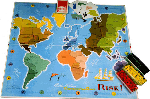
I first learned basic world geography playing Risk! On that game board, Greenland is huge.
Even on 1:1 scale, with the proviso that the globe is still perfectly spherical, and the triangles are non-zero size, and “embedded” in the sphere, and by “equilateral” we mean that the sides are segments of geodesics of the sphere, and are equal in length as measured along the sphere, not in the space it’s embedded in.
Granted, for human-sized triangles on an earth-sized sphere, the difference would be too slight to notice by a long shot.
That’s why I’ve never trusted the Australians. They’re just waiting down there, biding their time, mark my words.
You not say Ukraine weak!
That was a concession to the Atlantic ocean lobby, who wanted to split up the Pacific and downplay it’s size.
That photo is actually a wide angle distortion. I’d guess that it shows a view from three or four thousand miles up. (About half Earth’s diameter.) The photo doesn’t come close to showing an entire hemisphere. It’s like taking a picture of someone’s head from from 6 inches away – the closest features will be exaggerated.
That’s more like it.
I posted a comment on the blog and she deleted it almost immediately. I hope this person isn’t really a college professor, although unfortunately I can’t say I’d be shocked if she was.
I’m still wondering why the OP is “outraged”.
AWB, I’m reminded of Bill Clinton’s musings on “what the meaning of ‘is’ is”. What gives you the idea that I *am *outraged, present tense?
I find it odd that the Mercator projection, no matter how common, is assumed to be accurate. You’ll see various maps throughout your schooling, and, if you have a good school, even have a whole class about projections.
But, even if you don’t, why in the world would teachers teach about the Earth using the Mercator projection? Even splitting the Earth into two circles is more accurate (which, BTW, is the map I was taught on–ALONG WITH A GLOBE.)
That depends on what you mean by “accurate”. It’s about as accurate as it’s possible for a flat map to be, when it comes to the shapes of continents. And it’s perfectly accurate when it comes to showing paths of constant compass bearing, something that even a globe can’t compete with. It’s terrible for showing relative areas of different landmasses, but you can’t have everything. And by comparison, a Peters projection, say, which keeps the areas true, is absolutely terrible about distorting shapes.
Incidentally, Greenland isn’t even the best example for showing the bias of the Mercator projection: Antarctica is. The Mercator projection shows Greenland as being about the same size as Africa, an error of over an order of magnitude. But it also shows Antarctica as being infinitely larger than Africa, an error of an infinite number of orders of magnitude. We just don’t notice this because all Mercator maps are cropped somewhere to the north and south-- If they weren’t, they’d be infinitely tall and still never reach the poles.
Is there any digitized Mercator that automatically morphs the map as you move the center point? That would be a great tool ti demonstrate projection.
Mostly that already linked to in my post#28. Here it is again.
The problems with Mercator projectors for general world maps is something that has been recognized for many decades, and Mercator schoolroom maps are actually pretty rare. That’s why cartographers were so—ahem—Galled when Peters raised such a stink in the 1980s and why it seems odd to see this straw man trotted out so often.
The projection Peters claimed to have invented to solve all the world’s problems was one that had been developed by a Scot named Gall a century earlier.
This image from space gives a pretty spectacular representation of the actual size of Africa…
That image has already been posted, and it, too, is misleading, since it’s taken from a relatively low orbit. Africa looks much bigger in that picture than it should, because the camera is really close to Africa.
Is 22,000 miles considered to be close, since that was taken from a geostationary satellite? If so, how far do you have to be before viewing angle effects become insignificant (e.g. Moon)?
Goode Homolosine for the win
10 to 20 times the diameter of the earth. The diameter of the earth is about 7900 miles.
Is it possible to peel an orange (apple, whatever) in such a way that what you have ends up completely flat?