At what point in time did the world finally become fully mapped? (Not necessarily every single tiny feature or village, but basically, the point where there were no more un-accounted for regions in the whole globe?)
I read that in the US the last area mapped was SE Utah in late 1800s. I guess because Utah became a state in 1896. I would have thought it was Alaska. For the world I would guess Antartica.
How detailed do you want? Is it enough to say where there’s land and where there’s water? Because even before that final mapping in the 1800s, folks knew that that corner of Utah was land.
Eh, let’s say down to 50x50 mile squares or so. At what point would all the squares on the atlas/map all be accounted for, no Still-Unknown squares?
According to this cite, probably 1983.
I doubt that there were any other places mapped later than Antarctica.
I think most ocean bottoms are mapped , maybe all of them are.
How accurate do the maps have to be? Last year I participated in an expedition up the Rio Balsas in the Darien here in Panama. We found that the villages and the course of the river itself were misplaced on the best available maps. (Of course, satellite images have been available of the area for decades.) In 1997 I led an expedition into a mountain range in Darien and found the map elevations and many other details to be wrong. (Our farthest camp was in a place that even my Indian guides said they had never visited before.)
There were probably areas in Amazonia and probably other remote regions that had not been mapped by aerial photography into at least the 1960s and probably the 1970s.
A lot of the Ocean Floor is mapped, but not entirely, or very accurately. Here’s an excerpt from a fascinating New Yorker article about a submarine expedition to the deepest points:
Most maps showing the ocean floor in detail are commissioned by people looking to exploit it. The oil-and-gas and deep-sea-mining industries require extensive knowledge, and they pay for it. But, with a few exceptions, the characteristics of the deepest trenches are largely unknown. As recently as the nineteen-sixties, ocean depths were often estimated by throwing explosives over the side of a ship and measuring the time it took
It may appear as if the trenches are mapped—you can see them on Google Earth. But these images weren’t generated by scanning the bottom of the ocean; they come from satellites scanning the top. The surface of the ocean is not even—it is shaped by the features beneath it. Trenches create mild surface depressions, while underwater mountain ranges raise the surface. The result is a vaguely correct reading—here is a trench!—with a ludicrous margin of error. Every pixel is about five hundred metres wide, and what lies below may be thousands of feet deeper or shallower than the satellite projects, and miles away from where it appears on the map.
Link to the full article (which is mostly about constructing and operating the sub:
This is probably a question for another thread so OP, please forgive the gentle hijack…
Colibri, you are resident in Panama and have knowledge of this region, the Darien. It’s more widely known as the “Darien Gap”, meaning, the only part of the Americas where the Pan-American highway does not penetrate, hence the “gap” in the road. Great American civilizations developed on either side of the Darien, but it seems even they did not bother settling it much, as there are no known great monuments present there. Why is such a small piece of real estate, relative to North and South America, so mysterious, unexplored, unsettled even in modern times, and considered so dangerous?
Regarding just the continental US, the Southeast Utah claim is usually for the Henry Mountains, first mapped in 1872 (Henry Mountains - Wikipedia). But note that is the last range in the 48 contiguous states so doesn’t include Alaska.
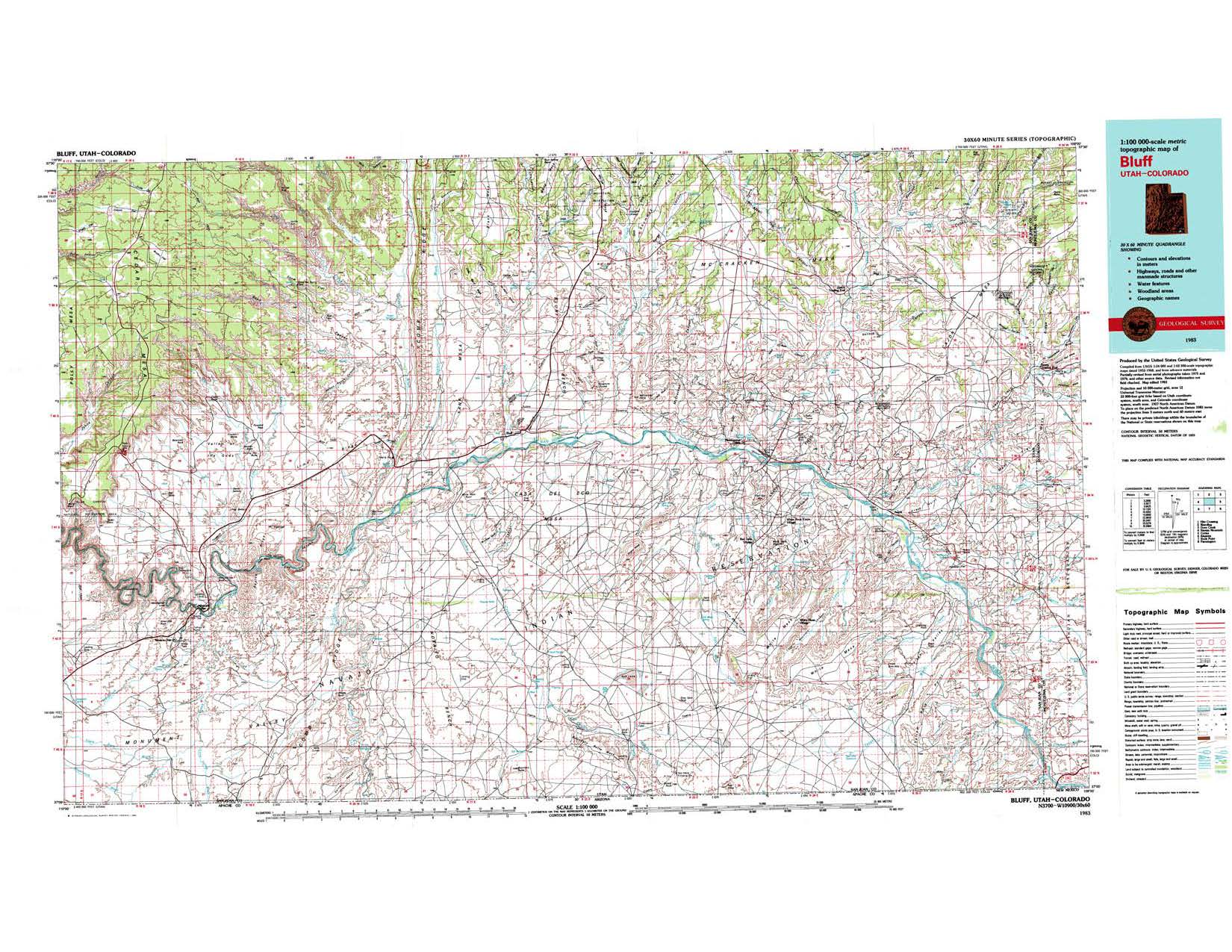
Then again, “how accurate” becomes part of the question. Even in this (USGS 1:250000-scale Quadrangle for Abajo, UT 1893 - ScienceBase-Catalog) 1893 map of the Buff, UT area it is mostly accurate, but the course of the San Juan River west of Comb Wash is complete fiction. Compare a more recent map: https://geology.utah.gov/apps/topomap/30x60Quads/images/30x60Bluff.jpg
It looks like they knew the river flowed into the Colorado down in Glen Canyon but just sort of drew a squiggly line headed west to get there.
Not a 50x50 mile area, but in the 20x20 mile range.
The Western Australia/South Australia/Northern Territory border, 1,874kms long notionally on the 129th East meridian wasn’t surveyed until 1968.
Even in the US boundaries can change. A couple years ago they did a new survey and some NC houses ended up in SC and SC houses ended up in NC. This was near Charlotte.
OK, thanks - what if we expand it a bit, to 200x200 mile squares? (in other words, broader chunks of the world, but not France sized.) At what point was pretty much the whole outline of the world, and most of the inner features of each non-Antarctica continent, known? 1900?
Darien was actually heavily settled and farmed before 500 years ago, as were almost all of the lowlands of Panama. Balboa rode across the isthmus on horseback through maize fields after the Spanish arrived. What appear to be the pristine forests of the Darien have grown up since 1500, after 90% of the local population succumbed to smallpox and other diseases, war, and enslavement.
The present inhabitants of the Darien, who include the Embera, Wounaan, and Guna indigenous groups, and the darienitas, who are descended from escaped slaves during the colonial era mostly came into the region after 1600.
I have visited the Darien more than 35 times. Our mission on our most recent expedition was to try to locate the oldest patches of true “old growth” forest in the area. We worked with Embera elders to identify areas that their oral histories indicated they had never cut over and cultivated. We discovered forests of giant trees that were probably already large when Columbus arrived,and with some of the highest levels of carbon concentration ever discovered. (We got within 6 km of the Colombian border, and had an escort of heavily armed SENAFRONT troops, Panama’s border patrol, because of the presence of drug traffickers in the area.)
In pre-Columbian times Panama had a medium level of cultural complexities. Panama (and the rest of southern Central America) never developed large empires, but consisted of local chiefdoms a few dozen miles across. While they didn’t build large monuments, they had very sophisticated ceramicsand gold work.
Awesome, Colibri.
My dissertation advisor, Peter Herlihy, as a young geographer in the early 1990s, led a two-year-long pioneering participatory research mapping project across the entire Emberá and Wounaan comarcas in Darién. This was when GPS was brand new. About 40 villages selected someone from among them, to train a bit in cartography, and to locally conduct surveys and fieldwork to identify the land use locations and toponyms (place names). The main goals were to improve the local governance/management by the indigenous people of their comarcas, with tools that might be more respected by “modern” national government agencies and the like.
What does this have to do with this thread? I suppose this: Besides caves and ocean floors and Antarctica (for the latter, read the terrific book “Soundings” about the oceanographer-mapmaker Marie Tharp), there are big parts of the world (typically rain forests, rugged mountains, and deserts) where the PHYSICAL geography has been well mapped (since the year- 2000 Space Shuttle-based radar elevation model missions, at the latest), but the HUMAN geography — what local people call things, etc. — still needs better mapping (though this sometimes gets into ethical issues of “traditional knowledge” dissemination, and also it can change over time — but, then again, so can aspects of the physical geography).
Clarification:The “Soundings” book (by Hari Felt) is about the first accurate mapping of the world’s ocean floors, circa 1958, by Marie Tharp and her associates (not Antarctica).
A professor at UAB does a lot of archaeology work via satellite images. Sarah Parcak.
There are still a few phantom islands and phantom reefs which, following cartographic traditions, are included in some maps of the oceans but where opinions differ as to whether they really exist. See the Ernest Legouve Reef and Tabor Island.
Well, Captain Cook did a lot of voyages of exploration during the 1700s, equipped with some really futuristic tools, including sextant and chronometer. If you trace his voyages, he zig-zagged out in the middle of the Pacific, making sure no large land masses the size of Australia were present in the ocean between S. America and Australia. So upon the completion of Cook’s voyages and others at that time, most of the world’s coastlines, rivers, mountains and such were mapped with a high degree of accuracy (pun sort of intended).
Now, for a more recent milestone date in cartography, I would nominate 1957 or 1958. Why?
- It was the International Geophysical Year, a bit of a break during the cold war, where nations were encouraged to collaborate on Geophysical topics including high-precision mapping.
- Humankind finally had satellites, which could photograph the earth and give us an outsider’s perspective for mapping that we never had before.
FWIW, all you gamers out there, you’ll recall that in Civilization…Civ II in particular, when you finally discover satellite technology, then suddenly the entire game map becomes visible for the first time. (Contrast that to your knowledge when you start. It’s just your small tribe, and the immediate surroundings. All else is dark, terra incognita. The satellite moment is a pretty big one, sometimes revealing lost continents and civilizations you only suspected but had not ever seen.)
Right on, Limmin. It’s no coincidence I mentioned 1958 in my post. 