Broadly. I live in a city that is largely made up of gridded streets that align with the compass points closely, except for when a river or hillside messes things up a bit, so I’m generally always aware of which way north is in all my mental maps, even when inside a building. It sometimes turns out I’m not always right, but I do at least think I am while I’m doing it.
Unless you live in Santa Barbara, Malibu or long Beach where it’s South. ![]()
ETA, or Avalon, where it’s East again.
My mental mapmaking process seems to assume that streets run north-south or east-west. So if the street I’m keying off of runs NE/SW or NW/SE, I can be up to 45 degrees off.
For instance, I mentally think of our house as facing north because it faces a street I think of as east/west, but it’s really more NW/SE, so the house really faces northeast. Intellectually I know this, but even after 17 years in the same house, it’s something I have to remind myself of, unless I’m looking at the sun near sunrise or sunset.
Talking about mental maps, I was always confused walking around the Boston Common. I never understood why until I read a paper by Marvin Minsky on frames. He was confused also, but he figured it out. As a New Yorker, like me, his model of a park was that it had four sides. The Common has five, so when you walk around four sides of the Common and don’t wind up where you started you go wha??
As far as cities not being where you think they are, the question about where LA is in relation to Reno (it is East) is a common one.
Reminds me a little of my experience with the sun. Growing up in CA, I pretty much counted on the sun to show me either East or West, depending on time of day.
Now that I live north of Seattle, the sun is a much better indicator of South, regardless of the time of day. “High noon” is just not all that high, and distinctly in the southern part of the sky.
State street is the E/W demarcation line in Chicago. Which is pretty easy live above North Avenue, since everything is then West of that line. Higher number address are more west, easy peasy. Then once I get south of North avenue and I have to deal with east address I start to get really confused. Same thing once I’m south of Monroe (the N/S line)
Montreal has a street grid with so-called north-south and east-west streets, just like in NY, say. The trouble is that the N-S streets are really only about 15 deg from E-W and vice versa for the E-W streets. The street I live on is nominally E-W, but I know that true north is just 15 deg east of the “east” direction. I have always assumed that this started because the St. Lawrence River runs generally towards east, but right around Montreal Island, it turns left and is running nearly north. Nonetheless, the streets perpendicular to the river are considered to running north.
But one city I am really confused about is New Orleans. It has been in the news a lot lately because this is the 10th anniversary of Katrina and all the talk is about the east end of the city. Now most of the time I have spent there is in the Garden District (because I was going to meetings at Tulane and staying at a hotel along St. Charles), which I had always thought was east, because I felt the Mississippi was running N-S. It obviously isn’t at that point and the next thing I am going to do is look at a map of the city.
I’ve always lived in upstate New York and I’ve grown used to seeing satellite dishes pointing at a certain angle. So when I’m visiting Texas, all the satellite dishes look like they’re pointing in the wrong direction.
Underlining mine.
Prepare for head asplosions.
The river runs in every conceivable direction; the only thing it doesn’t (quite) do is form a loop. And each section of town is a mostly-grid, but oriented a different way. With lots and lots of odd angle interfaces. They’re not even consistent in always being parallel and perpendicular to the nearest point on the river.
That’s weird. Because I live in New York and I’ve always tended to think you go south to get to the ocean. And due to New York’s unusual geography this is generally true - if you want to reach the ocean from any spot in New York you travel south to New York City which is the southernmost part of the state. And even in New York City or Long Island, you would travel south to reach the ocean.
It could be worse. You could live in Oahu where the ocean is N, S, E and W.
Same here. For every buiding I have a mental map of it is aligned on a NS/EW axis.
And when I’m inside I perceive it being on that axis.
I’ve never been in a building (that has walls/halls at 90 degree angles) that I perceived as being off this axis.
About half my family is real good at directions, I’m in that half and then add boats and airplanes and then working as a mapping pilot = No understanding of ‘no sense of direction’ from people. Or not knowing how to swim, or many things I know must be taught or learned someway but seem so obvious or easy to me that I must guard my mouth when talking some kind of orientation with most people.
Now there are new pilots who have been taught to use maps but cannot use them while under the pressure of flying the plane at the same time. They are totally dependent on a GPS. Now that is scary to me, for me and about being in the same sky with them. It is plenty dangerous enough as it is without adding this type of pilot to the mix.
They need a good map to fly IFR (I Follow Roads).
My mental maps are topologically equivalent to what they represent, but not geometrically equivalent. I remember the connectivity of roads, but not their direction. As such, I usually don’t have the slightest clue what direction I’m facing, and certainly don’t have a north reference.
Roads around here are weird anyway, and rarely go in the same direction for their whole length.
I’ve found myself off by 5-10 degrees at times, but I’m honestly really good at that.
My mental map of my neighborhood and most of the city is skewed by about 90°.
Really? OK, I grew up here, so I guess it’s easy for me, but I always found Chicago one of the easiest cities to determine north, because of the grid system, and the lake is always to the east. Now Boston and New England cities, on the other hand, where streets go in circles …
Having lived all my life in southeast Louisiana, the idea of using upslope or downslope to navigate if completely foreign to me. Then again, the idea of land not being completely flat is foreign to me.
Just remember, you have to go east across the river to get to the west bank.![]()
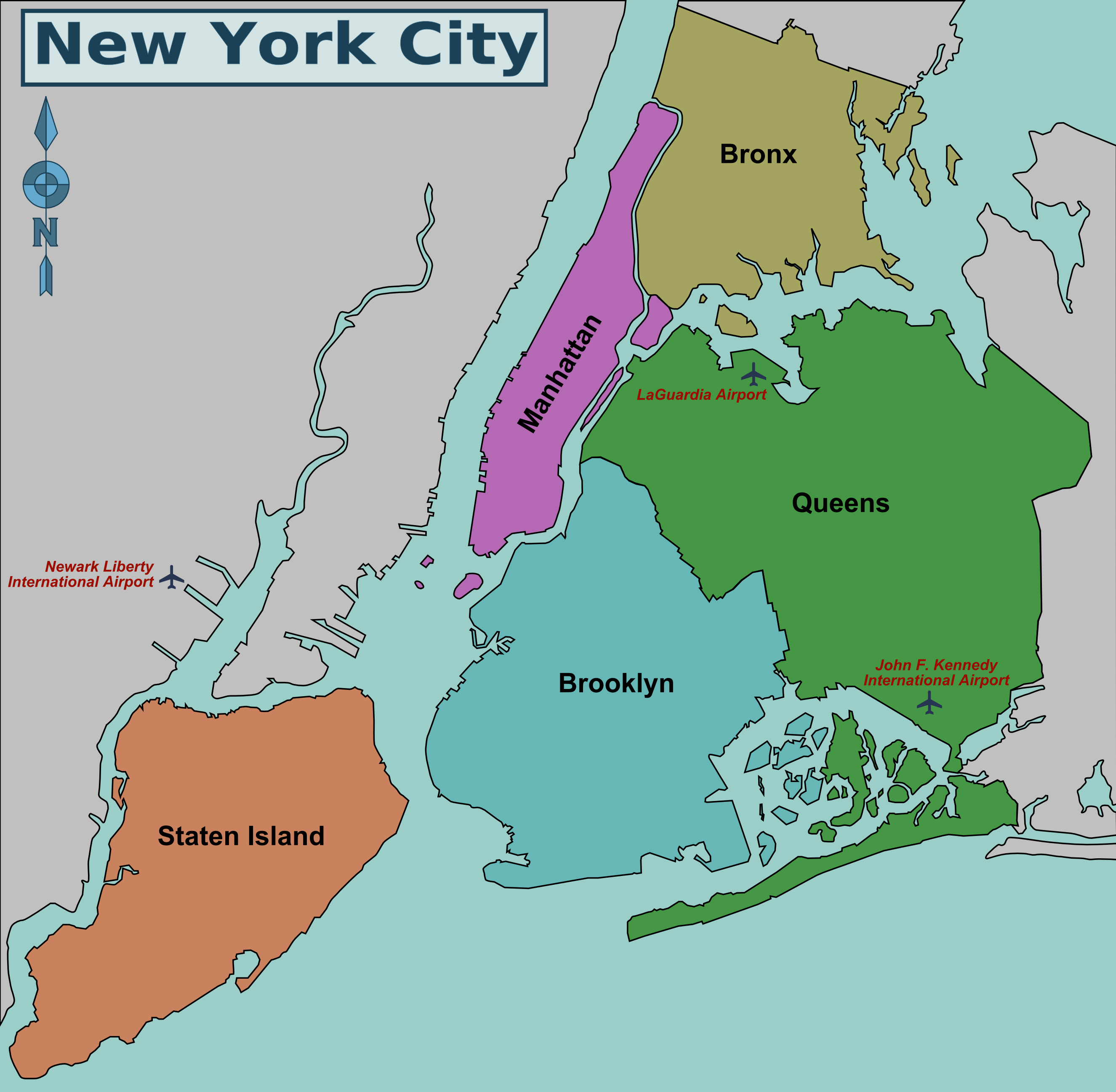
I grew up in Queens, so the water was in all directions. South was ocean, North was Long Island Sound and Connecticut, but East was toward Montauk Point and the real ocean. And Europe was that way also.
In New Jersey where I also lived the ocean being eastward was more clear cut.