If Every Southern State Cooked Your Supper.

He is spot on for North Carolina.
If Every Southern State Cooked Your Supper.
He is spot on for North Carolina.
He was, in fact, correct. At least for my part of Wisconsin. Small water features spelled “creeks” are pronounced “cricks”. Unless it is a town, because the suburb of Milwaukee is Oak “Creak”. (or Ook Creek, in the Sousider accent).
Now I think the real and proper division of the country is whether you call carbonated drinks pop, soda, or cokes. Everything else is meaningless detail.
My wife is western PA and there it’s “pop,” I’m central MD and I have a “soda,” my Mom’s northern Alabama and they drink “R.C. Co-cola” (or sumpin like ‘at).
There are some mountains, but I’m pretty sure saguaro cacti are more of a further west kind of thing, like in Arizona and California.
This is the answer ^^. Saguaro natural range is the Sonoran desert, and that does not include Old (or new) El Paso (which appears to be in the Chihuahuan desert, which may have a different iconic flora). I suppose using a small dog on the logo doesn’t have the same impact.
Dogs as part of logos for human food sounds like a marketing failure in the making.
Dogs as cute spokesanimals can work well, as Taco Bell’s chihuahua can attest.
Not entirely. I have a reasonably fancy compass that I can use to trianglulate mountain peaks* in a remote area to work out my position using a land survey map (typically 1:50000). It is very easy, with this compass but I can do it with any compass.
I also write cursive.
My mum was an English & Geography teacher, so I guess there is an element of hereditary ability.
Her cursive writing, though, is almost illegible, so we kids prefer her (also poorly) typed emails. Her blackboard writing is excellent.
* illegal over-border trips into the eastern part of the Chimanimani mountains where Zimbabwe meets Mozambique…map reading is really important due to landmines left over from the Rrhodesian Bush War.
By that standard, I have crossed Mississippi Creek.
“Just about dead” does not equal entirely dead. And surely you can acknowledge that your map reading skills are ones not held by many?
If we were on the same continent, I might think we were siblings. Mom’s handwriting is such that one time she hand wrote a letter to her father-in-law instead of her usual typing of such missives, leading my grandfather to write back and say that he appreciated the letter, but in the future she could wait to send one until she had enough time to type it.
In her defense, she is left-handed and from a time when teachers would correct that ‘deficit’. She does write with her left hand now, but the lack of early practice makes reading it an adventure.
People who hit maturity after about 2008 or so are the ones who probably don’t have good map reading skills, because the phone took that over.
Now being able to triangulate with a compass and map is more of a dedicated outdoorsman/military/Boy Scout kind of thing.
That was the case even when I was young, and probably when all of us were young, because you only need that skill outside of civilization, and most people don’t go into untamed wilderness where they need it, and haven’t for longer than our lifetimes.
Matt Mitchell is a stitch. ![]()
Definitely. I know how, because I was a Scout and we actually did have to find our way on a 10 day hiking trip with map & compass, but that was 1986. I haven’t actually used a compass since, until my sons started in Scouts.
Maps, sure. All the time, but they were street/highway maps.
I did land navigation in the army. I was never very good at it - lousy sense of direction and an inability to walk in a straight line - but I still remember the principles. We used sealed maps, so we had to memorize the terrain, and we did it at night, so the best way to do it was to count your steps, follow the stars, and think in terms of watersheds. Even now, I look at a topographical map, and I immediately start tracking ridgelines and basins.
I was a Scout, but went through Cub Scouts into Boy Scouts and didn’t stay with the Boy Scouts because (believe it or not) at that level most of them were troublemakers who I didn’t get along with. That seems weird to say about Scouts, but that’s how it was. I never learned navigation there.
On the other hand, I did take a backpacking and survival course in college, and I learned it there. I’ve carried a compass with me since then. ![]()
Agreed, and following a paper map, even a street map you don’t need actual navigation to follow, that is a skill that used to be ubiquitous that I think is being lost thanks to devices like smart phones.
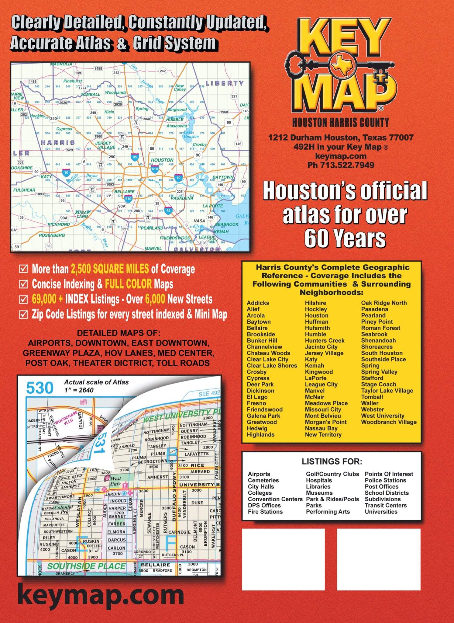
Yeah, I was explaining the concept of a Key Map (Houston) or Mapsco (Dallas) city map to my children a while back, and they were oddly baffled. They felt like it was an overly complex scheme to find your way, but they’re firmly Google maps children, despite being Scouts and knowing all that stuff.
These are the maps where the city is broken up into 1 mile square blocks (which are each broken up further into smaller squares denoted by letter) and each page of the book corresponds to one of those mile squares. The front of the book has a fold-out map of the numbered grid, so you can look up which page. There’s also a street index that would contain entries like “9000-9500 Elm Avenue - 43B”, meaning that your address of say… 9105 Elm Ave would be found on page 43, in the sub-square “B”.
You can see it here: https://www.keymaps.com/cdn/shop/files/ScreenShot2023-06-06at2.43.30PM_1024x1024@2x.jpg?v=1686080726
I used to buy map books by Roadrunner which worked exactly like that. They were great. I haven’t had one in a while, because like most people I use my phone, but now that I’m thinking about it I might get one because what if my phone dies or has some other problem?
I don’t think they make Roadrunner atlases anymore, but other publishers make them.
Seems like each major city / urban region had one publisher that produced their proprietary version of the key map AKA grid map.
Well, it might be just me that understands them that way, or a small group of people including me.
I dunno; I think you could justify calling Texas either “South” or “Southwest”.