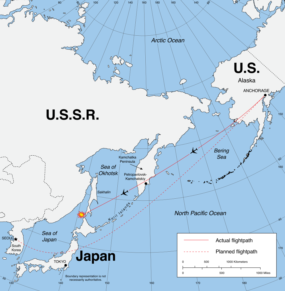
Makes sense, ie, if you draw the line from, say, Chicago you would be flying over Bering Sea and Northeastern Japan.
BTW, I hope it’s nothing I did; I did link the larger map.
I have no real issue here either with my OS nor with any of browers: Safari, Chrome normally & sometimes Firefox as well.
Right, but someone in Japan, or the US, is likely to be looking at the conventional view of the earth centered on the equator, and that straight line would look like a big arc.
The Earth spins East to west. While you are flying to the US from Japan, the earth is still spinning west, against you. If you travel west to the US, the earth is spinning with you.
Also, that is largely irrelevant unless you leave Earth’s atmosphere (which you certainly don’t in an airplane.) It’s the direction of the prevailing winds that matters the most to whether an eastward or westward flight is faster for the same distance.
The phrases ‘East to West’ and ‘West to East’ are kind of meaningless here. Hopefully one of our esteemed geographers knows an unambiguous description for earth’s rotation. I generally use the terms ‘earthwise’ and ‘counter-earthwise’. Guess which one the earth does
I assumed he was joking. If not, he and the OP should meet.
No, I wasn’t joking. I was watching an episode of Mr. wizard (Don herbert) one day and he was discussing the polar route of flights, and instead of a straight line flight, a flight would be more like a parabola.
Now, that was a long time ago, so maybe I did not remember the facts as good.
It would look like a parabola (or some sort of arc) on a flat map, yes. If you look at a globe, find two points, and connect them with the shortest line, that’s straightforward and easy for pretty much anyone to do. The thing is, when that route is taken from a 3D sphere and put onto a 2D rectangle, it looks like the arc of a circle, because of the transformation from a round three-dimensional space to a spherical two-dimensional space.
Even if the earth was a perfect sphere, taking a northern route would be shorter. Lines of latitude look like straight lines on the map, but (other than the equator) are not geodesics on the sphere.
It helps to think of two points very near the north pole, but with very different latitude. Like have both of them be 89 degrees north, but one 90 degrees west and the other 90 degrees east. If draw a line between them on a standard map projection you’ll end up going around the world, but on a globe it would be pretty clear that the shortest route is to pop over the pole, which on the map looks like going straight up instead of towards your destination.
That’s the easiest way to describe it. Rotation is always relative to something, and can’t be unambiguously described as relative to points on the rotating object.