I had this shower thought recently. We see TONS of traffic islands everywhere we go when we drive. But, no one every stops to think just how many there are. There must be some sort of census or estimate out there somewhere for traffic islands, as they are an essential element of road safety. Furthermore, we do have a list of the top 300 islands on earth. If all the combined surface areas of these traffic islands where added together to from an actual island with an equal surface area, how big would this island be? Where would it be on the list of largest islands, and what real world island would be the closest in size?
You have to determine what you think qualifies as a traffic island. If it includes median strips they could be massive between exits on highways. In some cases they are tiny, barely room for one person to stand. Maybe you could find some approximate factor to apply to the total miles of streets in the US to get some kind of number. I doubt the number and areas of traffic islands are currently accumulated anywhere, but those numbers could be extracted from the massive databases that have the details for providing instructions, satellite type imaging, and even street views.
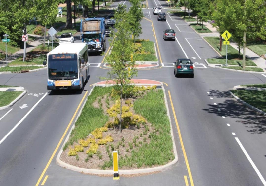
Do these count?
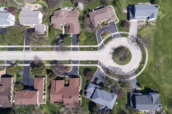
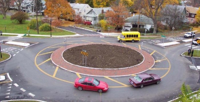
How about these?
Just to try to Fermi this:
First, I’ll assume that we’re only talking about the islands in city-like streets. Freeway medians don’t count, and most non-freeway inter-city roads won’t have islands.
A quick Google suggests that there’s about 12 million miles of city streets in the US (itself a Fermi estimate, but we’ll roll with it).
Based on what I see around my neighborhood, I’m going to guess that maybe 5% of the total length of city streets have islands. A lot of length is covered by side streets that are too small to have islands. So that’s 600,000 miles of islanded streets, or 1 million km.
And let’s say that the average traffic island is 2 meters wide. That’d be a total area of 2e9 square meters. Lump that all together in a relatively compact space, and it’d be a rectangle 40 km by 50 km.
For this hypothetical, I would say that roundabouts would count, while off-road elevations like the first picture would not.
Wow! Even by that extremely conservative fermi estimate, that would roughly make “American Road Island” about as big as the Spanish Island of Tenerife, which can support a population of almost a million people.
Figure about 12,000 roundabouts in the US* based on this database search plus an estimate of how many are not in that DB. If the average roundabout center island has a radius of 8 meters, that comes to a bit over 2.4 million sq meters. But I’m just guessing about the average radius and, thinking it over, 8 meters may be somewhat on the high side.
*Also note that the number of roundabouts in the US is a moving target. Roughly 500 are built each year and even that number is slowly increasing.
ETA: I didn’t include the splitter islands that most roundabouts have. I don’t know if you want to count islands that only have growing stuff in them or all islands. If they have to have growing stuff, ignore the splitters.
Clearly, the question is far too vague for a definitive answer.
Perhaps the OP could define what he means by “traffic island”.
@Chronos. Nice one. Thank you.
I started on that same approach yesterday but abandoned it when I couldn’t locate the key number for my starting WAG parameter. You chose your first parameter more wisely than I and had success.
Just for conversation sake … I think your 5% number, though 100% reasonable, is maybe 2x too high. As Fermi estimates go, that’s spot on. Since we’re comparing the result to a list of real world island sizes which should take the shape of an exponential decay curve, that difference may really alter where our aggregate “island” falls on that list.
My thoughts: If we posit a standard US older suburban rectilinear grid, the mile boulevards are separated by ~10 side streets. So the boulevards represent 10% of the street mileage. Depending on what part of the country you’re in, boulevards are heavily islanded, or are mostly bi-directional left turn lanes, or simply a yellow stripe, or a mix of each. Net, net, I WAG the islands as 1/4th of the total mileage, not half. So 2.5%.
Which drives the total down to 1E9 m2 or 1E3 km2. So from the OP’s list of islands, down around #300 vs your estimate of around #200.
Still, thank you for a great answer to a fun question.
Here is a more precise definition:
Any elevation on an American road that is used to divide traffic. Also including roundabouts.
My question is how many can Steve Wallis actually stealth camp in?

But that’s assuming a one mile boulevard has one mile of median. In fact, each of intersecting streets interrupt the median, and that reduces the total median space. Now an intersecting street to a main thoroughfare can range anywhere from roughly 20’ for a residential side street to something like 60’ for a major thoroughfare.
Well, sometimes. In my experience, on roads with medians, most often side streets come in only from one side or the other, with the median interrupted only by other major streets.
So you do want to count splitter islands. Of the 12,000 roundabouts and other circular intersections, perhaps only 8000 have raised spliter islands. The roundabout db says about two-thirds of them have 4 approaches and the other third 3 approaches. Guessing 5 sq meters per island, that adds 146,800 sq meters to the previous total, bringing it to around 2.6 m sq meters.
Besides those at roundabouts, there are many splitter islands at regular intersections separating the right-turn from the straight-ahead traffic. Usually a fairly small triangle, but there’s lots of them. Far more than there are splitter islands at roundabouts. Are there enough to make a significant addition to the boulevard medians? I don’t really have a good feel for this. Anyone else want to SWAG it?
What about the islands created inside the “clover leaves” where two highways interchange?
All true.
The 10% figure I stated is simply my WAGged boulevard mileage as a percentage of total urban/suburban road mileage. The next factor I mention is 1/4th: that portion of boulevard mileage that I WAGly conclude has islands.
As you rightly suggest, islands represent far less than 100% of the boulevards’ length.
Interesting question. I used to see “wetland” signs posted in marshy areas inside of highway cloverleafs.
I’ve always been fascinated by these spaces. It seems like, due to their inaccessibility, they would be little islands of wilderness in sometimes relatively urban environments.