I am wondering if there are any lines of longitude that do not cross any land at all (except, of course, Antarctica). We all know that the 180th comes sort of close, but it crosses a chunk of Mainland Asia in Siberia, as well as a couple of Fijian islands.
I’m not necessarily referring to longitudinal lines that are whole degrees (like the aforementioned 180), I don’t think any of them fit the bill anyways, but maybe something like 171d 42m 38s W (randomly picked, not tested) - in fact, I think the 170s W are our best shot.
From west to east, the mainland of Eurafrasia extends from 17° 33′ W to 169° 40’ W. So that covers the entire eastern hemisphere and then some. The mainland of the Americas goes from 168° 5’ W to 34°48’ W.
What this leaves is the space from 34° 48’ W to 17° 33′ W and from 169° 40’ W to 168° 5’ W. The first of these is roughly the Atlantic Ocean, and the second is the Bering Straight.
Now, it turns out that Greenland spans from 73° 8’ W to 11° 19’ W, thus covering the entire gap in the Atlantic. Thus, as you surmised, if there is a landless meridian, without considering Antarctica, it must be somewhere from 169° 40’ W to 168° 5’ W. Now some of this span is covered by islands, but I would guess that there’s probably some small sliver that manages to evade them.
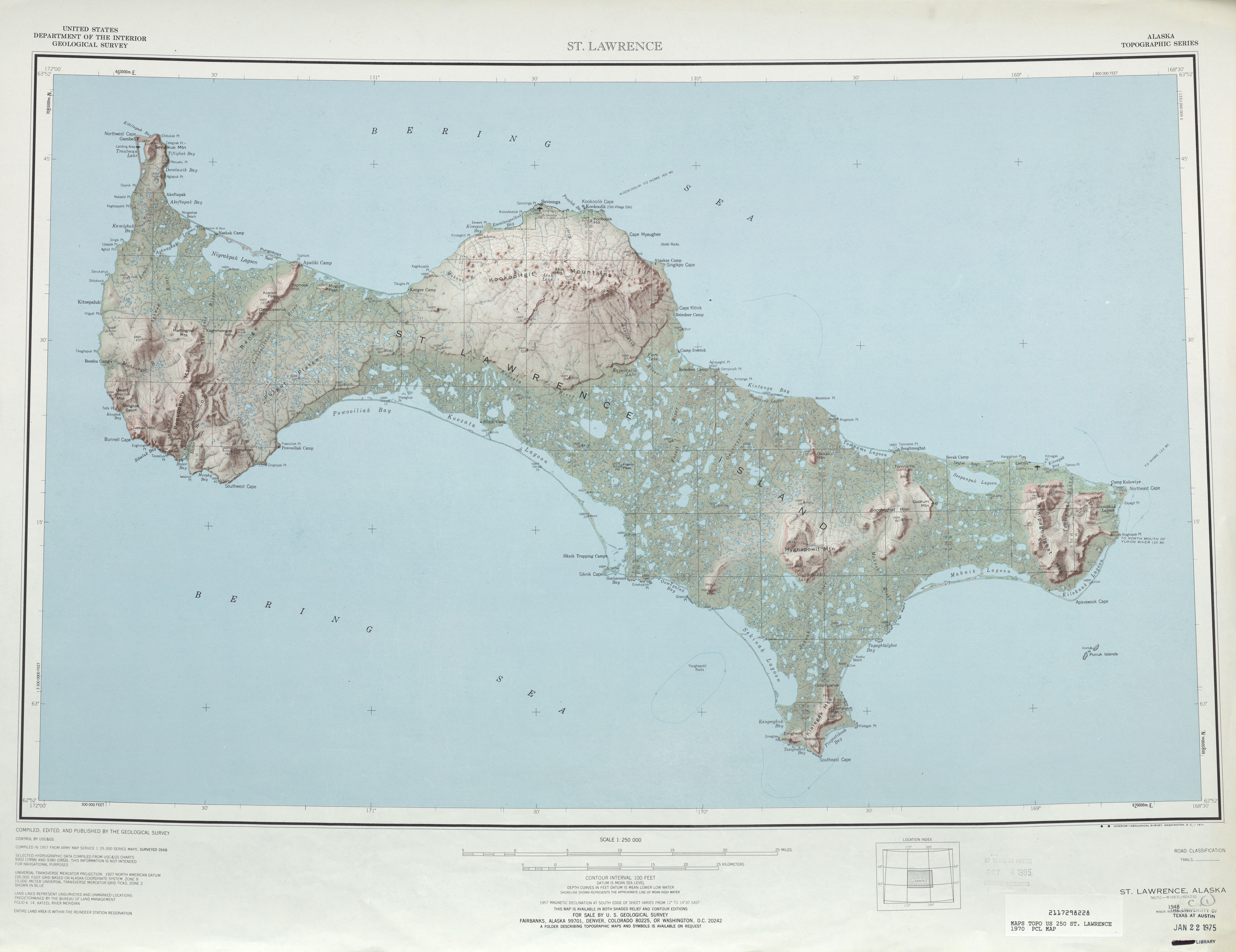
You’ve got to thread the Bering Strait, so that constrains you to longitudes between Cape Dezhnev (169°43’ W) and Cape Prince (168°05’ W). The Northeast Cape of Saint Lawrence Island looks to be at about 168°42’ W (and its westernmost point is at about 172°W.) And this map implies that Umnak Island spans at least 168° W to 169° W.
I had to put in airports on land, so the real path over water is slightly different , but it does work to go all the way over water thus connecting many pairs of antipodes.
If you look at this image (http://upload.wikimedia.org/wikipedia/commons/6/64/Antipodes_LAEA.png), right by the upside-down coast of Chile and the right-side-up coast of Vietnam is a small c-shaped area where the Pacific Ocean is antipodal to itself. If I had to guess, that would be my bet on an antipodal half great circle that hits no land. Although, I couldn’t tell you if this route hits any islands.