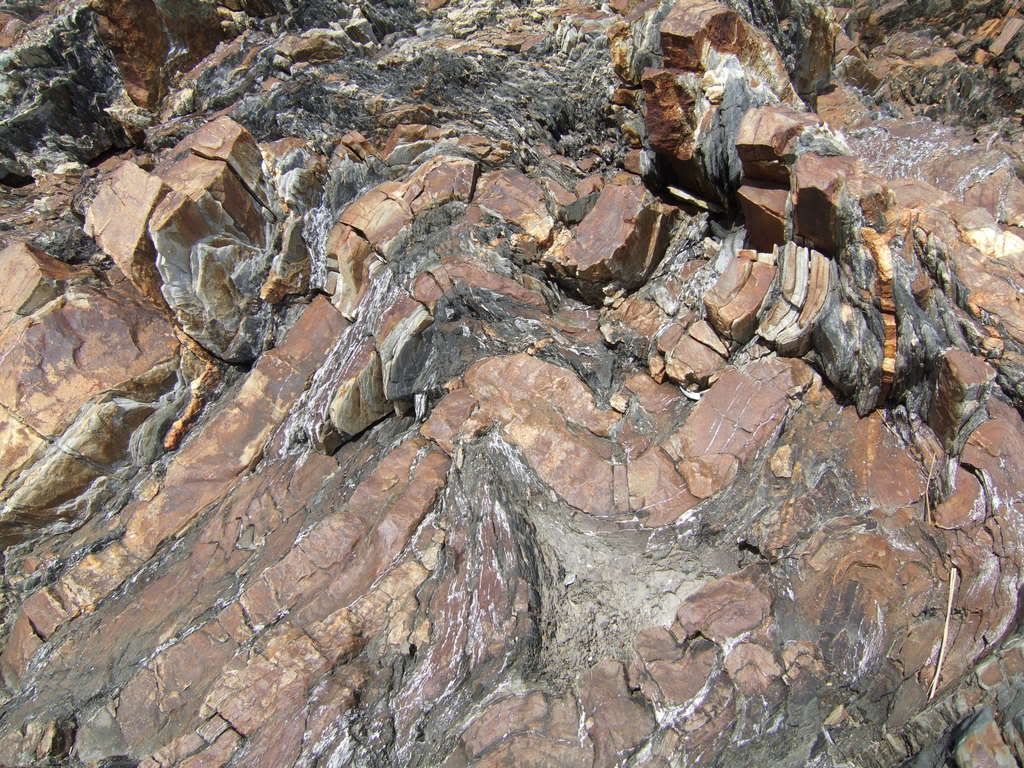
So I was in Maine this weekend for a wonderful festival and my wife and I had some time down at the shoreline. We walked all over this one area near Bar Harbor - I say this very interesting rock formation, or or maybe I should say conglomeration of stone: See Here
I thought only lava bent rocks like this, can anyone tell me what caused this, and perhaps what the composition is?
We were in a tidal region, and this was well above the high tide line.
I am not a geologist, but it looks like sedimentary rock, possibly chert, bent in the process of uplift or bent as it scraped off one formation onto another.
But my ability to ID rocks is highly suspect, so I hope someone more geologically knowledgable comes along.
I’m not familiar with the lithologies of that area but what’s shown in the pic isn’t unusual for sedimentary rocks (limestones, sandstones, shales, etc) subjected to pressure over time. A little folding, some faulting here and there. What you’re seeing isn’t how it was deposited but instead how once thin, relatively horizontal beds have responded to compressional forces.
I’m just guessing but it sounds like you were actually observing the type locale for the Bar Harbor Formation.
Most of the Bar Harbor Formation consists of siltstone and sandstone beds measuring a few inches thick. Where exposed, the beds generally weather to a tan, gray, or lavender color but are typically dark gray on a freshly broken surface. These sediments were also deposited in an ocean environment, but possibly at shallower depths than the Ellsworth Schist sediments. Some volcanic material is also present. The Bar Harbor Formation takes its name from the excellent exposures along the shoreline at Bar Harbor where you can see the bedding inclined gently toward the ocean (Figure 3). The lack of complex folding and the gentle tilt of the beds indicate that these rocks were not subjected to the strong deformational forces that altered the Ellsworth Schist.
If you want to see some complex folding, look at the Ellsworth. Consider the assessment as to a “lack” somewhat relative.
For a general description of the overall Acadia National Park complex, this is fairly understandable.