Zoom in, definitely some sort of lines of construction. I’m guessing shellfish farming or something, since a seafood farm is usually an enclosure, not strings of construction?
I’m just reporting on what Google maps says, which is literally:
Peche interdite
Seafood farm
I suppose meaning “don’t fish here because it is a seafood farm.”
After some more googling, I believe it is an aquaculture business called Douesnard Ludovic. An image search for the name will pull up some photos of whatever those enclosures are.
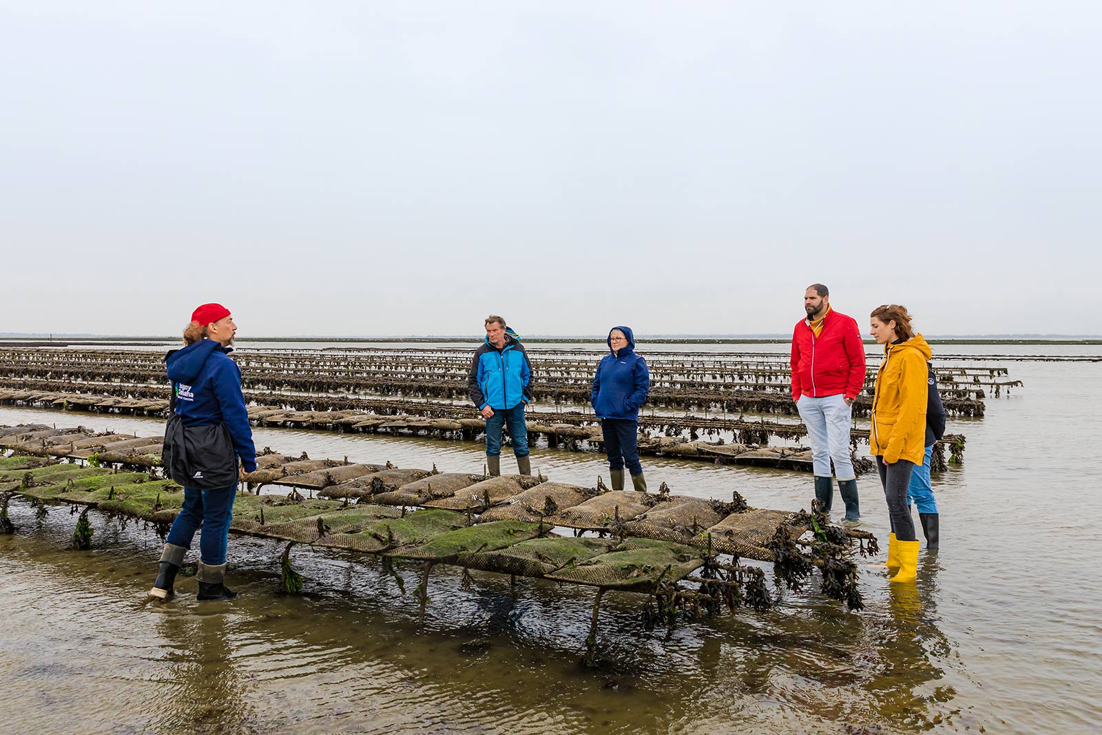
I am very familiar with this as I usually spend my annual holidays in areas of the west coast of France where this kind of “ostréiculture” (oyster farming) and is practised. It is a huge industry with millions of tonnes produced every year. The thing to understand is that these coasts have some of the most extreme tides in the world (tidal ranges in excess of 10 metres). That means that twice a day, vast areas of seabed are exposed, often stretching a couple of kilometres out from shore. So the image that you are seeing where the squares are underwater will look very different six hours later. At low tide, it is possible for vehicles including vans and tractors to drive out to tend the oyster farms and for pedestrians or private cars to cross the sand to visit islands and fortifications that are inaccessible at high tide.
In the second link in the OP (“temporary Mulberry B harbour”), i’m seeing a flag about 3.5km north off the coast labelled “Villemandeur” which it says is a convenience store.
ETA:
For the first picture, yes oyster farm. There are wood pickets with nets on which the little oysters grow. The fishing nets will be caught on this pickets, hence the “no fishing” rule.
For the second picture, Villemandeur is a town 300 km south of the coast… barring an extreme flood, I would say this one is a glitch.
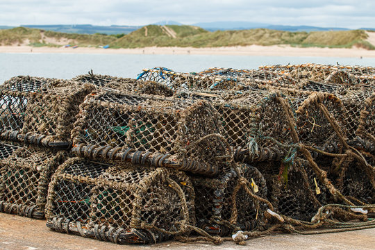
Those are for catching wild lobsters, nothing to do with seafood farming. From the air you’d just see a floating plastic buoy tied to the pot, and they would be very dispersed across an area of sea.