See subject. As in border shape. An important question that came to me while falling asleep. Help me fight my ignorance.
Poland would be my first guess. Or Lesotho.
The Vatican City State?
Nauru is very round, if not very circular.
Uruguay is roundish, but I have to go with Sierra Leone.
This is actually a fascinating question. I would love for it to be Poland, but I suspect it isn’t. What about Zimbabwe or Cote d’Ivoire? Or, more likely, some random island I have limited knowledge of?
Of countries that are a decent size, i.e. fairly bigger than the average US state, I’d say it’s Zimbabwe, followed by Poland. Of ones that are around state-sized or smaller, I’d say the nod goes to Lesotho or Swaziland. Vatican City and Andorra are also basically round, but have much jaggered edges on a small scale than Lesotho or Swaziland do.
Isn’t Vatican City square? That ain’t round, last time I checked.
Swaziland is a good candidate.
What about islands? Iceland is pretty round…
Sri Lanka ain’t too bad.
I can’t seem to find a list of countries by total border length. I can find land border length but not land+maritime border length. If you could find such a list, then the quantity R=(border length)[sup]2[/sup]/(area) is one way to quantify the roundness, with a circular country having R = 4*pi = 12.57 and non-circular countries having larger values.
The CIA has (or had – I downloaded a version some years ago) on-line data which gives land area, enclosed lake area, land boundary length, coastline, and (in a few cases) lengths of border with inland sea.
There are problems (beyond just parsing the data :smack: ). Note that the coastline of even a very roundish country will be bumpy; that coastline measurements can vary; and that for two circular coastlines of equivalent scaled bumpiness, the larger may be likely to have disproportionately longer measured coastline!
Despite these difficulties I went ahead and did the obvious arithmetic. Various data idiosyncrasies render the results doubtful, but some of the countries that scored well were:
Niue, Swaziland, Macedonia, Zimbabwe
It is impossible to make a rigorous list. Borders can only be measured without ambiguity when they are defined by calculated points and lines, not natural features.
Here, this looks* like it can help.
*I said ‘looks’ like it. Never said it was actually helpful.
I’d be happy with an infrared cutoff at the scale of a few hundred meters – the sort of minimum scale of relevance when you eyeball a country on a map.
OHIO is round on the ends and high in the middle.
…I’m sorry…
A way to answer this question without worrying about the coastline measurement would be to figure out which country takes up the largest amount of space percentagewise of the smallest circle that contains the whole country. Not that I have any way of figuring out which country that is.
Not round but definitely circular…
http://www.mfe.govt.nz/publications/oceans/offshore-options-jun05/html/figure-1.html
NZ lays claim to an economic zone that is defined by a radius of 200 nautical miles.
Now, if any small island nations do the same, then that would definitely be the winner.
Depends how big a map, doesn’t it?
If you flip Zimbabwe horizontally, then rotate it about 30 degrees clockwise, it looks uncannily similar to Ethiopia.
And Ethiopia looks like a duck.
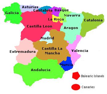
I’m not sure what this proves, but they are both quite round. Spain is also pretty round. If they made Galicia and Catalonia independent then it would be a clear winner (and also look less like a pair of knickers hanging on a washing line).
Edit:
That looks like a very fat stick figure playing football.