How do the borders of modern day Iraq correspond to the “administrative borders” of that area during the Ottoman era? I’m wondering how much of what we call Iraq today existed as a political entity as we go back in time thru the Ottoman era.
Also, I have seen sites that mention “Persian Iraq” as being outside the Ottoman borders, but what is “Persian Iraq”?
No guessing, please. I’m hoping to tap the brain of experts like **Tamerlane **on this subject, and don’t want a debate to ensure here.
Persian Iraq was the area east of the Zagros mountains. It’s the northwestern part of Iran, and corresponds to the ancient kingdom of Media. The term isn’t used anymore, and really hasn’t been used since the 16th century.
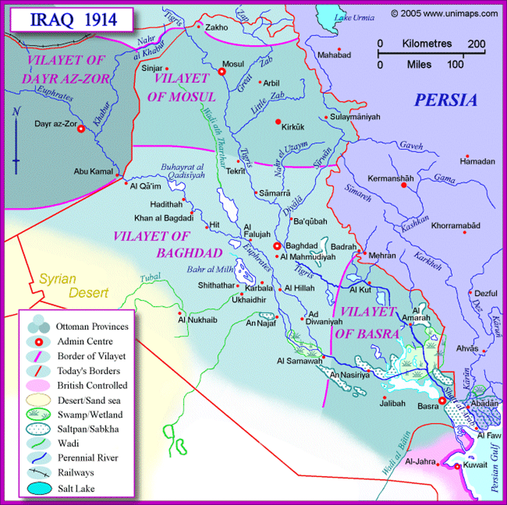
As for Iraq under the Ottomans, remember that the Ottoman empire lasted for a long time. But by the end of the Empire, what’s now Iraq was primarily made up of three villiyet (provinces); the province of Basra, the province of Baghdad, and the province of Mosul.
What Captain Amazing said. But I’ll note that the conception of Iraq changed several times.
The original concept from the Sykes-Picot treaty of 1916 was for the British to get the Basra and the Baghdad vilayets. Meanwhile the Mosul vilayet ( already known to be oil rich and hence valuable ) would go to France as a buffer.
By 1917 that had morphed into Britain outright annexing Basra and setting up Baghdad as a buffer state.
By 1918 France ceded Mosul to Britain, which again was to be set up as a buffer state ( eventually the idea was to merge it with the new Kurdish state carved of the Turkish southeast as envisioned by Sevres, below ), while Baghdad and Basra were now combined to form a mandate territory, a new concept that appeared as outright annexation came to be looked upon as passe by the new international community.
The Treaty of Sevres formalized this somewhat in 1920 with Turkey being dismembered down to Austria size in north-central Anatolia, but Turkey refused to accept those massive teritorial losses and successively fought there way out of it. Mosul was a disputed zone until 1926, when Turkey was finally obliged to cede it to Britain/Iraq, who then was folded it into the new composite mandate monarchy established under the western Arabian Hashemite prince, Faisal ( whose real goal, thwarted by the French, had been Syria - Iraq was a consolation prize ).
A good book on the development of Iraq under British auspices is Inventing Iraq: The Failure of Nation Building and a History Denied by Toby Dodge ( 2003, Colombia University Press ).
So, is “Persian Iraq” now part of Iran , Iraq, a little of both, of something else?
As for the 3 provinces, how do they compare to modern day Iraq? IOW, how much of modern Iraq would they cover, and were they centrally administered, or were they autonomous from each other (within the Ottoman empire)?
Here is a good place to look for Iraq maps, but most of the historical maps are WWII era and later.
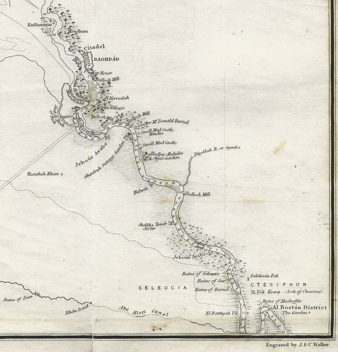
This is Baghdad and a small portion of the Euphrates from 1849, but doesn’t show much else.
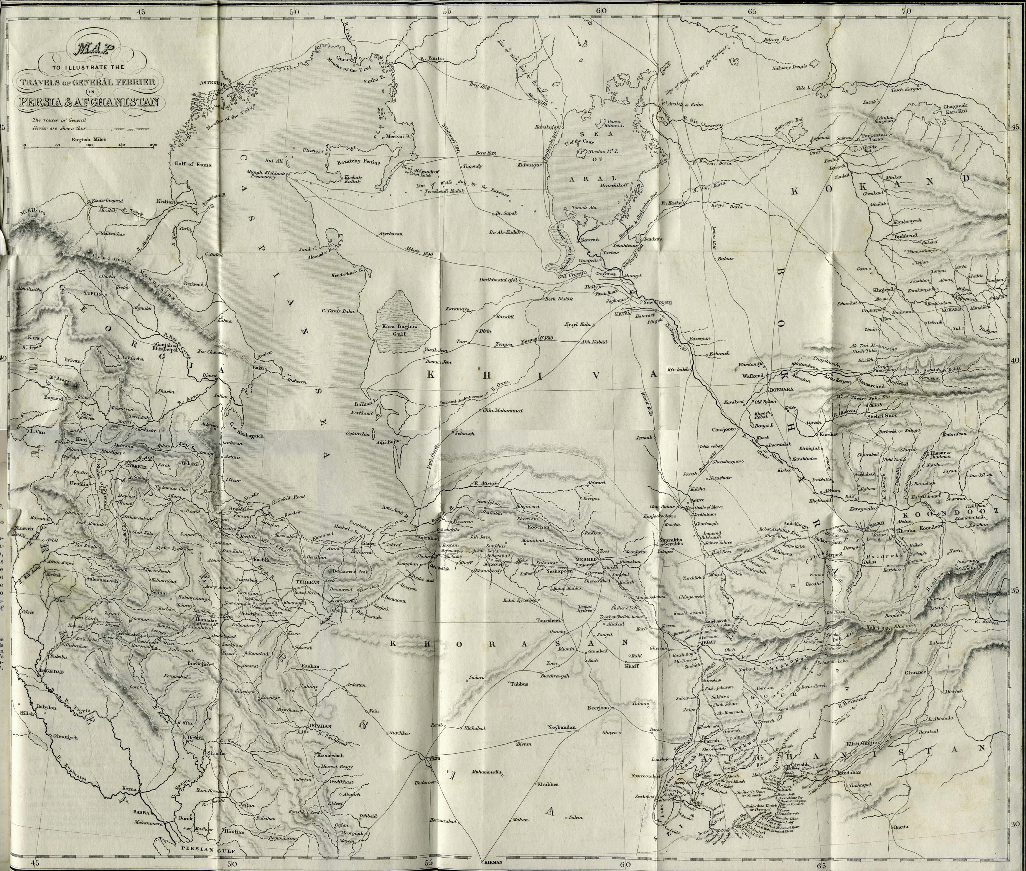
I had much better luck with this map, which is primarily a map of Persia and Afghanistan from 1856, but has such detail that you see a lot of eastern Iraq on the western edge of the map.
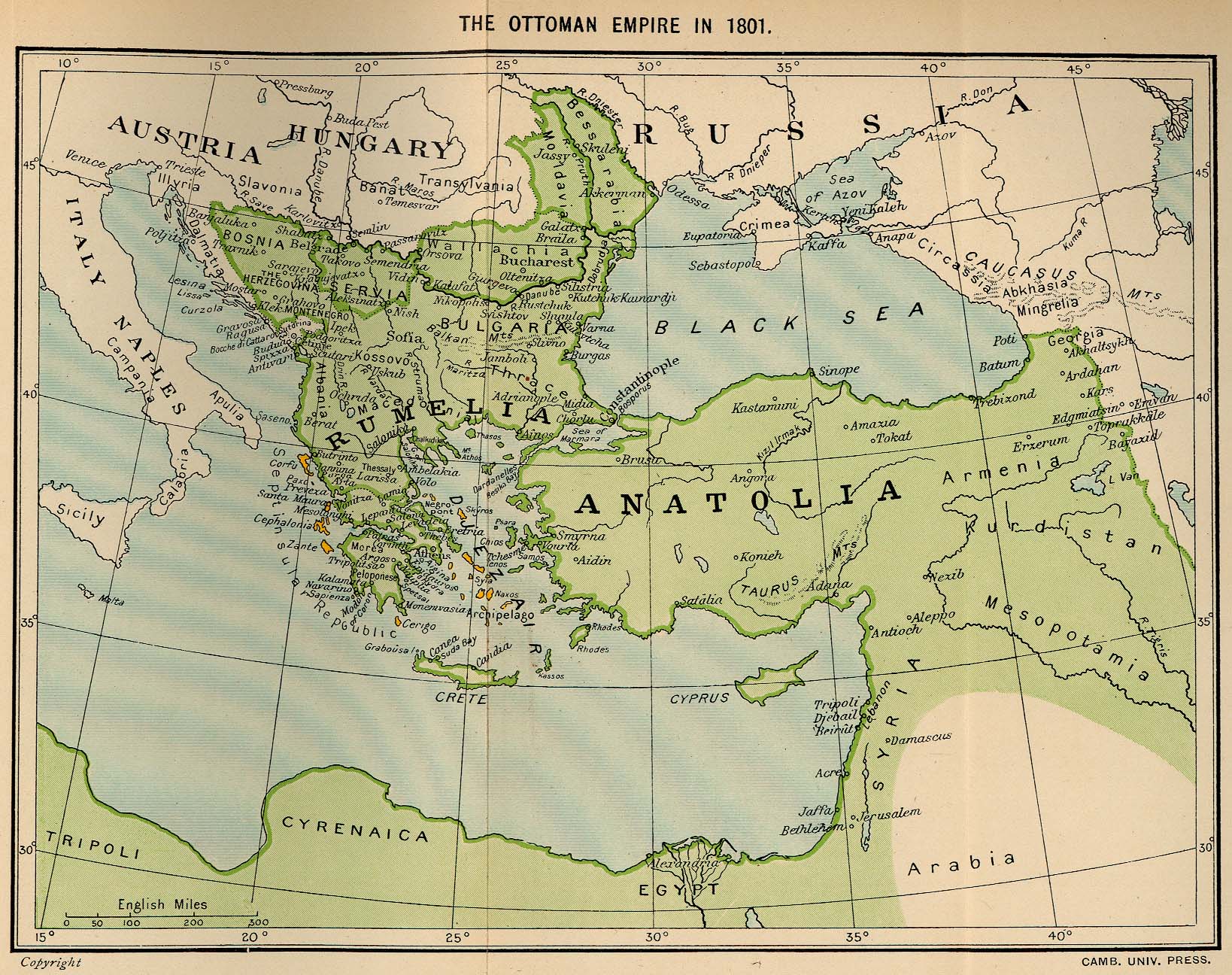
This map, published in 1913, depicts the Ottoman Empire in 1801, but shows practically no detail of the area of Iraq. Most of it, in fact, is chopped off as it goes off the edge of the map, and no cities are shown.
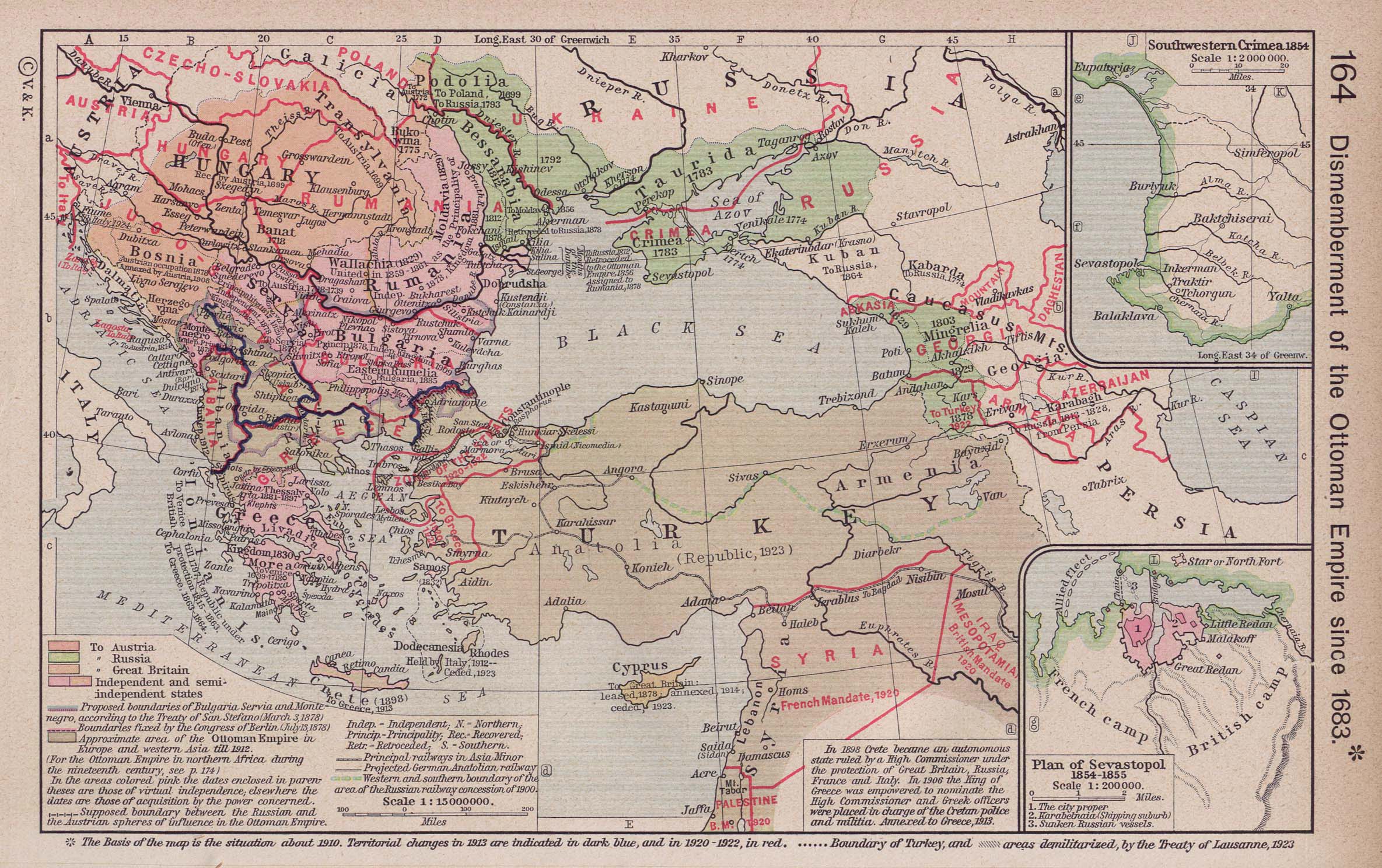
This map, showing the “dismemberment” of Turkey as of 1923 is little better. You can only see Mosul, and most of Iraq is cut off by an overlay.
“Foreign/Persian Iraq” was a medieval Arab name for what’s now northwestern Iran. The capital of the region was Hamedan. It’s entirely within Iran and doesn’t have anything to do with modern Iraq.
As to the vilayets, each vilayet had its own governor appointed by the Sultan. Each vilayet was divided up into smaller areas called sanjaks. The three vilayets I mentioned above together make up pretty much the entire area of Iraq. There was a fourth villiyat, Sharazur, which had a capital at Kirkuk, but that was annexed by the Mosul vilayet in 1879 as part of an administrative reform.
In addition the Basra vilayet ( briefly subsumed into Baghdad for a few years at one point due to political instability ) in the 1870’s-1910’s technically covered northeastern Arabia - i.e. Hasa ( or Ahsa ), Kuwait, Qatar and tentatively and shiftingly parts of the Najd ( depending on whether the hostile Sa’ud family of Riyadh or the Ottoman allies/subjects the Rashidis of Ha’il were in ascendancy ). The degree of Ottoman control exercised in that remote region ( exercised to a significant extent through the authority of local tribal appanages ) varied over time, first revived focefully in a military campaign in 1871 after a long period of benign neglect, but was eroding towards the end.
