In most U.S. cities with which I have had any contact, there is a fairly straightforward building numbering scheme. In Portland, Oregon and many other cities, buildings are numbered based on their distance from certain base streets or avenues, generally at the rate of 100 numbers per block. In San Francisco this is not the case, instead building numbers start at the beginning of a street and continue until the street ends, which is a scheme with its own charm and lack of practicality, but it is at least consistent.
Manhattan, on the other hand, has this, the Manhattan Address Algorithm, which is a sort of formula for determining the cross street for any Manhattan address. The formula involves dividing the address by 20 and then adding a special number which varies by avenue; then there are exceptions to even this arcane rule. I presume, if a new building were added that didn’t already have an address, the new address would have to fit into this algorithm as well.
Can anyone tell us where this numbering scheme comes from, when and why it was adopted? Manhattan north of 14th Street is pretty regularly laid out, why not just a grid of numbers that matches from avenue to avenue?
Puzzled in Peoria
Your mistake lies in assuming that a person invented this algorithm in order to lay out Manhattan. But your cause-and-effect is backwards. The algorithm is a descriptive tool for working in the layout that already existed.
So that raises the question of why the layout is that way in the first place.
Manhattan’s street grid (above Houston St.) pre-dates the grid systems used in most other North American cities, which had the benefit of more systematic planning.
It begins with the Commissioner’s Plan of 1811, which established the numbering systems for streets and avenues. However, this plan did not take building numbers into account. Building numbering patterns were often haphazardly continued in an arbitrary manner as the city grew from south to north, with different avenues starting at different numbers and having different spacings between adjacent numbers.
Numbering on the streets is far more consistent than the avenues, with numbers increasing as you move east or west away from Fifth Ave, one century per block.
Well, pooh, that’s so boring it’s probably right. I was hoping for something along the lines of a mad genius, or Tesla, or someone like that, inventing this.
The original numbering (i.e. the different spacings between adjacent numbers) must have gotten somewhat regularized somewhere along the way, as the number of building numbers per block is 20 most of the time (with the exceptions noted in the link). That’s ten per side of the street, which doesn’t seem like very many per block except that the blocks on the avenues are fairly short. Plus, of course, large buildings.
You are correct that the general rule is that along the avenues you have 20 numbers per street block. The “magic number” is approximately the street (or equivalent) where the avenue starts. In other words, Lexington Avenue starts at about 23rd Street, 10th Avenue starts at about 14th Street, Lennox Avenue starts at 110th Street, and 6th Avenue starts about 12 blocks below 1st Street. The few anomalies where there are 10 numbers per block are the sections of Fifth Avenue and Central Park West where there are only buildings on one side of the street and Central Park on the other. Similarly, Riverside Drive has buildings only on one side and Riverside Park on the other.
Most New York City block fronts along the Avenues are about 200 feet long, so having one street number for each 20 feet or so provides sufficient numbering.
In the UK we don’t have your wacky grid system or blocks as meaningful ways of expressing distance.* Honestly, the posts in this thread make little sense to me. Here we just have streets with names (not numbers) and addresses which are in numerical order as you travel along the street. There may be anomalies if buildings are replaced or changed, and generally all the odd numbers are on one side and even numbers on the other.
*I can’t promise there is nowhere in the UK does. Maybe Milton Keynes does - it’s one of the few places that wasn’t just made up as we went along.
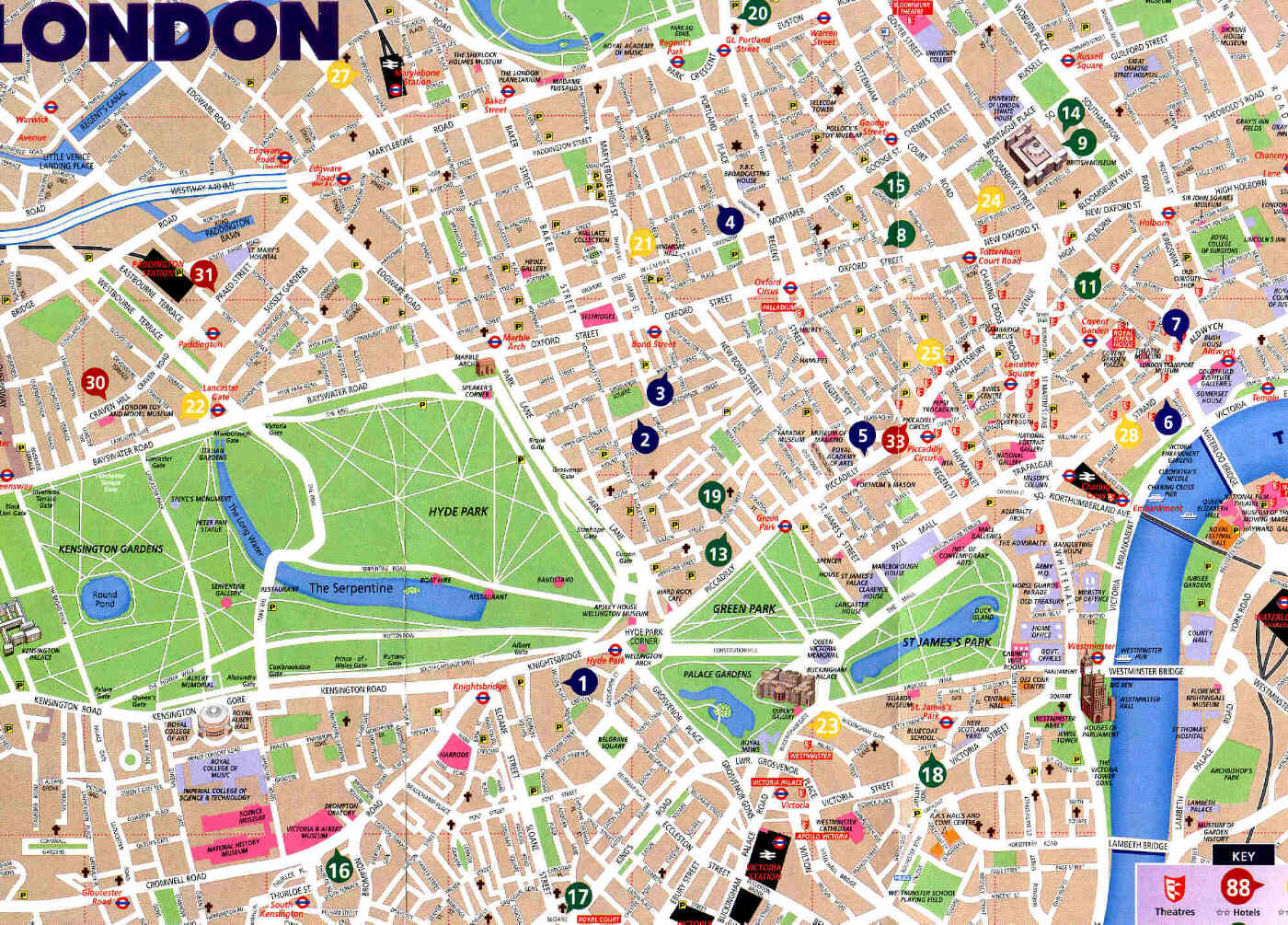
ETA: Here is a street map of part of central London to illustrate its messiness.
Depending on how slavishly a city adheres to its grid numbering system, you can get strange numbering patterns on streets that aren’t orthogonal to the grid lines (that is, diagonal streets.)
There is one curvaceous street in Fresno that I know of that is primarily a north-south street, and has numbers along the north-south grid. But the street is curvaceous, and a few blocks of it run nearly east-west – but the numbering there still follows the north-south grid.
See the kinda-sorta problem there?
You have several blocks running nearly east-west, with very little north-south gradient, but numbered according to how far north-south each house is. With a very small north-south delta from one house to the next, you have a very small differential in their numbers from one house to the next. For a long stretch, the houses have numbers incrementing by just 2 (to keep the evens on one side and the odds on the other side), and I suspect they had to fudge to do even that. The houses should probably have been numbered at increments of 0.5 or maybe even less.
Yep - I used to frequent MK quite a lot, and they do, more or less, have a grid layout. There are 11 roads aligned roughly north-south and 10 aligned roughly east-west, known as “V roads” and “H roads” respectively (for “vertical” and “horizontal”). V-roads are named as “Streets”, and H-roads as “Ways”. The roads are not precisely straight and aligned, and there are several places where two H roads, or two V roads, meet at a junction.
MK is famous for their excessive number of roundabouts. Oh! - and the concrete cows.
London’s haphazard street layout might well have been ‘improved’ after the great fire (1666) and I think Sir Christopher Wren made a proposal to introduce Parisienne style streets and boulevards. As so often happens, the owners of the plots refused to cooperate, and the city could not afford to force them, so the medieval layout was retained.
What we now take for granted in most of North America was a relatively new innovation, called the “Philadelphia System” when Chicago switched to it in 1879. Numbering houses from a point of origin, rather than sequentially along the street, was one innovation. The idea that house number 2801 should occur just after passing 28th Street was still another.