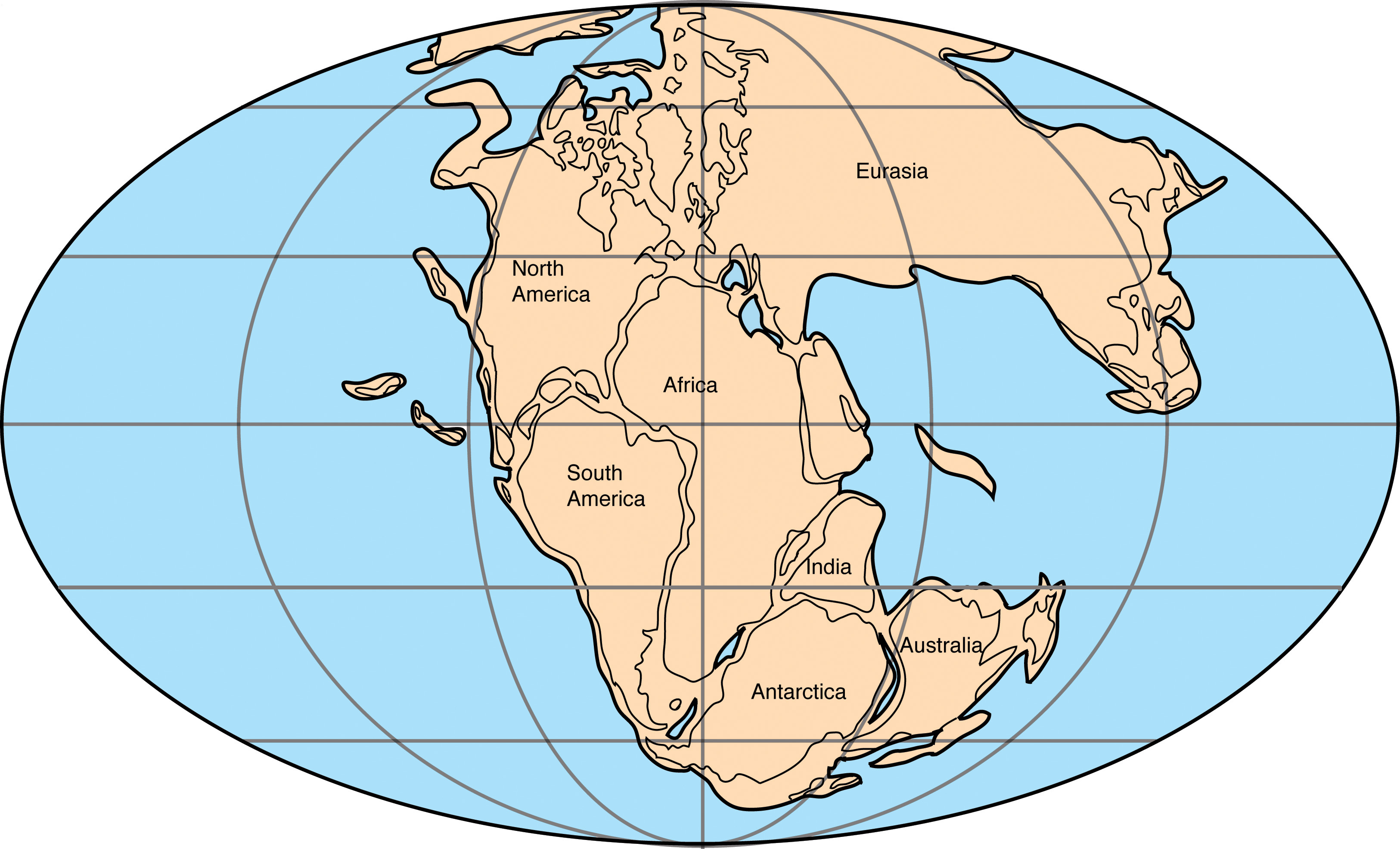
I’ll go first. I live in Virginia, whose Pangaean neighbor was Senegal. The indentation on the east coast of North America at the outlet of Chesapeake Bay matches up with Cap-Vert, Senegal, the farthest west point in all of Africa. I live in Northern Virginia, so my neighbor was northern Senegal, perhaps Saint-Louis.
The Baja peninsula is a more modern feature. It was all once part of North America, but as the new plate boundary between the Pacific and North American plate is opening up in the Gulf of California, Baja and the parts of Southern California west of the San Andreas fault are now on the Pacific plate. I don’t think it was ever a separate landmass before that.
I’m not sure what they DO represent, but the most common paleo-maps on the internet at www.scotese.com don’t show them: Jurassic
I suspect that they’re just representative of the various exotic terranes that crashed into the west coast of North and South America at some point AFTER the time the map is representing. So they know there were some large island arcs out there, but the exact position they were in might be unclear.
Farallon Plate, I believe. It gave us the Cascades’ and Rocky Mountains’ orogeny and Mount St. Helens and the Yellowstone Caldera hot spot, via subduction under the North American plate. There are cool graphics showing how the remnants of the Farallon plate, after being pushed down into the mantle by North America, sank all the way down to the bottom of the mantle and wound up lying on the outer core by the time it got all the way under the east coast.
So the present-day answer would be the Farallon islands and the Juan de Fuca mini-plate underlying the Cascades. Not much else is left of those old scraps of crust.
Paleomap Project for many more looks at the Earth’s past. Pangaea existed during the Permian and Triassic. In the middle of its existence, it went through the Permian-Triassic Extinction Event, the most massive extinction ever, in which 96% of marine species and 70% of terrestrial vertebrate species went extinct. After the mass extinctions the Earth was almost lifeless, hot, and dry. Terrestrial ecosystems did not recover for 30 million years. I’m wondering if the effects of compacting all continents into one intensified geological activity, causing climate change that caused mass extinctions? Could having a Pangaea be bad for the biosphere?
The Canadian Shield has been a stable interior continental craton for at least a billion years, since the Precambrian. Beginning with Wisconsin and Minnesota in the Devonian, and then the Dakotas and Nebraska in the Mississippian (early Carboniferous), extending south from the Canadian Shield, the Upper Midwest has also been a stable interior continental landmass for about half a billion years.
I’m still between Egypt, Saudi Arabia and Turkey, although the Mediterranean sea has shrunk to a couple of lakes, and the Indian Ocean is much closer, which is nice.
Ah, but which coast? It looks like Islamabad is just about on top of the plate boundary between the Eurasian and Indian plate. So possibly depending on what side of town you live on, you either would have been next to your current Central Asian neighbors or way down by Madagascar.
