"Why is Greenland considered an island but not Eurasia?
March 12, 2008
Dear Straight Dope:
What are the requirements for being classified as an island? Africa, Europe and Asia are all connected and surrounded totally by water, how come they aren’t considered an island whereas Greenland is?
— JPetraliaX
Well, JP, Mr. Webster conveniently answers your question with this definition for “island”: “a tract of land surrounded by water and smaller than a continent.” Since Africa, Europe and Asia are all continents, they’re automatically disqualified. Greenland, on the other hand, isn’t considered a continent, so voila. I don’t have my atlas in front of me, but I’d venture to guess that Greenland is even smaller than The Middle East, so even if you’re a follower of the new upstart cartographers who consider the Middle East to be a continent (as well as communism an ideal economic situation) Greenland still wouldn’t qualify.
— Veg"
ummmm Australia??? It’s both an island and a continent
Australia is 3 million square miles, Greenland is less than a million, and there are no isolated tracts of land on Earth of an intermediate size. So unless you want every island to be called a continent or every piece of land to be called an island, this is the best cut-off point there is.
(For reference, Europe is just under 4 million square miles and Antarctica is five and a half, so Australia is in the right league. Also, we don’t have a good body of knowledge about Greenland, so a lot of what we’re currently counting as ‘land’ could be an ice sheet covering the ocean.)
I thought Australia was part of a continent, one that also includes New Zealand, Fiji, Micronesia, Nauru, etc.
(If I was wrong, what continent are they in? I thought that “Australia” and “Oceania” (to prevent confusion with the country whose capital is Canberra) were two names for the same continent covering roughly all landmass in the Pacific Ocean.
Having lived in Hawaii, I can tell you it did not seem like anyone considered the place to be part of any continent. Part of Polynesia, yes, but no one felt it was North America, Asia etc, certainly not part of Australia.
Dudes, “continent” is a descriptive term, not a scientific one. It just so happens that on Earth in 2010 there’s a land mass with 3 million square miles, and the next smallest land mass has only 1 million square miles. So we call one a continent and the other an island. It’s perfectly possible that Earth in 2010 could have had land masses with 3, 2.5, 2, 1.5 and 1 million square miles, making the distinction between continents and islands completely arbitrary. However, it turns out that some land masses are a lot bigger than others, and we happen to call the big land masses “continents”, and the others islands.
wow, lot of people wondering around the bords lol. I grew up in Australia, we were always taught in school that Australia was both an island and a continent (the only one), just thought it was strange this post with the Webster’s quote seeming to say that if it is classed as an island then it can’t be a continent. Anyway thanks for all the great answers folks.
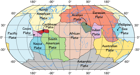
Australia is also on its own tectonic plate*, along with New Guinea and half of New Zealand. Greenland is on the North American plate. I wonder how we’d class Greenland if it were on its own, independent plate.
I seem to recall reading Greenland is actually a bunch of islands underneath an ice sheet. Does that sound familiar to anyone? Can’t be arsed to look it up at the moment.
The central basin of Greenland is some 300m below sealevel. If all the ice were to melt, this central basin would flood and Greenland would resemble a gigantic lagoon.
The depressed land there is mainly the result of all the ice depressing the rock. Without the ice, the basin would rebound upward and possibly eventually rise above sealevel. However, that would take a long time – the land of northern N America and northern Europe is still rebounding from the last glaciation which melted some 10 to 12 thousand years ago.
On the subject of continents, I like Wikipedia’s page (Continent). It shows pictures arguing for anything from seven to four continents. I’m rather partial to four, myself, there’s less to remember and it keeps border disputes to a minimum.
There are hotshot foreign executives who like to advertise themselves in Bangkok as having worked with companies on every continent. I always say: “Even Antarctica? :eek:”
Here’s a map showing Greenland without ice. It’s apparently before ‘rebound’ as there’s an inland sea in the middle, and the rest of the world shown seems unaffected by whatever might have melted the ice…
Geologically (as opposed to what happens to be above sea level at present), New Guinea and Tasmania, but not New Zealand or (most) Pacific Islands, are part of Australia-the-continent. )To clarify, there are a few islands off the ‘tail’ of New Guinea that would be included – but not most of what people think of as Oceania).
Expanding on dtilque’s excellent answer, I suspect you may have confuted the fact that central Greenland is depressed by the weight of the overlying ice with the geological state of an ice-free Antarctica, which would be comprised of an Australia-sized continent of East Antarctica and an island chain including West Antarctica and the present Antarctic Peninsula (along with a few present icebound islands).
A paper airplane and an Airbus A380 are both airplanes, by definition.
An island is smaller than a continent–by definition. Simply put, size is a critical attribute in the definition of some objects, but not others. Similarly we don’t speak of tiny giants or enormous midgets.
