If you mean me, I meant a line starting in the east and ending in the west, pretty much like anyone else. But your idea of Coastal California and Inland California intrigues me. Everybody gets what water they already have and away we go!
As far as I can tell from that Wikipedia article, none of those 27 attempts to split the state even made it onto a ballot as a proposition. Most of them were just ideas announced by one random politician or another that got no traction at all.
If we’re gonna start redrawing state boundaries, the first thing we should do is make separate states of our dozen or so largest metropolitan areas – those being real, indivisibly organic entities that could benefit immensely from a metropolitan government with the full constitutional powers and functions of a State of the Union. (Of course the Framers never envisioned such thing as a city-state (with the marginal exception of D.C.), but they lived before the Industrial Revolution and the emergence of megacities.)
Beyond that, I guess we could start by drawing lines based on the Nine Nations of North America and go from there. E.g., a division of Texas into three parts (one MexAmerican, one Dixie, one Breadbasket), each more culturally homogeneous than the whole state is now, might make a certain sense.
Here are some other ideas that have been floated, in earnest or otherwise, for reorganizing the American state system:
- From Sinclair Lewis’ 1935 novel It Can’t Happen Here, Chapter 16 (at this point in the story, a Midwestern populist-fascist demagogue, Berzelius “Buzz” Windrip, of the Corporate or “Corpo” Party, has just been elected president of the United States, has taken office, and has seized dictatorial power through his partisan army of “Minute Men” – modeled, clearly, on Hitler’s SA stormtroopers; the protagonist Doremus Jessup, a newspaper editor in a small town in New England, reflects on the changes):
- In his 1972 book Reclaiming the Constitution: An Imperative for Modern America (Santa Barbara, CA: Clio Press), Leland D. Baldwin proposed reorganizing the “lower 48” into a system of 14 new states of roughly equivalent populations. Going from west to east (population figures are, of course, based on census data available in 1972):
Oregon: 6.3 million people. Includes the present states of Washington, Oregon, Idaho, and the northwest edge of Montana
Sierra: 8.2 million. Most of present-day California north of the L.A. area.
California: 11.6 million. All of Southern Cal from L.A. to San Diego, down to the border with Mexico.
Deseret: 4.7 million. All of Nevada, Utah and Arizona, plus western New Mexico, western Colorado, and the southwest corner of Wyoming.
Missouri: 9 million. The Dakotas, Nebraska, Kansas, most of Montana and Wyoming, eastern Colorado, and northern strips of Oklahoma, Texas and New Mexico (all in a line with the present Oklahoma panhandle).
Texas: 15 million. Most of Texas and Oklahoma, plus eastern New Mexico, western Arkansas and northwestern Louisiana.
Mississippi: 18 million. Minnesota, Wisconsin, Iowa, Missouri, and Illinois outside the Chicago metro area.
Chicago: 8 million. The whole Chicago metro area, including adjacent urbanized parts of Indiana.
Erie: 23.7 million. Michigan, Ohio, and Indiana outside metro Chicago.
Savanna: 23.2 million. Mississippi, Alabama, Georgia, South Carolina, Florida, eastern Louisiana, eastern Arkansas, and the western tip of Tennessee.
Appalachia: 16.5 million. Virginia, West Virginia, North Carolina, Kentucky, and the bulk of Tennessee.
Alleghenia: 19.7 million. Pennsylvania, Maryland, Delaware, and southern New Jersey.
New York: 17.6 million. The whole New York City metro area, including northern New Jersey, southeastern New York, and western Connecticut.
New England: 16 million. The remainder of New York and Connecticut plus all the other New England states.
For geographic reasons, Alaska (pop. 295,000), Hawaii (718,000) and Puerto Rico (2.7 million) are left as separate states.
The People’s Almanac, by David Wallechinsky and Irving Wallace (Garden City, N.Y.: Doubleday & Co., 1975), includes maps for two more reorganization schemes.
- “A 16-State Nation,” proposed by Dr. Stanley D. Brunn, associate professor of geography at Michigan State University. The states are:
Pacifica: Alaska, Hawaii, Washington, Oregon, California north of the L.A. area, plus northwestern Wyoming and Idaho, and a western strip of Nevada. Capital: San Francisco.
Rocky: Montana, Colorado, Utah, most of Nevada, Wyoming and Idaho, northern strips of New Mexico and Arizona, western strips of South Dakota, Nebraska, Kansas, and some western bits of Oklahoma and Texas. Capital: Denver.
Angelina: Southern California, most of Arizona and New Mexico, and southwestern Texas. Capital: Los Angeles.
North Plains: Minnesota, North Dakota, most of South Dakota, northeastern Wyoming, northern strips of Nebraska and Iowa, the northern half of Wisconsin, and the Upper Peninsula of Michigan. Capital: Minneapolis.
Central Plains: Most of Kansas and Nebraska, plus western strips of Iowa and Missouri. Capital: Kansas City.
South Plains: Most of Oklahoma and northern Texas. Capital: Dallas.
North Heartland: Central and eastern Iowa, southern Wisconsin, western Michigan, northern Illinois and most of Indiana. Capital: Chicago.
South Heartland: Eastern Missouri, southern Illinois, a southern strip of Indiana, western Kentucky, northwestern Tennessee, and the northern third of Arkansas. Capital: St. Louis.
New South: Georgia, north-central Florida, southern South Carolina, the west ends of North Carolina and Virginia, a bit of southeastern Kentucky, the bulk of Tennessee, southern Arkansas, eastern strips of Texas and Oklahoma, and all of Louisiana, Mississippi and Alabama that are not assigned to Gulf Coast (below). Capital: Atlanta.
Gulf Coast: Southeastern Texas, southern coastal strips of Louisiana, Mississippi and Alabama, and the western end of the Florida panhandle. Capital: Houston.
Industry: Ohio, eastern Michigan, northeastern Kentucky, western West Virginia, western Pennsylvania, western New York. Capital: Detroit.
Yankee: Maine, New Hampshire, Vermong, northeastern New York, eastern Massachusetts and half of Rhode Island. Capital: Boston.
Empire: Connecticut, western Massachusetts, southwestern Rhode Island, central and southern New York, northeastern Pennsylvania, northern New Jersey. Capital: New York.
Mid-Atlantica: Maryland, Delaware, south-central Pennsylvania, southern New Jersey, northern Virginia, eastern West Virginia. Capital: Baltimore.
Carolina: Southern Virginia, most of North Carolina, northern South Carolina. Capital: Norfolk.
Tropicana: Central and southern Florida, Puerto Rico and the Virgin Islands. Capital: Miami.
4. Also in The People’s Almanac: A 38-state nation proposed by G. Etzel Pearcy, geography professor at California State University, Los Angeles. The resulting map looks a lot like what we’ve got now, except that the states are an average of 1/4 larger in area and there are no straight-line boundaries. I won’t try to list or describe the new states. More interesting is the commentary:
When you think about it, a river should never be a state boundary, not anywhere in the world – because the local economy and community are bound to be trans-riparian every mile of its course. Two Kansas Cities, two St. Louises, in different states yet, what’s up with that shit?!
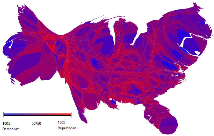
Several of those ideas make sense to me, much more sense than the idea of creating administrative boundaries based on perceived, and often transient, socio-political loyalties. Such loyalties should be allowed to flow throughout a state and not be gerrymandered and calcified based on current notions of liberal-conservative, urban-rural, Democratic-Republican, red-blue, etc. Most important, a city should never be politically cut off from it’s surrounding hinterlands. Diverse populations should be required to work together politically with the local urban economic engine at the heart of each administrative division. State lines should be drawn in a manner that treats the population as a collection of residents/citizens with equal status, not as members of permanently opposed socio-political camps. Within each jurisdiction, no contemporary political faction should feel secure as a permanent gerrymandered majority with a kind of first-class status in comparison with the out-group having second-class status within the jurisdiction.
This is not new. In 1941 the state of Jefferson was formed in Northern California/Oregon. It was to be announced Dec. 8, 1941. But the Pearl Harbor attack came ending the idea . But the idea has been festering ever since.
Not all state splits involve the typical north-south, LA/SF break. Many folks in NORTHERN California want nothing to do with even San Francisco. Some folks want a new state based on California North of SF, which would have a population of about 12.
Of course, the old codgers (like this one) around here declare that this was only done to stave off a war between MA and NH: MA kept trying to annex NH so that it didn’t have anything between it and the “northern part” of the state, and they were sucessful at least once.
As a native Californian who has lived in both northern & southern, my feeling is that it would make more sense to split the state into east and west, not north and south. Whatever differences you can point to between, say, San Francisco & Los Angeles (and there are plenty) pale in comparison to, say, San Francisco & Fresno. Just look at the color coded voting patterns.
If by “it was to be announced” you mean some crackpot politician was planning a speech, you might be right.
There was never any serious plan to do this.
Why does everyone talk as though it should be a North/South split?
Butterfly the state. Start where the Cascades cross into Oregon, draw a line that is roughly parallel to the border with Nevada, and end in the Colorado River Desert. Voila! East and West California!

http://www.jeffersonstate.com/jeffersonstory.html
Perhaps a lot more serious than you think.
A split between North and South has been the traditional approach. For the sake of argument, assuming that we want to split the state, and that it could be done, I think a lengthwise split between urban/coastal and rural/inland would make more sense. I think the L.A. - S.F. rivalry has become largely irrelevant, because the two cities have become more similar politically over the years. A generation or two ago Los Angeles was much more conservative than San Francisco.
Right. Ever traveled through Appalachia? A few state line markers where a mountain road crosses from Virginia and West Virginia is no boundary.
You are correct - but most coastal states are that way. The differences between Seattle and Spokane are far greater than the differences between Seattle and San Francisco, but to divide up California in that manner would just create another under populated state with disproportionate voting rights, and we already have enough of those.
North/South would make for fairer national representation.
We really need to abolish the U.S. Senate and render all that irrelevant, but that’s another discussion.
Here is an LA Times blog on the current idea - with a map. As I said in another thread, they should just use the current name for the new state - “El Norte”.
I’m trying to figure out whether that Times column is one big whoosh or just really stupid.
It’s a really bad idea to draw state lines primarily for the purpose of partisan gerrymandering, and that’s pretty much all that that column talks about. States last a long time. It’s not just district lines that are going to get redrawn in 10 years (or sooner).
And if the presidential election is really such a big motivation, I think it’s better to get rid of the electoral college than to split one state to satisfy a certain partisan faction. Why not split every state along partisan lines, then?
The Times blog is tongue-in-cheek, but this is the latest proposal. The Republicans in those counties are tired of their effective irrelevancy at the State level.
It’s never going to happen, but I hear they are talking of drawing the line at LA. That would put almost all of CA’s population, and most of the money in the southern state. The water and agriculture in the north. I can’t see it happening. And the flag. What would they do with 51 stars?