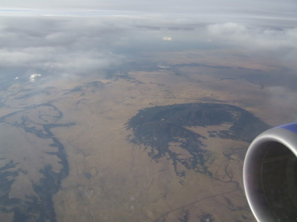
I flew from Providence to Phoenix and somewhere in the Colorado plateau or northern New Mexico region I photographed this. To me it looks like a crator of some kind, either pushing up through the crust or it’s an old impact site.
It looks a lot like this pic.
Which I believe is this.
From here
http://www.nmnaturalhistory.org/pdf_files/NMvolcanoes.pdf
Yes, yes - in the northwest of that map is the exact site I took the pic. You have to drag is down slightly. I thought it was impressive from my vantage point. I’d love to go down and explore it, hike around maybe camp. Looks like it might be private land or BLM land.
Thanks for the link!
gazpacho, your map started at 3699 S Monaco St, Denver. That sounded familiar. Turns out I spent 2 weeks there a while back.
Fubaya, I think that 3699 S Monaco St, Denver is left over from some search you did. I see no such stuff in my google maps link.
I was really amazed at how quickly I found the spot. If you zoom out to where you can see all of New Mexico you can see what looks like it may be it. If I hadn’t seen it in about a minute I would have given up.
Not only am I a geologist, I’m a bona fide volcanologist (although one on the very not-exciting side of things: igneous petrogenesis and trace-element geochemistry).
That said, and I hate to be a buzz-kill, but what is pictured (and shown in the google map) is absolutely, positively NOT a volcano, ancient or otherwise. It is a structural dome that may have an igneous (although not volcanic) origin… in other words, it MIGHT be a laccolith, but it is, alas, not a volcano.
(As noted, it does like in the Ocate volcanic field, so it most likely a laccolith.)
My source? This Geologic Map of New Mexico. Warning! Gigantic (17Mb) PDF:
http://geoinfo.nmt.edu/publications/maps/geologic/state/NM-500k-geology.pdf
Explanation (1 Mb):
http://geoinfo.nmt.edu/publications/maps/geologic/state/NM-500k-explanation.pdf
Linking page:
http://geoinfo.nmt.edu/publications/maps/geologic/state/home.cfm
Update:
In that pic, the big, black obvious thing is what I described in the post above. Probably a laccolith, domed Triassic rock, etc.
However… a bit less obvious in that picture, right at the “mouth” of the big laccolith and just in front of the jet engine there does like a wee volcano: the Maxson Crater, part of an old basaltic shield volcano!
Coordinates:
35.8986503 -104.8897209
Aerial photo:
Oh sorry. I thought you were staying there. Nice place but I was going to warn you about… well doesn’t matter. I guess it’s not such a small world. That’s weird, that address shouldn’t be on this computer or under my google account.