By which I mean, you know how you sometimes see maps on tv with little pins in them to, well, pinpoint locations? Often color coded? Does someone have an app or website that will do that?
I want to do two things: I want to map all my scheduled stops (6-9 a day) for the week, color coded by day of the week. I want to look at a map of my whole week so I can figure out how to schedule clients with the least amount of driving around.
Then I want to have my coworkers put up their clients so that we can figure out who is where, geographically, on which days. So if we get a new client, I can look at the map and go, “Oh, Pat’s over in that neighborhood on Tuesdays, let’s give it to Pat.”
Surely some logistics company has already done this on something more customizable than Google maps, yes? Anything that doesn’t cost a fortune?
Upon further investigation, Google’s own My Maps (formerly Maps Engine Lite) is probably easier to use than Caltopo. The traveling salesman problem (quickest route between multiple stops) is still addressed in that other thread by other websites.
I sure don’t know how I’d do home nursing without it! Can’t imagine the days of paper maps in a job like this.
I’m also pleased to find (after putting pins on a virtual map) that - apart from a few “but he has to be seen on Thursday, even if it’s inconvenient” exceptions that I already knew about - I’ve actually been scheduling fairly efficiently intuitively. I’m pleased. 3 years and I’m finally getting the hang of that portion of the job!
If you have a list of addresses, you can even have Google Maps locate the pins for you by creating something called a Fusion Table, which is an option in your Google Drive. It’s pretty straightforward and you can easily find how-to notes and videos online, but basically you say Create a New Fusion Table, upload a list of addresses, indicate which column has addresses, let Google geocode them, and switch to the map tab. Easy peasy.
If you prefer, Microsoft’s MapPoint is a stand-alone solution for plotting a bunch of addresses.
I’ve been trying to use Google Maps to do these kinds of things for a long time with limited success. Maybe it’s just me…I wonder if there is a good tutorial available?
Does the new and improved version or the classic version work better? I don’t care for the new one…my main gripe is that the routes are so thick that you can’t see alot of the detail until you zoom in farther than you otherwise would.
Have you tried it with the new-ish My Maps link? There are various types of lines you can draw now, from thin black generic ones to driving/walking/biking routes that automatically follow the roads and such, just like the regular google maps.
If that still doesn’t work for you, give caltopo.com a try. It’s a bit more complicated/powerful, but you can set line sizes, base maps, and all sorts of other things. Still free and sharable. Caltopo is meant primarily for making hiking maps, but you’re not limited to that. It uses Google’s driving map as its default basemap.
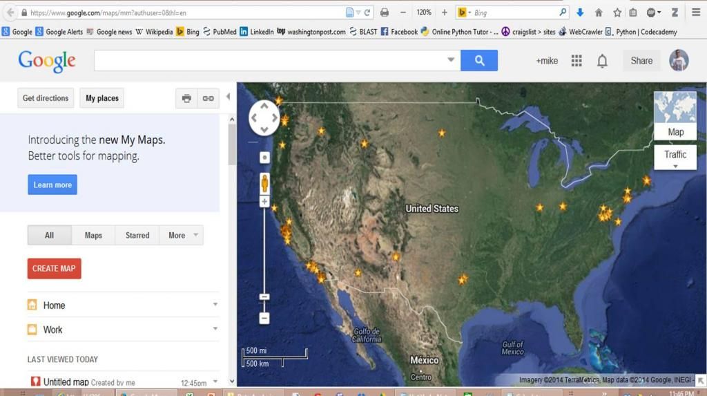
I don’t see the KML link. I see my map with starred places on the right hand side.
On the left below the Google Search field up top, there are the Get directions, My Places, Print, and Share buttons. Then there’s the upgrade to My Maps Learn button. Below that are the All, Maps, Starred, and More buttons, and below that are my scrollable starred places links.
When I was googling how to do this, I saw screen shots of Google Maps with the Folder icon and the export KML link, but my screen doesn’t have those.
Once you click on one of the entries (like the “Untitled map” with the red icon next to it), it’ll open up the editor in a new tab. In that tab, under the map name should be a folder icon. Click it and you should see the “Export to KML” option. Does that work?
If you have maps you created with the older editor, it might look like a yellowish map icon with a small red pin on it. In that case, it’ll open up the older editor and the KML link will be text instead of in the folder icon.
Thanks Reply, I can now find the KML link by selecting a map and using the Edit button.
However, all my maps with the red icon were created with in the last few days trying to figure this out and don’t have all my starred places. In the map in the viewer, I had added starred places individually over time, but never saved them to a specific map. It’s sorta of my default map, I guess.
When I create a new map now, there are no starred places. I see the Add Layer and Import option, but I don’t have a KML file to import.
Is it possible to use the URL in the Link option and then go to Google Earth and use that to add starred places? Could Google Earth then export a KML with those starred places?

