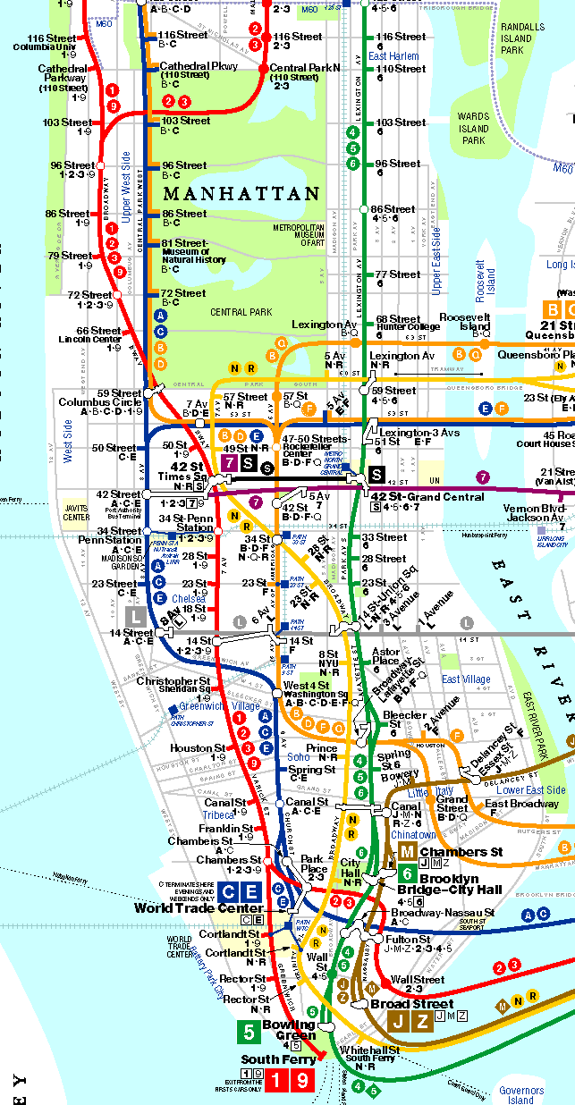
The MTA website shows the subway lines, but not the street grid. The map web sites I have found show the street grid, but not nearby subway lines.
Is they a website out there that combines the two?
Sua
The MTA website shows the subway lines, but not the street grid. The map web sites I have found show the street grid, but not nearby subway lines.
Is they a website out there that combines the two?
Sua
Well, I searched for +manhattan +subway +map on altavista, and this is what I found:
This one doesn’t show the actual grid, but I included it because it’s cool. You click two stations and it gives you instructions to get from the first to the second.
I also found this, which does show streets.
The MTA Bus maps have both bus + subway plus most of the streets. You can download a .pdf from their website or when you get to the city most buses and subway stations have them. http://www.mta.nyc.ny.us/nyct/maps/busman.pdf
Sort of. The New York Times’s New York Today guide gives directions by foot and subway, so you can enter an address and find which lines are nearby. It gives several alternatives, too. You’ll find it here.
Actually, the best map for transit, albeit one with the subway lines in the background, is the MTA’s bus map (it’s also just a good map of NYC - and it’s free at any subway station!). It shows a very detailed street grid, along with subway stations and lines.
(shows what happens when you leave your reply box open for an hour)…
Well, Mack, great minds think alike and all that…
Thanks all.
Sua
Maybe I’m crazy, but I thought that the MTA site used to have a PDF of the subway map, too.
The REAL map–the paper one they give out at stations (which is pinned to the wall behind me) that has cross streets.
Either I’m misremembering, or they “upgraded” to that crappy clickable map and did away with the useful one.