Any claims of partitioning the United States along “red/blue” lines are a fantasy, just on simple geography.
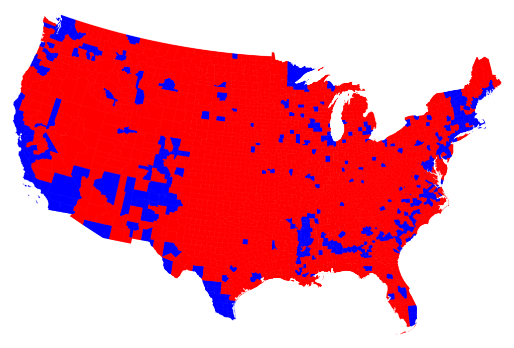
Look at the various maps on this page. Starting with this one, any proposed borders are already pretty complex, with a large “red” area which is contiguous, but nonetheless has a pretty complicated border with the “blue” areas, which exist as a series of enclaves. Imagine trying to “build walls” between all of those areas.
And, of course, a number of the 2016 “red” states were blue as recently as 2012–that’s how Trump won, by breaching the “blue wall”. And, although almost all U.S. states allocate their electoral votes by “winner-take-all”, many states–include states that were crucial to Trump’s victory–were won by very narrow margins.
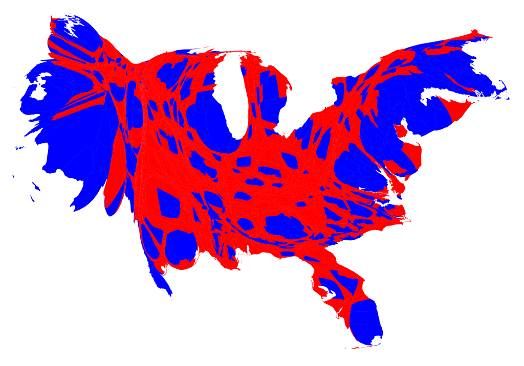
We can start to see this better by looking at a map of red and blue counties, rather than states. Ah-ha! Why, Trump carried practically the whole country, except for just a few scattered enclaves of liberal snowflakes! Heck, they can all just move to [del]Russia[/del] uh, Sweden.
But of course many of those blue areas, being cities, have way more actual people than a lot of those vast empty red spaces. If you tried to partition the country that way, not only would the mostly urban blue areas be reduced to isolated enclaves, but those rural red areas would be cut off from the places that form the natural markets for their agricultural or mining products; and that (naturally enough) form the nodes of their communications and transportation networks.
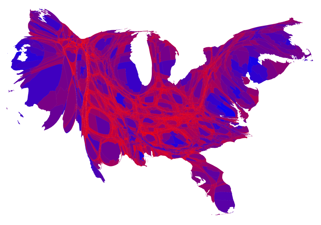
We can also see how unworkable such a partition would be by looking at a county-level “cartogram”, in which the sizes and shapes of the areas are distorted to give an idea of their relative populations. Now, the red counties are looking rather squeezed in many places, and there are some quite large “blue blobs”. Finally, although we talk about a candidate “winning” a county, showing counties as “winner take all” isn’t necessary any more accurate than showing states that way. Hence the last map, combined a county-level cartogram with different shades of red, purple, and blue: Some bright red strings (which in the real world may be quite large, but also mostly pretty empty), some pretty large and vividly blue big cities, and a whole lot of reddish-purple, purplish-red, purplish-blue, and bluish-purple. How the hell are we going to partition that?