Does anyone know where there’s a list of ZIP code ranges by state? What I’m looking for, specifically, is a chart that says ‘If the ZIP code is greater than or equal to [minimum number] and less than or equal to [maximum number], then the state abbreviation is [XX].’ That is:
90000 - 96199 CA
98000 - 99499 WA
That sort of thing.
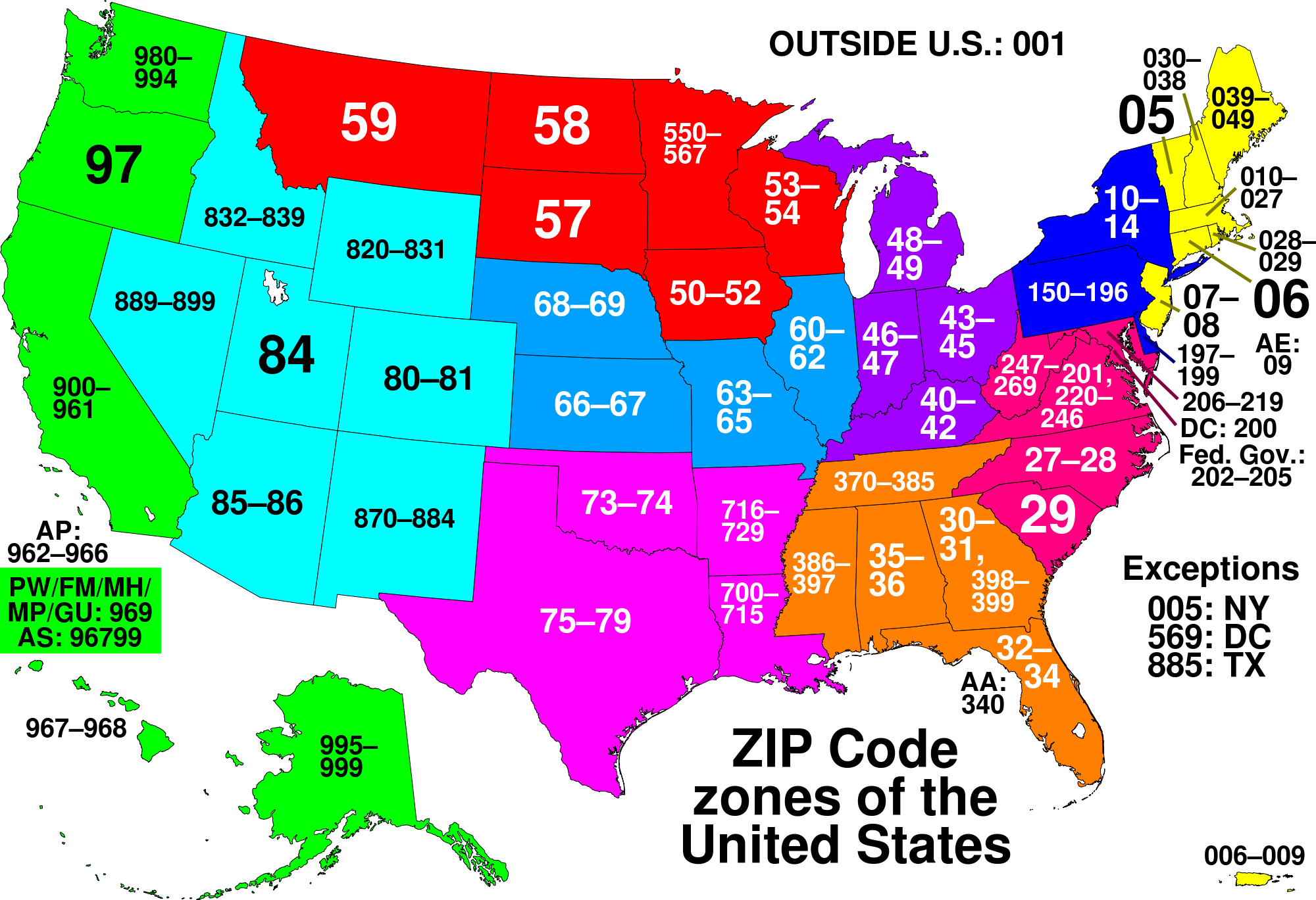
I found this page, which at first glance looks like what I want; only there are overlaps. For example, the minimum ZIP code for VA is 20040 and the maximum is 20167 (also 22001 to 24658). But there’s also 20042 to 20599 for Washington, DC, and 20042 to 20042 for VA. So without looking up the ZIP code, I don’t know if 20042 for DC, or for VA. So that page isn’t entirely useful to me.
I could use a U.S. map with ZIP codes on it and type everything up, or (which I’ll probably do) use the linked source and just look up questionable ranges; but it would be a lot easier if there’s an accurate list as I described earlier!
You’re not going to find such a list, because ZIP code ranges and even individual ZIP codes can cross state lines. ZIPs are about delivery zones, not about political boundaries.
The overlap among DC-MD-VA comes from federal offices in the suburbs carrying zip codes that do not match the surrounding area. If you look on Wikipedia, several prefixes beginning with “20_” are categorized as “Government” rather than assigned to a particular state.
Bottom line: contrary to popular belief, the zip code system is not hierarchical and is not aligned with state, county, or city boundaries. It’s *mostly *that way, but not to the degree that you can build an algorithm with that as one of your conceptual foundations.
I can even see one error in the map. At leastone place in New York State has a zip code beginning with 06 – the number for Connecticut. There’s a logical reason for it.