Eh, it seems to me that when we’re talking in a context of mountains (or even “mountains”), “anyone can do it in a day” is a pretty good standard for “easy”.
Perhaps “easy mountain” implies a different context from “easy hike”.
Generally true however it’s a pretty damn tough day hike. 21 miles round trip. If you do it in one day you’re going from the trailhead at about 8000 feet to the peak at 14,700 feet and back. If you aren’t used to higher altitudes you may get sick (I got quite ill at the peak and saw several folks vomiting along the last few miles leading to the peak).
There’s an endless series of switchbacks from 12.5k to 13.5k…I guess you can say it’s graded and well-maintained in the same way that the stairs to the top of the Empire State Building are. ![]()
Once you make it to the trail junction at the top of the switchbacks you are hiking on a narrow trail for a couple more miles to the peak. There’s at least one spot where the trail is a ridge a few feet wide with very long, steep drop-offs on both sides. Someone who isn’t good with heights would not be happy. The thinner air is noticeable; most people take a few steps, stop and breath, repeat all the way to the peak.
For the record, the National Park Service rates the Guadalupe Peak hike as “strenuous”.
![]()
That’s a few ifs. I’ve done it, I wouldn’t consider it easy.
[quote=“MikeS, post:34, topic:729517”]
After following the links from the Peak Baggers website, I stumbled across this list of peaks by their difficulty. It’s subjective, of course, but here’s are the easiest ones (with a ranking of 1 on a scale of 1–10):
[ul][li]Cheaha Mt., AL[]Ebright Azimuth, DE[]Britton Hill, FL[]Hawkeye Point, IA[]Mt. Sunflower, KS[]Black Mt., KY[]Mt. Greylock, MA[]Mt. Arvon, MI[]Woodall Mt., MS[]Taum Sauk Mt., MO[]Panorama Point, NE[]Mt. Washington, NH[]High Point, NJ[]Mt. Mitchell, NC[]Campbell Hill, OH[]Mt. Davis, PA[]Jerimoth Hill, RI[]Sassafras Mt., SC[]Spruce Knob, WV[*]Timms Hill, WI[/ul]The “hikes” to all of the above peaks require less than 150 feet of elevation gain and less than 0.6 miles of horizontal distance, assuming that you drive to the nearest road access.[/li][/QUOTE]
Mt. Washington really has no place on that list. Granted, if you drive up the auto road or take the Cog railway, you’re only a few feet from the top, but that’s the best case, and it’s a harrowing damned drive even in good weather. Just the drive up the mountain makes it a 4 at least. But you can also do it the hard way and that’s probably a 3-4 hour hike each way, up steep rocky trails with weather and terrain that will cheerfully attempt to kill you if you’re not cautious.
Highpointers don’t care how you get up top, so the fact that you *can *hike up is irrelevant. You can take the stage (get driven up in a modified van) or take the train and just sit back. It just costs money.
Hiking or skiing up the mountain is much more difficult, but if you want to bag Mt Washington you can do it with no more effort than swiping your credit card. It’s best to pick a day with good weather.
I don’t know how hard it is to climb Mt. Arvon, Michigan, but the main impediment is its location: Way up in the western Upper Penninsula, miles from anywhere down a remote logging road.
Some Googling suggests that the highest point in Michigan’s Lower Penninsula is not known for sure, but is apparently somewhere near Cadillac. The Lower Penninsula in general is pretty flat, so its high point is almost certainly an easy walk.
Another team of intrepid peakbaggers
For anyone contemplating Charles Mound in Illinois, be aware that this is the last weekend that you can climb it during 2015! The mound is on private land, and the owners only open it to the public during the first weekends of June through September.
I drove out and “climbed” last summer. The mound is at least recognizable from a distance as a hilltop, which is saying something in table-flat Illinois. (The glaciers missed the northwest corner and left it a little hilly.)
The owners set up “base camp” about a half-mile from the summit, and you park and walk. The final “ascent” is maybe 100 feet. That doesn’t sound like much but it’s like going up ten flights of stairs and damned if I didn’t work up a good sweat.
31 out of 40 is stretching the definition of most?
Yup, that’s exactly what I expected Kansas’s lowest point to look like.
To be fair, a short walk is required after your train, van or car arrives near the summit.
Yes: days on which the summit is in cloud are rather common; days on which the wind is calm are not.
All of the ascent is in the last mile or so of the hike. The rest is a horizontal hike through a swamp. We made the mistake of descending at dusk and were running through clouds of mosquitoes.
That’s a fair point, though I’m not sure whether one can really put a harrowing driving experience on the same scale as a long hike. For comparison, the webpage via which I found that list notes that “both North Carolina and New Hampshire would be rated a 5 if hiked via standard routes, and Massachusetts would be ranked a 4.”
About two years ago I did the full climb of Mt. Greylock with my (relatively fit) parents, who are in their 60s. It’s quite nice if you take one of the longer routes up the western side, rather than going along the shorter but steeper paths along the eastern side.
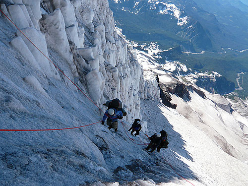
It just dawned on me how much of a slacker I’ve been. I have visited the highest point in just one state: Mount Rainier in Washington. First two times via the standard route. Third time via the more technical Kautz Glacier route: Switchbacks? What switchbacks? ![]()
Agree that you definitely notice the altitude. Makes everything seem farther away in terms of how long it takes to get there. I can’t really imagine climbing much higher so when our group had the opportunity to climb [del]Mount McKinley[/del]Denali, I passed.
Hey, it’s my thread, so how about we assume that you’re going to hike from the base of the ‘mountain’ or something reasonably close to it, assuming it can be identified without too much difficulty. Maybe impose some maximum distance condition, like ascending to the ‘peak’ by foot from the lowest spot within a quarter-mile of the peak, horizontal distance. Pretty easy for Panorama Point, Nebraska; a bit more of a workout for Mt. Washington, NH.
Mauna Kea will be a bit of a challenge. ![]()
This is a very easy peak indeed. I’ve been there and never noticed it was a hill.
I’ve been to the highest point in Missouri (mentioned in post #22 by kunilou). I, uh, drove there. You park in a parking lot, walk a few feet, and there it is.
http://www.missouritrekking.com/wp-content/uploads/2015/01/IMGP0590.jpg
That plaque confuses me, FWIW. I don’t know if it’s referring to the rocky outcropping behind it as the highest peak in Missouri, or if the plaque proper is at the highest point in Missouri and the rocky outcropping behind it isn’t included in the calculation, or what, but nevertheless, the top of that rocky outcropping is a good meter above that plaque.
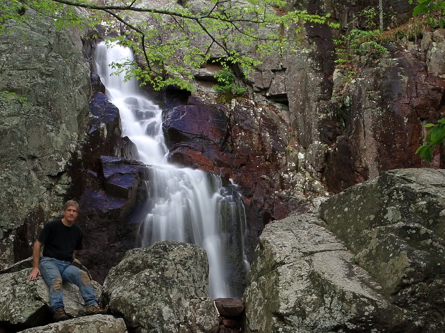
No for nothing, from that same parking lot you access Missouri’s highest (as in, biggest vertical drop) waterfall, Mina Sauk Falls, but it’s a 3-mile hike.