Is there any dashcam-style footage of a rocket going far enough into orbit that you can see the whole earth, or at least a significant portion of it, in the background?
All the videos I see are very unsatisfying edited cuts between the rocket-mounted cameras and 3rd-person view cameras, or they end just before the really good part with the earth a big obvious ball behind it.
I guess what I’m looking for is something like the left side of this video, but without the edit to the other camera at 2:29 and 3:24, and a journey a bit further away showing more of the earth.
I just want a one camera “single take” going all the way to space. Even cooler would be if it goes all the way out of Earth orbit, so we can see it getting smaller and smaller. Does anything like this exist? And if not, why? I’d be glued to my screen all day if it was available for the launch of one of the Mars probe missions or something.
You’re not going to find a single take for all the way out of Earth orbit, because that takes way too long. The Apollo astronauts took three days to get to the Moon.
Also,
[Moderating]
This isn’t really about the arts, so I’ll move it to General Questions.
Here’s a video showing a space shuttle launch from the POV of the external fuel tank. It includes the launch all the way up to the fuel tank separating about 10 minutes later.
Low earth orbit is only a few hundred miles up, which is tiny compared to the size of the Earth (8000 miles in diameter). The earth still looks huge - you need a fish eye lens to capture all of it. Just look at photos of the ISS and see how big the earth looks.
Some satellites go much higher (including most telecommunications satellites which are in geostationary orbit) but it takes a while to get there, and maintaining continuous video downlink isn’t trivial.
So even though it’s possible to downlink continuous video from an ascent to higher orbits, there may be no compelling reason to allocate the bandwidth or mount a camera for this.
Ascent to higher orbits is often not done in a continuous burn. E.g, launch vehicles for GPS satellites use a two-burn profile which takes 3 hr 15 min from liftoff to spacecraft separation.
The ascent profile for geostationary orbit can be even more complex. Note the timeline in the below link. These would be pretty boring videos:
NASA gets some feel-good PR/publicity value out of ride-the-rocket videos (and so does Space-X), but the science value is pretty limited, and that camera costs money. NASA didn’t even put a camera on the shuttle external tank until after the Columbia accident; the cost was justified at that point because this provided a view, all the way through tank separation, of the areas that were a concern for foreign-object damage (this is what destroyed the Columbia).
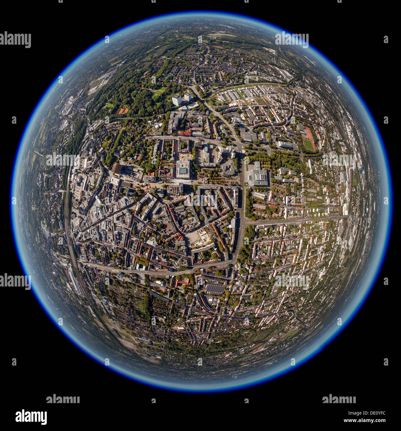
This is key: from an altitude much lower than low earth orbit, and with a sufficiently powerful fish-eye lens, you can see 360 degrees of horizon, i.e. “the whole earth.” Here’s one example of an aerial shot of the earth; you can clearly see the edges of the earth in all directions - “the whole earth.”
Consider that the iPhone’s camera has a field of view angle of around 73 degrees. I did some quick line drawings in Solidworks and figured out that if you’re looking straight down, you’d have to get up to an altitude of about 2700 miles to capture the whole earth with your iPhone.
At other altitudes, the view angle to capture the whole earth looks like this:
5 feet (typical human eye height): 179.92 degrees
7 miles (commercial airliner cruise altitude): 173.23 degrees
17 miles (SR-71 cruise altitude): 169.74 degrees
62 miles (edge of space): 159.95 degrees
249 miles (ISS orbit altitude): 140.58 degrees
26,199 (geosynchronous orbit): 15.22 degrees (instead of a fisheye lens, you’ll want a zoom lens to make the earth fill your camera’s view)
238,900 (distance to moon): 1.89 degrees (you’ll want a pretty powerful zoom lens)