Not a film; a short story. IIRC, the title was “The Man who Shrank”. It was based on the notion that atoms really are tiny solar systems, with each electron a world full of people and other objects, each made up of smaller atoms, and so forth. The protagonist originated from a world many (it’s implied at least thousands) of layers above ours, before he started shrinking and progressively exploring all of the layers below him. Which makes the objects at the start of the story, most likely, the largest objects ever featured in science fiction, and he and his lab partner the largest living things.
The 2012 film Safe House is set (mostly) in Cape Town, and was filmed here. Of course it has the usual geographical weirdnesses where they turn a corner from one street into a different street that’s actually in a different area entirely. But there were a couple of things that I particularly noticed.
One of the first scenes in the movie revolves around a character escaping from a team of assassins by hiding in a large crowd of protesters in the city centre and then entering the US Consulate. Thing is, the US consulate here is notoriously in a secure compound in an outer suburb (notorious because the suburbanites object heavily to its presence).
Then, another scene is set in the World Cup soccer stadium, and features the protagonist diving down some stairs at the stadium into an underground metro station. In reality there is no metro station anywhere near the stadium.
Finally, a really subtle detail but one that for some reason stuck in my mind: license plates. One side of this city has plates starting “CA”, the other side starting “CY”, in both case followed by 6 digits. They got that almost right, except that they used letters in place of some of the digits. Presumably they had some reason to not use real plates.
That would undoubtedly be Henry Hasse’s He Who Shrank. I read it in Healy and McComas’ classic anthology Adventures in Time and Space (1946, although my copy was the first Del Rey paperback edition from 1975) and later in Asimov’s anthology Before the Golden Age
It always bothered me that the hero could shrink down to sub-atomic size by drinking a chemical mixture, which ought not to affect anything on that scale. It also bugged me that momentum appeared not to be conserved in his universe, since he was able to move himself over to a planet when he found himself shrinking between worlds. Don’t ask me why those aspects bothered me, rather than any of the other violations of physical law.
In Stephen Kings “The Stand” he has the good guys coming into the Boulder/Denver area via Interstate 80. Inter state 80 doesn’t come into Denver it goes north through Wyoming. A spur called Interstate 76 comes into the Denver area. To be fair it would be easy to take a left in Nebraska and not notice you had switched interstates. Also possible that it was called 80 when King lived there if the interstate across Wyoming hadn’t been built yet they might have called the spur to Denver 80 and renumbered it later.
Another climate/weather example;
On Tonight’s “The Goldberg’s”, set at “January 27, 1980-something”, Pops and Adam jump into an outdoor pool (and do other outdoor activities. Trees were green.) The show is based (at least sometimes and loosely) on real life events and in Jenkintown, PA.
People are not using outdoor pools in January in Pennsylvania.
(Has there ever been snow in the show? I recall some Christmas episodes but don’t remember snow. I would think Adam would have some snow related memories (or even movies))
Brian
Some googling shows that there was a “Snow Day” episode.
Brian
I just watched the season 1 finale of CW/HBO show “Stargirl.” The show is set in a small town in Nebraska. The episode features a flyover of a snowy evergreen forest. Doesn’t fit my idea of the kind of landscape one would find in Nebraska. Does however fit my idea of British Columbia.
Hahaha! I just watched that episode last night and didn’t even notice that.
Yeah, not close at all!
Another one is in “The Umbrella Academy”- the 2nd season takes place in Dallas… sort of. They clearly filmed it somewhere else, and used digitized distance shots. I mean, it looks sort of like Dallas of the era might have looked- they got the skyline right and they got Dealey Plaza right, but the street that most of the action takes place on… just doesn’t exist. The perspective of the skyline looks like it might be Preston or Hillcrest, but the retail area on it looks a lot more like some of the older parts of Greenville avenue might have looked in that era. But with the shots of downtown where they are, there’s no actual street with that degree of retail at that distance or angle from Downtown. My wife and I were pretty amused by that- it looked just plausible enough to probably be fine for someone who hasn’t lived here for a decade or so.
This shot is what I’m talking about. (the top one, not the actual filming location in Canada on the bottom).
Funny that this thread came up today, a few hours after I was watching an episode of L&O SVU, where Ice-T stated that EZ-Pass records confirmed a Suffolk County LI-based suspect’s alibi about having been on LI (traveling to Bellport that day).
Having lived there (albeit a dozen years ago), I know that once you’re on LI, there are no more EZ Pass readers.
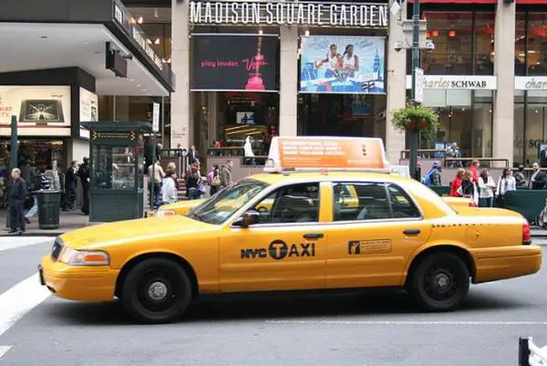
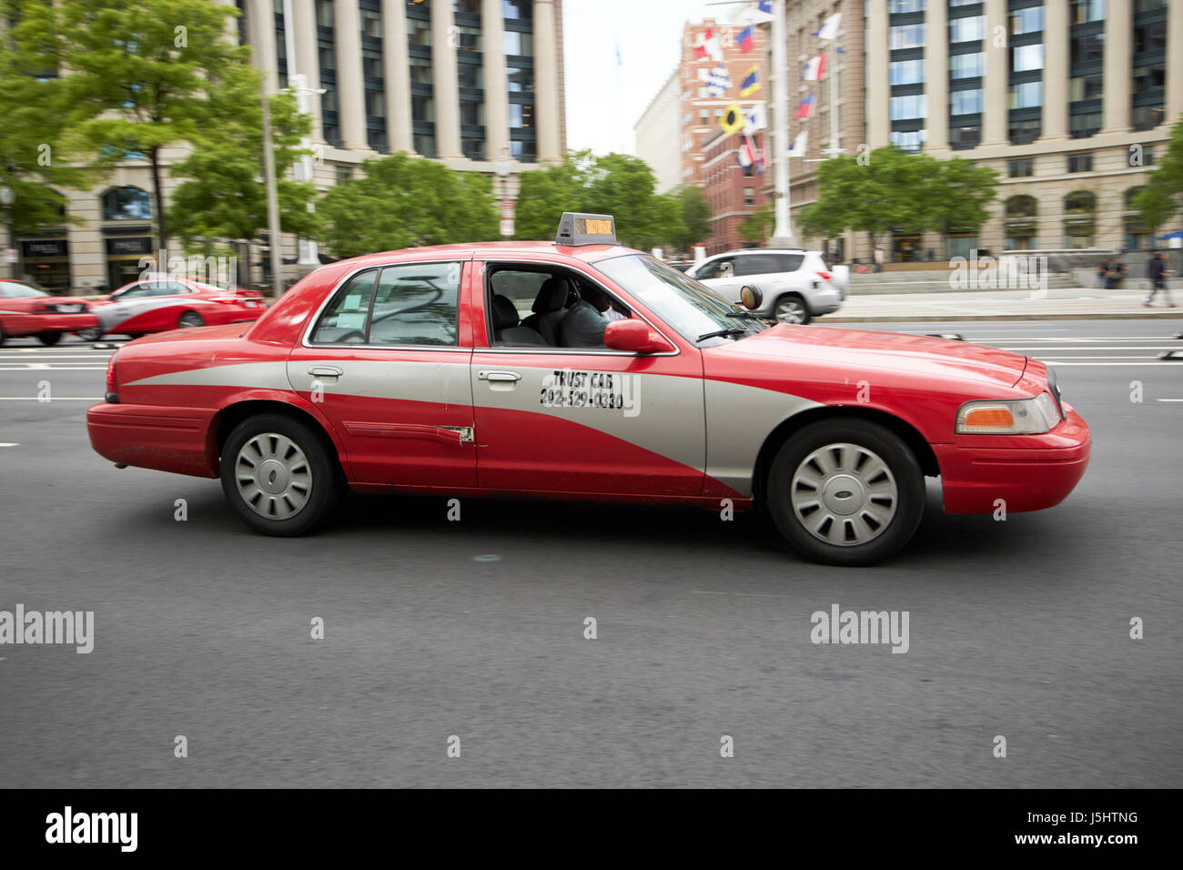
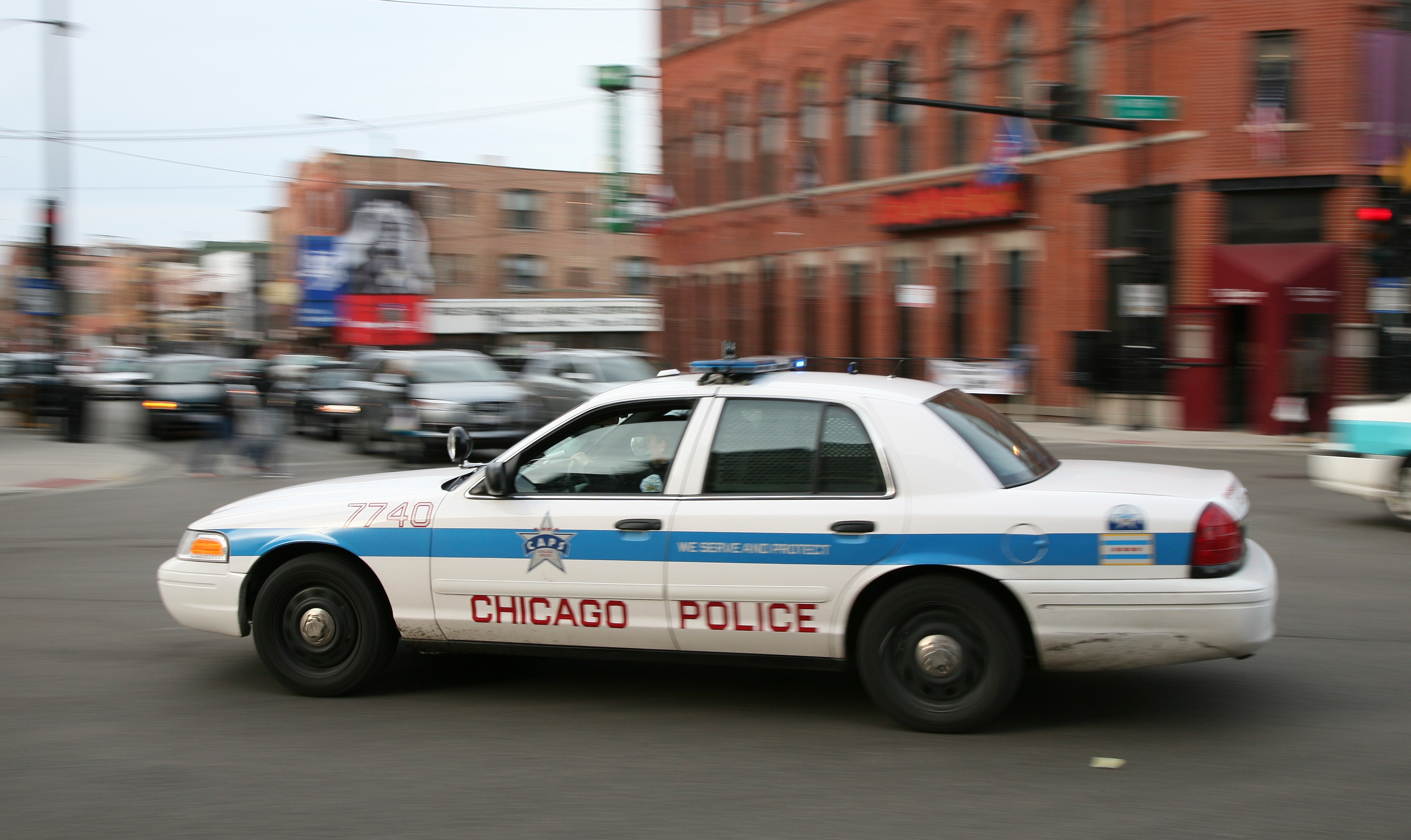
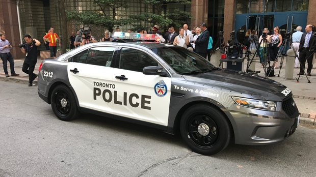
Police cruisers and taxi cabs tend to have very distinctive appearances from one major city to another, at least in the United States.
New York taxi
Washington taxi
New York police

Washington police

Chicago police
Los Angeles police

Boston police

Philadelphia police

Toronto police
Ohio sheriff

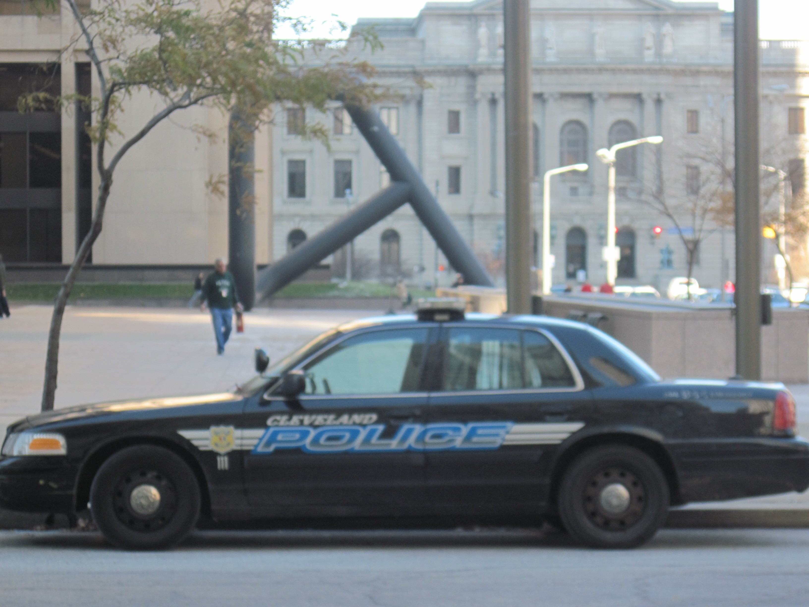
Cleveland police
Not so much a geographic inaccuracy, but there was once a TV movie about John Wayne Gacy starring Brian Dennehy as the killer. There was a scene where the detective was talking to one of the victims’ mother in the boy’s room. And on the wall was a poster of Ryne Sandberg of the Chicago Cubs…
…except that Ryne Sandberg’s rookie year with the Cubs was 1982, and Gacy’s last murder was in 1978.
One of the few things they got right about my home town in Emergence was the design of the police cars.
I happened to catch part of a show called the Blacklist on Friday on NBC. It wasn’t really my cup of tea, but anyway.
Much of the drama of that episode centered on a character who was supposedly at the “Silver Spring Train Station” in Maryland. We would call it the Silver Spring Metro Station but ok. The lighting and seating didn’t look right. For one thing, I don’t think there is any indoor seating.
The worst was that they made a sign the showing the position of Silver Spring on the Red Line. The sign was good in terms of its overall look, but they just made up names of the stations, including one called “Belt Lane”. Why go to the trouble of making a sign and then use madeup names, when they could just google it?
The thing about the train station reminded me of another one from Monk. In the episode where Jason Alexander guest starred as a rival detective, his character suggested the suspect would likely flee by train, not by air, and he suggests they check Millbrae and San Bruno. And sure enough they find the suspect in the lobby of some grand old art deco train station in one of those cities. Except there are no long distance trains that leave from either of those cities, or any city on the San Francisco Peninsula. The Amtrak trains all run through the East Bay. The only train on the San Francisco side of the Bay is the CalTrain commuter line. While it’s possible to take CalTrain to San Jose and connect to Amtrak there, CalTrain stops are just outdoor platforms, not the sort of station depicted in the show. And it was strongly implied the suspect was catching a long distance train and not a commuter train anyway.
But who wants to watch a scene with people wandering around a train “station” that’s just a slab of concrete?
But wait, why couldn’t they have said “He’s fleeing by train… quick, we’ll catch up to him at the San Jose station!” (or, insert your choice of decorative station building)…
I’ll never forget/forgive Justified for its description of a murder in the first episode - that occured on a rather large bridge over the (presumed) Ky River.
It occured - “East of 75 on Tates Creek Road” -
-
Lexington is almost entirely WEST of I-75 - there may be a piece of Fayette County that is East of 75 (no doubt there is , but it ain’t much)
-
Tates Creek Road runs South from Central Lexington past the Ky River - but there is no bridge, it is a Ferry - the only one that runs in the area - in any event - it, like much of Lexington, is WEST of I-75.
THere are a number of other issues with the geography in the show - mostly related to travel times to the area (Harlan County) taking what seems like minutes instead of the 2+ hours it would actually take. Pine Mountain is on the border with Tennesse (and actually well East of I75).
Isn’t it remarkable how much train stations in television and movies look like LA’s Union Station? ![]()
There is a surprising amount of movie- and TV show-related tourism. The general public wants to visit the places they’ve seen in their media. The advent of Google Maps, et al, plus cheap travel (pre-COVID), makes that trivially easy for the common Everyman, not just geo-geeks.
This whole thread is about places that are mostly real. And the liberties taken in geographical plausiblity.
Anyhow, if the producers of a show use actual locations as-is with their real names, they are causing, sure as sunrise, a steady flow of gawkers to that street corner or train station or whatever. Which is a bit impolite. By munging up the names, faking the maps, etc., they prevent these mass pilgrimages.
Speaking of Union Station, was there ever a train leaving there that went out of its way to make a stop in Anaheim before proceeding to Azusa and Cucamonga?