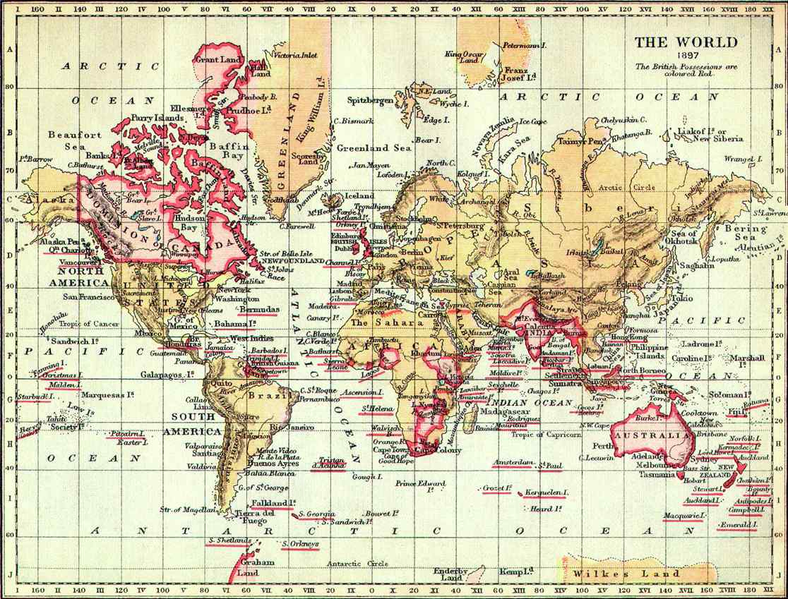
I was reading up on the history of colonial Africa when I discovered this image, purportedly a map of British dominions at the end of the nineteenth century (the queen in this case being Victoria). Link.
The picture is small, but large enough to see a wide red strip across the northwest edge of Greenland. I can’t find any other evidence of a British claim or presence in that area; what’s the story here? A British claim since renounced? A secret British Inuit Protectorate? Simply a mistake on the map?
If you look carefully at the map in Tapioca Dextrin’s link, the coast south of “Prudhoe Land” is dotted, indicating that it hadn’t been surveyed and people might not have been sure whether the coast to the north was part of Greenland or a separate island.
Looking through the wiki entry on Hans Island (which is still disputed between Greenland and Canada, it says that the coast of Greenland wasn’t fully surveyed until the 1920s and that “In 1933, the Permanent Court of International Justice declared the legal status of Greenland in favour of Denmark”. The History of Greenlandarticle mentions Norwegian and US(!) claims on Greenland, but nothing about anything from Canada or Britain.
If anyone wants to wade through the original court documents, they are here
It looks to me like that there was a big swath of unknown land up there with no white folk, so the crafty Brits claimed via a painting on a lunch box (there was also a history of British explorers trading with local Eskimos, with no intervention from the Danes), while the even more crafty Danes used International courts and junk to press home their claim.
The US claims come from Peary’s expeditions in that part of the world, but it looks like the US dropped its claims when Denmark gave the the US Virgin Islands.