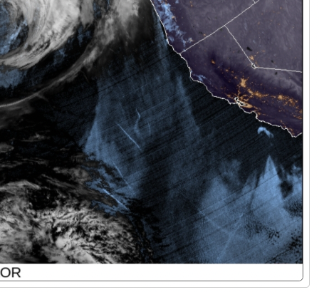
That’s interesting. Boat wakes? They look very straight, paralleling the lines of latitude
Can you say exactly where in the loop what you’re talking about appears?
I see latitude lines appear and disappear, which must be a setting that changed. They clearly are not caused by boats because they are parallel and also go across land.
So I’m wondering if that’s it, or if it’s something I’m missing.
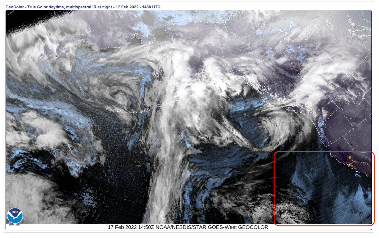
The lower-right corner, off the California coast. This satellite loop updates fairly often. If you go to the site, you can increase the time span. Try this
Damn those fucking lines. Damn them to Hell!
(Wait—was this supposed to be in the pit?)
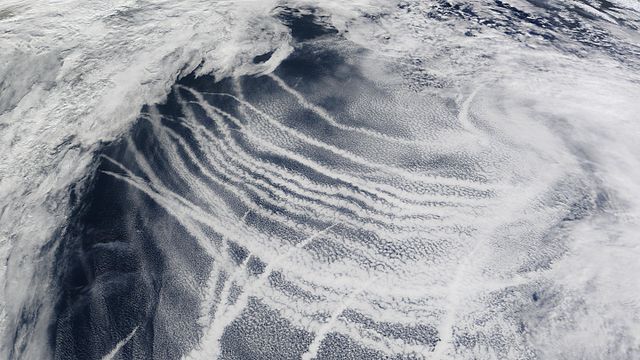
Not boat wakes. The condensation from the ship’s engines. Not sure what you mean by paralleling lines of latitude. But it doesn’t make sense to me that ship contrails would show up on this satellite loop. You can’t see jet contrails. It would not surprise me if someone is trying to make it rain in California. I hope that doesn’t have bad side effects…
Not sure…I haven’t ventured much here. But I don’t want to be know as a conspiracy guy. That’s why I came here.
A time stamp would be good, or a screenshot. All I’m seeing are a flash of latitude lines or similar.
OK, I clicked the link. Like a sucker. Am I on Candid Camera?
Yes!!
Curiously I can’t see anything in the links posted by the OP, but ship condensation trails do exist, and look like this.
They are just caused by the water vapour and particulates from the smokestacks.
I’m pretty sure you’re mistaken here.
I think you’ll find they’re isobars.
I’ve seen them on the weather forecast.
Screenshot it and put up a link with what you are talking about circled. I don’t know what you mean for sure but if you mean what I think you mean, I have trouble believing you are serious. But maybe I’m not looking at the same thing.
Are you talking about this bit?
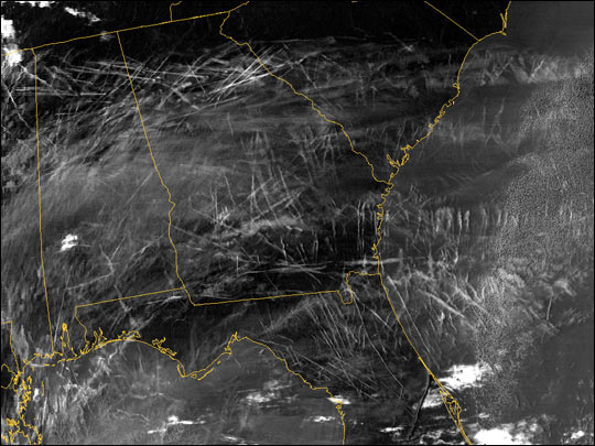
I’m not sure if you mean that jet contrails don’t show in general or in this specific satellite loop. If it’s the former, yes they do:
If it’s the latter, ships tend to sail at a much lower altitude than jets and so the atmospheric conditions are different and may be conducive to producing contrails for one but not the other.
If you go to windy.com you can see pretty much every atmospheric and oceanographic condition anyhwere in the world in real time. The waves off the west coast are mainly in parallel lines at a 90 deg angle to the coast in the area where Richard_Pearse zoomed in. I bet the wave crests and troughs would create those light and dark stripes.
never mind!
Gas turbine engines run pretty lean, with an air/fuel ratio generally going no lower than 60:1 (a gasoline-powered car operates at about 14:1) - so, not a whole lot of water content per unit volume of exhaust gas. Even so, when operating at cruise altitude, the ambient temp there can be low enough to cause that moisture to condense, producing an aircraft contrail.
Diesel engines, as on a large ocean-going vessel, can operate at an air/fuel ratio as low as 20:1 at full load. It’s good hot exhaust, and with such a large volume of it, it can cohere and rise through calm air to altitudes where it cools and causes the moisture to condense into a ship track.
If you don’t want to be known as a conspiracy guy, then don’t post stupid shit like this: