I have always had a fascination with maps and geography, even as a small child. I used to have a globe with me which I constantly look at. I also love history, which goes hand in hand with maps.
In my small apartment here in China, I have maps of the World, a large map of Vietnam, a map of China and other smaller street maps and road maps in Chinese and English.
We human beings have subdivided ourselves into nations and states (or provinces). Some nations and political divisions are natural and logical, some are crazy paychworks and others have extremely odd shapes. Some are long strips of land, while others are tiny microscopic places. A continent by continent breakdown of strange looking nations.
SOUTH AMERICA.
Chile. I start with South America (SA) because Chile to me wins top prize for an unusual looking political state. It has a 3000 mile coastline (long) and is about 100 miles wide. Deserts in both the north and the south, with most of the people living in the center of the country.
http://www.odci.gov/cia/publications...k/geos/ci.html
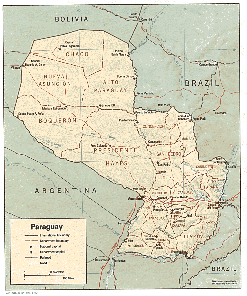
Paraguay. Not to be confused with Uruguay. Nation looks like a penis. Somewhat of a backwater place that had the same dictator for about 50 years until recently. P.J. O’Rourke, the writer, wrote a chapter in one of his books about going to Paraguay and really enjoying the food and the culture, and making fun of the tinpot General Stroessner (the 50 year dictator)
http://www.odci.gov/cia/publications...k/geos/pa.html
NORTH AMERICA
Central American nations. There are seven small nations composing of Central America, and I have wondered why these nations are so small and why these countries just do not merge together with a common currency and a common police/military. The peoples of these countries are similiar, and they all share a similiar background, culture and history.
EUROPE
Lichenstien, Luxembourg, Monoco and Andorra. Lichenstien is a tiny, tiny nation between Switzerland and Austria. Only 33,000 people live there. Another writer, Bill Bryson went to Europe and wrote a book about it and said that the people of Lichenstien were all basically rich Hapsbergs and he did not feel that welcome. Luxemborg lies between Germany, France and Belguim. Andorra is a tiny spot between France and Spain in the Pyrenees Mountains. Are all of these nations just left over from the Middle Ages, and the Papal States?
http://www.odci.gov/cia/publications...k/geos/lu.html
http://www.odci.gov/cia/publications...k/geos/ls.html
http://www.odci.gov/cia/publications...k/geos/an.html
Norway. Europe’s long narrow strip country. A cold rugged coastline. Unlike Chile, Norway is very valuable due to the oil and gas deposits in the North Sea.
Croatia. Looks like an alligator jaw, with Bosnia in its mouth. Almost landlocks Bosnia out of the Adriatic. This border shows the pettiness of Mankind, and how we are more geared for our own self enrichment and distrust to hostility to our neighbors instead of trust and mutual cooperation to share the waterway. Probably the most pathetic border. Unnatural and artificially conceived.
http://www.odci.gov/cia/publications...k/geos/hr.html
AFRICA
The Gambia. A tiny nation with a river flowing through it (The Gambia River). Totally surrounded by Senegal, which is a small nation itself but is huge around The Gambia. Note that the correct name for this backwater is THE Gambia.
http://www.odci.gov/cia/publications...k/geos/ga.html
Togo. Tiny, narrow strip of a country, bordered by Benin in the east and Ghana in the west, both Ghana and Benin also small nations squeezed by other small impoverished nations west of Nigeria on the Gulf of Guinea. Their leader, a one Gnassingbe EYADEMA, was overthrown by the Togolese people for having a name larger than the country. Supposedly this was against tribal customs. To note, I met a Togolese once, and he was the darkest black man I have ever seen. He made Samuel L. Jackson look Swedish. To wit.
http://www.odci.gov/cia/publications...k/geos/to.html
Mali. Large, landlocked, strange looking place that few people care about. Basically owns a lot of worthless land in the Sahara. It shares a border with Mauritania, probably my favorite nation name. If you get a chance to see Michael Pallin’s (of Monty Python) “Sahara”, please watch it. It will actually make you want to go there. Bamako and Timbuktu are in Mali.
http://www.odci.gov/cia/publications...k/geos/ml.html
Equatorial Guinea. the only nation in Africa to speak Spanish as a first language. Basically a small square of land in Africa and a small island off the coast. The capital is on the island. Has oil. Probably will never see it.
http://www.cia.gov/cia/publications/...k/geos/ek.html
Namibia. Actually a very straight forward looking square block nation except for its Northeast where there is a small strip of land that stretches east to Zambia. There is a town called Katima Mulilo at the end of it near Zambia. What is that strip of land? Why was it drawn this way?
http://www.odci.gov/cia/publications...k/geos/wa.html
(There are other weird looking ones in Africa, if this thread grows legs, I’ll add more.)
ASIA.
Afghanistan. Fairly rounded out sized borders except for a small strip of land in the Northeast that stretches out to touch China. It is called the Wakhan Corridor. Why was this nation drawn like this?
http://www.odci.gov/cia/publications...k/geos/af.html
Burma. Myanmar. The southern leg of the nation that borders the Andaman Sea. Almost cuts Thailand in two. Has this territoy been a contention of these two nations in recent times?
http://www.odci.gov/cia/publications...k/geos/wa.html
Brunei. A tiny, wealthy oil state on a large island occupied by three nations (Brunei, Indonesia and Malaysia) Indonesia (especially) and Malaysia are much larger poor nations surrounded by this oil rich state that floated to far away from the Middle East.
http://www.odci.gov/cia/publications...k/geos/bx.html
Malaysia. Is that peninsular Malaysia or island Malaysia. Why is it like that?
http://www.odci.gov/cia/publications...k/geos/my.html
UNITED STATES
West Virginia is probably the oddest looking state in the USA. My question is that spike in the northern part that splits between Ohio and Pennslyvania. Why did the Virginians draw that? is there valuable land there?
The Missouri Bootheel. Why is there a Missouri Bootheel? It consists of two counties in Southeast Missouri. How come this land belongs to Missouri and not Arkansas? Why did the boundry dip south at the Paragould river?
Oklahoma Panhandle. Why was this drawn up like this?
Idaho Panhandle. Same question.
Michigan Upper Peninsula. Why is this part of the state of Michigan when it is clearly part of Wisconsin? Of course, this could blow up into a conversation of why Wisconsin is not part of another state or blah, blah, blah, but I think the UP belongs to the wrong state.
Anything to add, please do. I love geography!

