Non-american here, will be delighted if anyone could come up with a helpful explanation of how and why most of the mid-western states are squarish while those especially in the east are more irregular in shape (as seen on a typical map)?
I’m not American, but as I understand it, it has to do with how the USA was settled - from east to west. In the east, there was already a relatively high population when the state boundaries were drawn up, so the land had been well surveyed and physical boundaries (rivers, mountain ranges etc) pinned down.
The interior was still more “uncharted territory” when a lot of the states were formed, so it was easier to define boundaries in terms of lines of latitude and longitude, which could later be surveyed on the ground (with varying degrees of accuracy).
That is a very simplified explanation, which I’m sure others can add to.
There is an entire book on the subject, C-Span featured it some time ago.

You can’t really make geographic borders when you don’t have a geography.
It’s not just the states – it’s partuicularly striking when you look at the counties that make up those states. Even in non-square states they tend to be square. Look at the ones in the central US – Texas, Iowa, Neraska, etc:

Of course, it’s because the original states relied heavily on rivers and other natural features as boundaries*. Straight lines tended to be easily-measured latitudes (as in the Northern boundary of Massachusetts). Out West, though, there weren’t so many major rivers, and in a lot of areas, no mountain ranges, either. If you’ve driven across Iowa or Texas, you can appreciate why they’re made up of rectangular counties.
And it gets even squarer when you go to the level of the township. In the Northwest Territory, starting in Ohio and moving westward, townships were surveyed as 6 miles by 6 miles, and subdivided into one-mile squares. Counties were then built up of 10 or so townships. If you look at a large-scape map or aerial photograph of almost anywhere in the Midwest, you can see those one-mile squares and six-by-six-mile squares, because the roads go on the edges. Before that, the surveyors (including young George Washington) were moving through Appalachia, where there were lots of mountain ranges and rivers to mark natural boundaries. However, past Appalachia, the land was mostly pretty flat.
*I forgot to add my footnote.
There are some weird exceptions to the rule of “natural boundaries” in the East, though. The one that amazes me is the way the Hudson River – a great, big, hard-to-cross natural boundary if ever there was one – is not the boundary between anything (except for dividing a bit of northern New Jersey from New York). The boundary between New York and one of Connecticut, Massachusetts, or Vermont lies twenty miles east of this big natural boundary, and I can’t see any good reason for it. I’ve certainly never heard about it. I suspect it’s the result of the big powerful colony (and later state) of New York throwing its weight around and asserting that it ought to have both sides of the river, not just one.
Here are two excellent references on the PLSS and how things were shaped for most of our land area:
[ul]
[li]Wikipedia’s PLSS article[/li][li]Rectangular Survey System[/li][/ul]
Originally, of course, New York was New Netherlands and when the British settlers of Connecticut were arguing about the boundaries of the two colonies, the Dutch, who had already settled the Hudson Valley, (on both sides), insisted that their jurisdiction remain over their people. When the British took over the colony, the new landlords saw no reason to give up land (and property taxes) that had been held by their predecessors, so various compromises were worked out. (The border was re-negotiated multiple times.)
In cases where the Western borders of states followed natural boundaries, (rivers or mountain ridges), there were, generally, no significant number of white settlers on the far side of the boundary. In the case of New York, there was an established community on both sides of the river before the matter of boundaries even arose. Kentucky/Virginia was a bit different in that the British had already placed a “sort of” Western boundary on Virginia in 1763. At the end of the Seven Years/French and Indian War, the British, hoping to reduce the number of settlers they had to spend money protecting, declared that Virginia’s Western boundary was the Atlantic watershed and negotiated that with the French and Spanish. Of course, the Virginia governments, (first the Royal governor and later the state assembly), did not like the idea of losing control of the lands West of the Appalachians, so there was a bit of fudging over the next 36 years, (including seven years of wrangling after Kentucky became a state), until the current boundary, partly riverine and partly surveyed, was established. The North Carolina/Tennesse boundary was originally defined by a series of mount tops and ridges that made East-West communication difficult.
Westerner here, chiming in. Looking at a physical map, there are actually plenty of natural features had they chosen to bother with them:
The main reason wasn’t that the land was empty of natural boundaries but that it was largely empty of people (except for the indigenousness peoples, of course). For example, the western edge of the Louisiana Purchase barely exists today as a political boundary, although it was well defined, if not particularly well surveyed:
From my reading of the history, it was just easier to carve up the land by latitude/longitude and leave the nitty-gritty surveying for later. Unless one has walked the entire length of a river and determined which tributaries constitute the “main” course, rivers are rather useless for boundaries. Same goes for determining mountain divides as they all come down to determining drainage basins. The advantage of using latitude/longitude is that it allowed anyone with basic navigational instruments to at least determine if they were in say, Colorado or Wyoming.
Looking at a map of the states, there are several lines of latitude of note as they form parts of the boundaries of these squarish states: Forty-nine degrees North which forms the northern border with Canada for most of the western states was established by treaty with the British. (We wanted 54-40, they wanted 42, so we split the difference more or less.) And speaking of 42 (the northern boundary of California) well, that used to be the northern extent of Mexico. 32 degrees North is apparently important as well (it’s the one that runs through Four Corners) but I’m not as familiar with that history.
And of course one of the problems with this is that we now have some terrible boundaries in places. You have people NW of the Grand Canyon who do all their shopping, etc. in Saint George, Utah instead of anywhere in Arizona, because of one of the worlds largest natural barriers sits between them and any towns of note in Arizona. Anyone who had ever even heard a rough description of the area would have made the Grand River (now renamed to the Colorado River) the border. And there are dozens of other places like that once you get west of the great plains.
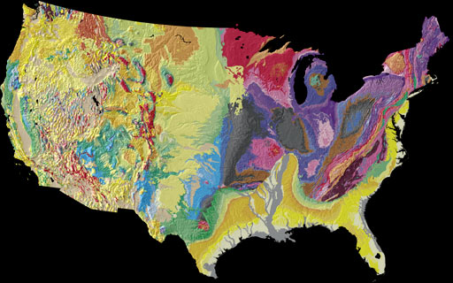
Notice a difference from the older south eastern part and the west?
I was told it had something to do with earlier French settlement vs. later.
The two “square” states have plenty of geography. The Rocky Mountains cut right through both Wyoming and Colorado (and Utah, for good measure). It’s not like eastern states have no straight lines between them.
Well, you can see that the Hudson does separate the counties in NY, forming the east and part of the north border of Saratoga County with Warren County and then splitting all of the counties once it turns south again, starting with Saratoga and Washington and going all the way down until it reaches the ocean/NYC.
On a map, rivers look like “natural boundaries,” but in real life, rivers were highways of communication and commerce. It makes more sense from a socio-economico-political point of view to center a jurisdiction on a river rather than divide it there.
But it usually didn’t happen, at least in the US. Look at how many rivers do serve as boundaries. New Jersey is bounded by two rivers. The Connecticut River divides New Hampshire from Vermont, and so on. The Mississippi serves as boundary for lots of states.
Back in the days before easy bridge crossing of such wide rivers, they served as clear and obvious borders. As Darth Panda notes, they separate NY counties, even if the state spans the river. Connecticut and Massachusetts span the Connecticut River, too, so it’s not an invariable rule, but its application is pretty obvious. In the case of larger rivers, I think it’s more the rule than the exception.
Two big examples are the Ohio River and the Mississippi, both of which are state boundaries for almost all of their length.
In the case of the United States, I think it’s proof that the boundaries west of the original 13 colonies were arbitrarily drawn prior to settlement. The Pittsburgh situation makes much more sense than the Cincinnati or St. Louis situations.
However, in each case the river concerned was so wide that as early settlement developed the only way to cross the river was by boat. The first bridge at Cincinnati between Ohio and Kentucky was built in 1866. While the Cincinnati metro area spreads well into northern Kentucky now, there isn’t a clear natural boundary for its southern edge: the Ohio River remains the most obvious boundary here.
And there’s another interesting case of a large metro area being split by a boundary along a river: the Detroit-Windsor metro area, where the Detroit River is an international boundary. Would it make sense for the boundary between Michigan and Ontario to be moved to the east, so that Windsor could be part of the U.S.? I doubt if the citizens of Windsor would agree.
A lot of people used boats back then.
There are plenty of borders that are drawn in the absence of “clear natural boundaries.” It’s a false concept.
Of course they wouldn’t agree now. How is that relevant to the original drawing of boundaries?