Whatever became of the cockpit navigator?

It sounds like a joke that needs a punchline.

In the old days, a flight crew consisted of a pilot, copilot and navigator. As far as I know, the navigator is no longer needed. A global beacon system provides guidance info and the computer on board tracks the plane and guides it to its destination.
What did the navigator do? Navigate of course but did he do so as a ships captain might with charts and rulers etc. Were navigation beacons not as accurate back them. With all the variables acting on the aircraft, with what level of certainty could he do his job? Was it OK if he got the plane in the vicinity of NYC or did he guide it straight to the landing strip?

Civilian navigators became redundant via technological advances, military navigators morphed into Combat Systems Officers, and Flight Officers which handle lots of mission/weapons critical stuff other than navigation.

See Aviation History—Demise of the Flight Navigator

Not exactly what the OP was asking, but still a bit relevant …

Through the early 1950s, the typical long range transport crew consisted of a pilot, a co-pilot, a flight engineer, and a navigator.

On civilian airplanes, the navigator was replaced by technology in new designs starting about 1950. Naturally it took a few years for all the older airplanes to be replaced, but the last of them in common civilian use probably went out by 1965.
The flight engineer was first removed from civil transport designs with the DC9, 737, and similar European models in the mid-late 1960s. And while most flight-engineer eqiupped airplanes have long since been recycled, there are still many 727s and older 747s plying the second-rate skies with a flight engineer on board.

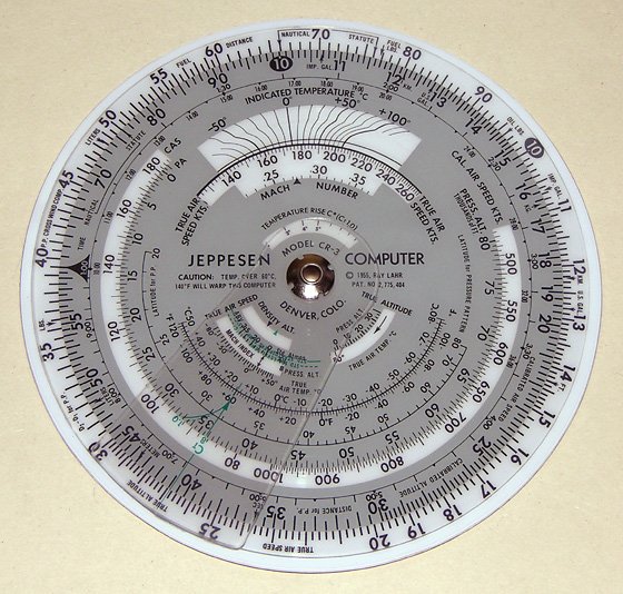
As to how aerial navigators did their job in the heyday, it was a combination of celestial navigation and dead reckoning, coupled with some Kentucky windage based on weather forecasts & pressure patterns. Their job was to get the pilot across the ocean or large areas of uninhabited terrain and within a hundred miles or so left or right of course as they approached landfall or civilization.

That was close enough to pick up the primitive radio beacons of the day, at which point the pilot could hop-scotch from one to the next without major assistance. In good conditions one could cross the Atlantic and arrive +/- 10 miles of the intended track, but 30 was more common.

Even when using radio nav as primary, the navigator was invaluable for providing adjustments for wind, as well as keeping track of time and distance. Given the very finite supply of fuel onboard any airplane (then or now) knowing when, and with how much fuel, you’ll get there is critical decision-making information. The flight engineer might have charge of how much is aboard at the moment, but only the nav had the tools & training to figure future predictions.

Nowadays much if this is handled by computers, but every professional pilot has at least the rudiments of old fashioned navigation in his/her head and at least a rough set of those old calculations are still done by hand on paper on most oceanic flights. You’ve never been lost until you’ve been halfway across the Pacific paying no real attention to the numbers on the screens, when suddenly they all go dark & stay that way.

This is a decent start into thetopic Air navigation - Wikipedia

They had navigation beacons back in the days of navigators but they required more input from someone on the aeroplane. I believe that the old NDB receiving equipment required someone in the aircraft to physically turn a handle to get the best reception. There was also a system where two different morse code signals were transmitted either side of the required track, the pilot would maintain track by keeping the respective signals at the same strength as each other. That’s actually very similar to how an ILS works now but the ILS receivers process the information themselves and display a visual representation of the required track and glidepath.

Navigators were used for the long distances between the beacons where there was no reception, for example on long overwater flights where astrological sightings had to be made to confirm position. Navigators would also use time/distance style dead reckoning between positive position fixes. So they’d use something for a positive fix, beacons, astrological sightings or just a visual fix over the ground, then set a course until they got another positive fix. From the second fix they good work out the effect of the wind on their speed and course and make a correction to maintain the desired track.

When I was learning to fly in the early 1990s we were taught visual navigation by visual fixes and dead reckoning. I flew in an area surrounded by mountains, valleys, power lines, railway tracks and other strong visual features so it was generally much easier to just fly up a valley until reaching a certain set of pylons, then following them to the main road etc. Now, although visual techniques are taught, GPS receivers are becoming more and more common on private VFR aircraft so the old navigation skills are falling into disuse. Any pilot with a half a brain still carries [url=http://www.stefanv.com/aviation/flight_computers/cr.jpgone of these.

As far as what happened to the navigators, I suspect some of them joined the pilot ranks, some became flight engineers (now also obsolete), and others would’ve gone on to aviation related jobs that made some use of their skills. Some would’ve left aviation all together.

Old airliners could have up to five crew in the cockpit, pilot, co-pilot, flight engineer, navigator, and radio operator. The last three of those positions have been designed out of modern aircraft.

Disclaimers: I’m a pilot but not an old one, most of what I know of the 50’s is what I’ve read in books such as Ernest K. Gann’s Fate is the Hunter which I highly recommend.

On preview: what LSL Guy said.

fixed link.

At the bottom of the first page of this PDF is a good picture of a Stratocruiser cockpit. Compare that to the A380 pictured here. Of interest in the A380 picture, there are no analogue dials, they’ve all been replaced by computer screens. Even the standby attitude indicator (artificial horizon), to the top left of the central screen, is a small electronic display. There are screens that can display a video image from several cameras around the aircraft. The central one is showing the tail camera image. Controls are operated via a sidestick that has no direct connection to the control surfaces. Screens either side of the pilot’s seats are for an “electronic flight bag” and can display enroute charts, approach charts, etc. There are three “jump seats” but these are for non essential crew members such as checkers, trainers, 2nd officers, and so on. Note also the heads up display in front of the captain’s windscreen.

It’s been small steps, but aviation has come a long way in 60 years (not to mention the internet which can bring us a panoramic image like this.)

I am starting to run into PVT pilots that can’t fly cross country using only a map. My jaw keeps hitting the floor.

Mine, too - aren’t map reading skills and ded reckoning still on the private pilot test? Good lord!

Me, I enjoy the challenge of map-and-compass eyeball navigation. But then I’m weird. I carry paper maps when I drive, too

The ocean hell, losing a GPS at night is a real eye opener when you’re flying a plane that will immediately bank over at the slightest of breezes. I can’t plot my position on a map without taking my hands off the yoke for a few seconds and it’s damn hard to do that at night without a periphial reference point.
I had that happen to me as I was following the back of a thunderstorm and the “dammit” factor shot up pretty quick. Had I not gotten into the habit of locating the closest airport every 5 minutes I would have freaked out. Yes, the maps were “close by” but I was relying on the GPS for all my navigation needs. It’s hard enough to read the maps in the day time. I wouldn’t fly at night without a GPS and a loran to back it up. The loran’s a pain in the ass to program on the fly but the “panic” button gives me the closest airport to fly to.

I’ve heard a lot of navigation horror stories from the old timers. God bless the GPS system.

B-52s have navigators and they are still the main bomber (without stealth) for the USAF. Also I believe C-130s still use navigators and the USAF has plenty of those and they are still buying new ones.

My former BIL taught navigation for C 130s in the Air Force. Spherical trigonometry and all.

For a long time during the adolescence of flight, pilots were simply expected to do their own navigation. The Dornier Do X, the monster 12-engine flying boat, was an early exception because it was so complicated to fly and because it was big enough to carry a navigator, as well as a radioman and engineers as surface ships did.

It wasn’t until the advent of 4-engine aircraft, like the Pan Am flying boats or the B-17, that it was considered important enough to relieve the pilot/co-pilot of navigation duties and carry another officer to do that task.

Until the outbreak of WW2 at least, the Army Air Forces did not even train navigators - all were pilots. Soon after, navigation schools were started, and a flight cadet could earn wings as a navigator. The Navy did likewise, though only for a short time.

On the* Bob Newhart show* Bill Daly played Howard Borden who was a navigator for a commercial airline.

Back in the day, LORAN and OMEGA radio navigation required special maps and some concentration to read off the time delays from the display and plot them on the charts. And then, one had to DR from those fixes. LORAN was accurate to within a couple of miles but OMEGA could be off by 30 miles out in the middle of the south pacific where you really needed it’s global coverage. Of course out in the middle of the ocean being off by a few miles wasn’t normally a problem-as you got closer to land navigation improved. But remember all these navigation aids required electricity. If the generator failed, someone had to shoot the sun and look up the data in the navigation tables. Tough to do while flying the aircraft. So, navigators were primarily there for safety and the rare long-distance flights. As reliability improved, it appears the need for a navigator lessened. I have never been part of a flight crew, but did do navigation ships (not a ship’s navigator! research scientist plotting courses for data collection activities).

One interesting thing, there is one famous plane that carries it’s own-Air Force One. According to the NatGeo story: Pilot CoPilot, Engineer, and Navigator. Nothing but the best for the boss.