I was reading about Connecticut geography in Encarta. It says Connecticut is divided into four physiographic regions: “the Taconic Range; the New England Highland, or Upland, consisting of the Eastern Highlands and Western Highlands; the Connecticut Valley Lowland; and the Seaboard Lowland.” The Encarta article also draws a distinction: “Because the Connecticut River leaves the lowlands, the Connecticut Valley Lowland is not identical with the Connecticut River Valley.”
Now this is the puzzling part: The river “occupies the Connecticut Valley Lowland as far south as Middletown. There the river turns southeastward across the Eastern Highland.”
Now let me get this straight. The river flows from the lowland to the highland. Have I got that? The river flows uphill? :smack:
OK, obviously this is not Mystery Hill, or whatever one of those spots where the laws of physics are allegedly reversed. (There was one such place in the Firelands of northern Ohio… coincidentally an district spawned by the state of Connecticut because Redcoats torched several Connecticut towns in the Revolution, and now a vacationland; I remember a lot of side-road [del]tourist traps[/del] attractions in Erie County hoping people would stop on their way to or from Cedar Point. But the alleged gravity reversal was nothing but an obvious optical illusion. I should also mention the Blue Hole of Castalia. It really was a big blue hole! A water-filled sinkhole in the limestone, I believe.)
Anyhow, although I’m sure there’s a perfectly irrational explanation for it, nevertheless it feeds my taste for the surreal or at least the absurd. Was it just an inaccurate account given in Encarta? I’m not sure how reliable a source Encarta is, though I haven’t caught them in any blatant errors before. A look at a topographic map would quickly clarify the river’s true downhill course. Any Yankee geologists in the house with topo maps on hand? My question is: Why was higher ground classified in the “lowland” while lower ground was classified in the “highland”?
It doesn’t say, or imply, that. A river can flow through a highland area without flowing uphill if it flows through a canyon or valley (which is what the Colorado River does in flowing through the Colorado Plateau via the Grand Canyon).
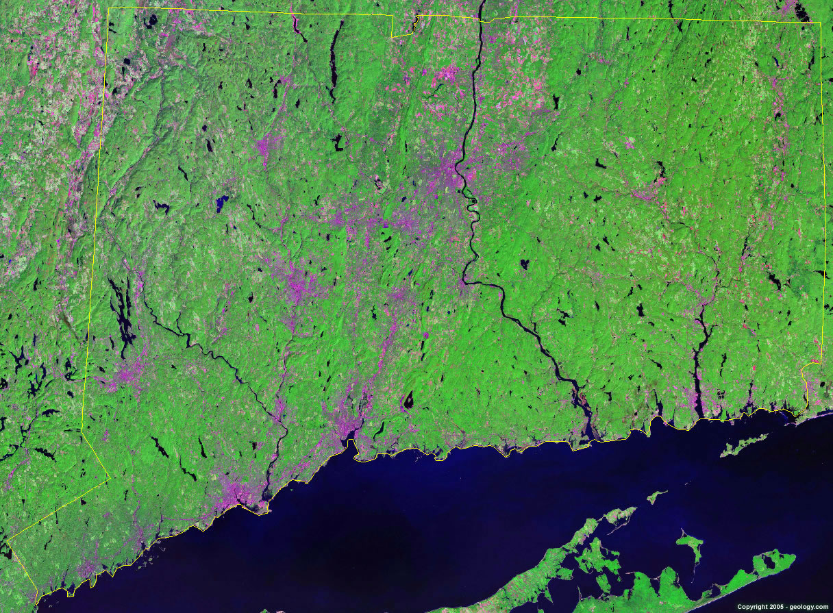
Here’s a map. The course could have something to do with the glacial history of the area.
There was an article in the Hartford Courant a few weeks ago that discusses the fact that the Connecticut Valley is actually a rift valley that predates the Connecticut River by millions of years. In other words, the valley was created by plate tectonics, not erosion by the river. Therefore, there’s no particular reason for the river to follow the valley for its entire course.
Apparently, at the end of the glacial period (about 10,000 years ago), the valley flooded and was dammed up at Rocky Hill (near Middletown). When the dam breached, the Connecticut River took a shortcut to Long Island Sound through a region geologically classified as a highland. The river still goes downhill, of course.
The Columbia River flows thru the Cascade Mountains. (Forming a darn impressive gorge.) It’s one of the few rivers that exits the Intermountain region of the US west. The Snake River also flows thru a group of mountain ranges forming Hells Canyon, one of the deepest canyons in the world. (Makes the so-called Grand Canyon look like a paper cut.)
Mountain gorges. Chasms. Canyons. Of course you’re right, Colibri, I should have thought of that. Mods, you can close the thread now. Asked and answered, as they say.