An interesting side discussion (well, to me anyway) there was about where exactly “East” and “West” are in reference to. A few examples:
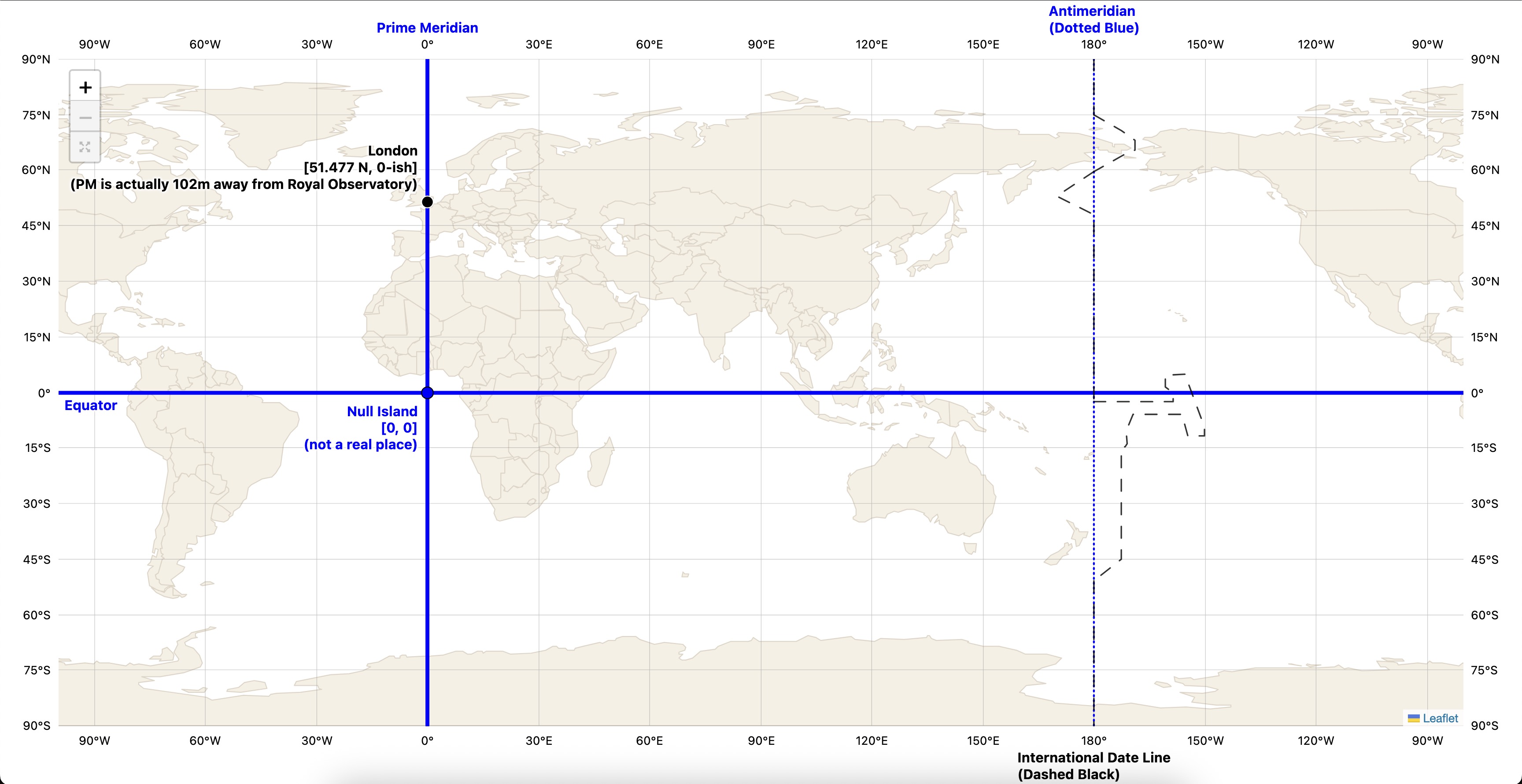
Is this a frequent source of contention? Do people think that the standard conventions aren’t ideal? And by conventions, I mean this sort of thing (or interactive version):
Is there an argument that the typical 0-line (in Greenwich) should not be the divider for what is considered East and what is West?
The current system puts much of Western Europe in the “eastern” hemisphere (viz, which includes China, Japan – you know, the Far East). That kind of sucks from a philosophical/cultural standpoint, but hey, this type of thing is entirely arbitrary so … [[shrug]].
I don’t think this needs to be complicated or overthought. As @Chronos said in the original thread, “There must be two dividing lines between east and west”. Right, and the one established at the International Meridian Conference in 1884 as the standard reference line was the one running through Greenwich, England, defined by universal agreement as the line of zero longitude. Longitudes to the west of it have negative values (or are designated “W”) and those to the east of it have positive values (or are designated “E”).
The fact that the same thing happens at longitude 180° is a necessary consequence of spherical topology, but that’s not the defined reference point.
I think it just seems natural to think of east and west as “beginning” at 0 degree longitude, and “ending” at the 180 degree meridian, so that terms like “farthest” apply to 180 longitude.
I suppose the system could be set up so that it goes all the way to 360 rather than going back down to 179 after 180, although intuitively that just seems wrong / unnatural.
IMO all the confusion started from people thinking in terms of which direction is the shortest direction from where they’re standing to wherever else they’re talking about.
Which amounts to a relative coordinate system centered on their body. Not on an absolute coordinate system settled for the whole Earth.
And some of those folks seemed pretty ignorant (no shame meant) about actual latitude and longitude, so they simply didn’t grok the idea of any absolute reference frame for Earth coordinates.
In almost any field of endeavor there’s a concept of relative or absolute. Whether that’s memory addressing. Or pressure. Or location. Or quantity. Or … .
When people mix the terminology and use relative terms for absolute quantities or vice versa, confusion reigns.
For Mars looks like it is usually done 0 to 360 instead of \pm 180
If someone was born near Greenwich, and didn’t travel much, (say from -1 to +1) this is only 2 degrees of travel
But if someone lived near the IDL, they could go from -179 to +179 which COULD be considered 358 degrees of travel…
As I said in the thread, I think your birthplace (or earliest memory) is you personal zero longitude point for east/west travel.
I’m not sure how much was that, versus knowing about the global coordinate system and simply deciding that their own personal coordinate system was more relevant. It seems odd, after all, that someone born in an Aleutian village who never went more than a mile from home could qualify for both the record furthest east and furthest west.
Ignoring history, there might have been better places to set the Prime Meridian than through suburban London, then and now one of the world’s great cities.
I think that a Prime Meridian that was selected to be generally the middle of the Atlantic and that set the anti-meridian also somewhere in the mid Pacific would have been ideal. So all of Africa, Europe, and Asia would have been Eastern hemisphere, and all the Americas would have been western hemisphere. Say the PM had been set where 25W is now, and the anti-meridian / IDL would therefore be at the current 155E. That would put NZ in the western Hemisphere, and would slice far eastern Russia such that the Sea of Ohkhotsk would be bisected, and the Kamchatka peninsula and points east from there would be in the western hemisphere. So not quite ideal.
But in terms of putting the most people in the sensible hemisphere, it would have been a decent decision. Given of course the essentially random (certainly unorganized) distribution of land around our planet.
I almost mentioned in that thread a former coworker who was born and raised in Kotzebue Alaska. Just walking to school they were far extreme travelers NW compared to substantially all of the human population.
I do agree there are times a personal- or home-centric coordinate system makes sense. Answering “How far have you traveled?” is arguably one of the better use cases for that relative system. That just wasn’t how the OP asked (and clarified) their question.
I was told in the other thread that there is no extreme East or West. I can’t grok that. If I visit and travel the full breadth of Taveuni in the Fiji Islands which is bisected by the 180 degree meridian, is that not my furthest East and my furthest West?
The French did not like that and used their own until 1911. Some time after that, various international organizations adopted some variant of it, with the aid of satellite data, and gave us our present day IERS Reference Meridian - Wikipedia which is close to but not exactly the Greenwich line.
Other countries historically did designate their own prime meridians, but it was more useful for international travel and coordination to have a uniform standard everybody could adopt, if only grudgingly.
I do agree with @LSLGuy that having the PM and AM but in the middle of the oceans and not bisecting a continent would’ve been better. But in fact that very proposal was voted down at that conference:
That the initial meridian should have a character of absolute neutrality. It should be chosen exclusively so as to secure to science and to international commerce all possible advantages, and especially should cut no great continent—neither Europe nor America. (Ayes, 3; noes, 21.)
It was overwhelmingly voted down (for reasons unspecified) by the nations at that conference.
You can keep going east, relative to your current position, essentially forever. You’d just end up circling the glove over and over.
But by longitude, once you crossed the AM, you’d be in the western part even as you kept going east. (This is why I personally think it’s clearer just to use positive and negative numbers instead of NSEW with long/lat).
I think it would be, according to the OP’s criteria in that other thread. Did anyone disagree with that?
It’s like English, another Britishism. Very few people’s first or native language, but the de facto standard in most places for international communications, even in many cases where neither participant is natively English-speaking. Or time, for that matter. UTC is basically the French compromise with Britain’s GMT.
There was no way to please everyone, and Britain was a major international power at the time. The rest is history, I suppose.
There’s nothing stopping any country (or person, for that matter) from coming up with their own meridian if they want to, but good luck getting the rest of the world to adopt it…
I mean, even if it went the other way (say, the prime meridian went through China or Japan or Malaysia or wherever), it still would’ve been useful to have broad international agreement over it so it could be used in international travel and communications.
That it happened to go through London is a holdover from the Age of Sail, but it had to go through SOMEWHERE, and inevitably somebody was going to feel slighted. But that’s still a better situation, I think, than having a hundred incompatible systems and countries unable to precisely describe a place on the globe to one another. Some sort of compromise was necessary and the choice of where that line goes doesn’t seem all that consequential in the end. That the US and Russia were the major contenders in the Space Race only cemented the relevance of the particular systems they favored (at the advent of satellite mapping).
Who knows, maybe in a hundred years a totally different coordinate system will be favored depending on the geopolitics of the time.
In both cases, wouldn’t it depend on where I wanted to go, or fly to in between? I’ve flown west across the Pacific but also flown east over Europe to get to Asia, depending on the airline and stops I wanted to take.
I still don’t follow. If there are dots I’m supposed to connect here, I’m still not succeeding, no matter how far east or west they go…
Are you saying, “thus, there are no absolute directions on the globe, no East or West, it’s all just relative to where you currently are”?
If so, that just goes back to the relative vs absolute directions earlier in this thread. It’s perhaps unfortunate that we use the same set of compass words (NSEW) to describe both the relative and the absolute. Perhaps traveling “spinwards” and “counterspin” would’ve been better. And for example a magnetic compass in Chinese culture “points” south instead of north. But so what? These are still just agreed-upon conventions.
I personally prefer the positive/negative notation, with Tokyo being at (35.69, 139.69) and Los Angeles being at (34.05, -118.25). But even if we shifted the meridian around somewhere else and rotated the numbers accordingly, having such an absolute coordinate system is still useful. What wouldn’t be useful is if “139.69” meant one thing to the Japanese and another to the Americans. I don’t care where we draw the line, as long as we can get international agreement over it.
Or maybe we could say that Tokyo is at longitude +139.69º if you’re approaching from mainland Asia, but it’s at longitude -220.31º if you’re approaching across the Pacific. And of course, Phileas Fogg ended his famous journey at a longitude of +360º, more or less.
Or, to be more mathematical about it, we could say that a longitude isn’t an angle at all, but an equivalence class of angles, and since -220.31º is part of the same equivalence class as +139.69º, it doesn’t matter which you call it.
Unless you wanted to be able actually observe various astronomical objects, take recordings, and then develop logbooks based on those observations to create a body of data around a fixed point or line of reference…