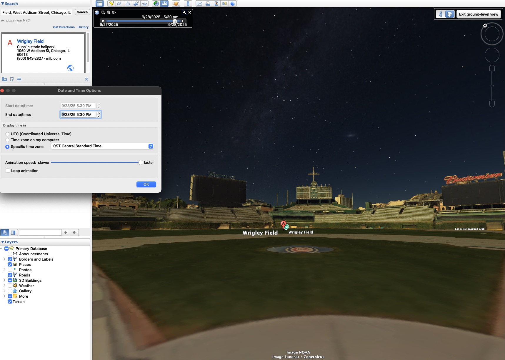
Long story short, I want to visualize just how dark it gets in Chicago on September 28 each year at 5:30 pm, ideally the view would be simulated from home plate at Wrigley Field. I want to know just how dark it was when Gabby Hartnett launched the Homer in the Gloamin’.
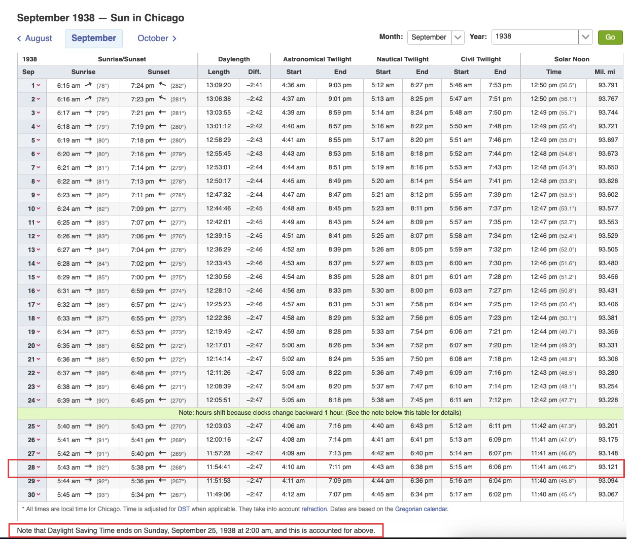
Well, the sun didn’t actually set until seven minutes later, so all you are accounting for is the shadow of the stands. The homer isn’t notable for being hit in the dark, it’s famous for securing the win before the game had to be rescheduled (in it’s entirety) for the next day. The whole Gloamin‘ thing is a poetic turn by a sportswriter.
Google Earth Pro (free) can do that. Just download the desktop app, navigate to the place, and set the date and time and it should simulate the sun.
It would look something like this in the app:
But I think in 1938, Daylight Savings Time would’ve ended earlier in the year (Daylight Saving Time Changes 1938 in Chicago, Illinois, USA), a few days ago. Google Earth doesn’t let you specify the particular year, so to simulate it in 2025 time, I think we have to move the clock forward another hour to 6:30 CST, which would make it much darker:
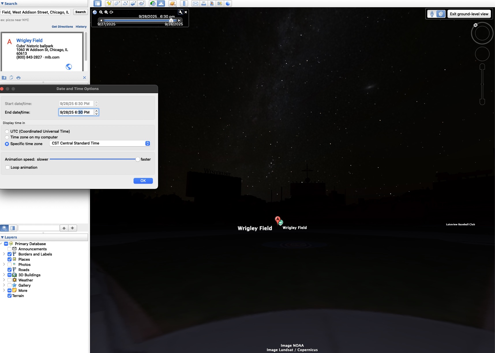
(without the stadium lights, of course… and apparently with a lot more stars than in reality)
Umm, wait, maybe correcting it to 2025 time would make it one hour earlier/brighter…?! I can never remember how to do this right ![]()
@Elmer_J.Fudd is right, though… even accounting for DST, sunset wouldn’t have been for a few more minutes:
So was the rule, at the time, that the game would have to be rescheduled if it wasn’t completed by sunset (local time), according to some standard (the local newspaper, for example)? Or was it at the umpire’s discretion?
Quick note: Upon further testing, I don’t think Google Earth is handling DST correctly (it doesn’t seem to shift sunset correctly, even for 2025). Better to convert to UTC first… (which gives you the first, brighter image, not the second). It’s just a rough approximation anyway.
There was a “canceled due to darkness” rule, but I don’t know who made that call or if it was pegged to exactly sunset.
It’s my recollection that the remainder of a game can’t be canceled due to darkness. Darkness always resulted in suspended games which were resumed from that spot.
I have an app called SkyGuide, it is mainly intended for astronomy and seeing what’s going over your head at night. You can set location and time and data forwards and backwards as needed.
I used it recently to see where the sun would be at different times during the year when looking at houses to buy.
Apparently not the case in 1938.
At the time, the rules did not provide for suspending a game due to darkness, so the game would either be finished that night—or replayed the following day in its entirety. - Wikipedia
Another site says the decision to keep playing was made in a huddle of the umpires.
Looking NE

And in 1938

Wouldn’t that second one be looking SW?
There was some oddness with trying to post the link from Imagur and have both NW and SW views turn up. The images in the links shows a NE and SW picture for both 2025 and 1938 I have no idea about baseball or wrigley field I just looked at the google map overhead and figured the batter was facing NE and pitcher SW
Try PhotoPills
ETAL I know it will do modern stuff; don’t know if it’ll go back to when that game was played, long ago