<?xml version=“1.0” encoding=“UTF-8”?>
<kml xmlns=“http://earth.google.com/kml/2.0”>
<Placemark>
<name>Manhattan Island</name>
<description><![CDATA[Enable <b>Buildings</b> in the control panel below.<p>Enable the <a href=“http://bbs.keyhole.com”><b>Google Earth Community</b></a> layer in the <b>Layers Panel</b> at the lower left. Then click on one of the <b>Information Icons</b> that appear on the screen.]]></description>
<LookAt>
<longitude>-74.0135161531766</longitude>
<latitude>40.70399949812894</latitude>
<range>1136.693225849449</range>
<tilt>71.97876731209369</tilt>
<heading>26.98589710041852</heading>
</LookAt>
<styleUrl>root://styles#default</styleUrl>
<Point>
<coordinates>-74.0135161531766,40.70399949812894,0</coordinates>
</Point>
</Placemark>
</kml>
Uh…I guess linking the coordinates’ image dosen’t compute. :dubious:
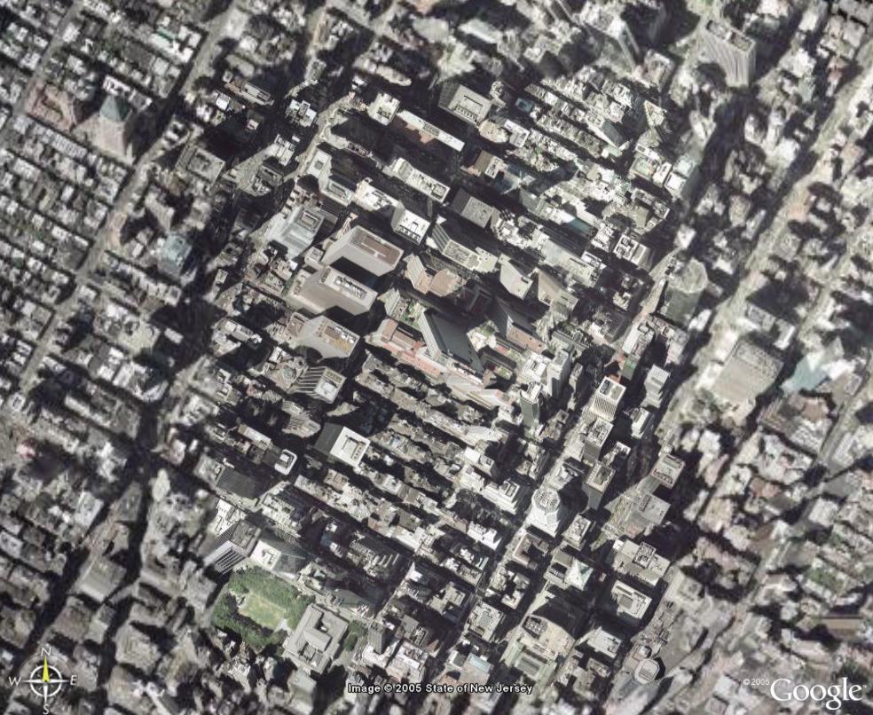
Anyways…look for the tall building halfway between the WTC site and Central Park.
Without seeing exactly what you mean, I’m guessing that you’re looking at two buildings with different angles of tile.
I’ve noticed this in many places too, especially in large cities where the skyscrapers are a giveaway.
It’s just compiled from several different pictures. The plane flying overhead takes lots of different pictures, and they have to be spliced together somewhere.
I deal with this effect at work when looking at aerials of my county. In particular, the condos on the south end of Estero Island lean towards each other.
You get a lot of weird effects from imagery composed of multiple sources. In some places, you can see half a car on the road. In the ocean, there’s a sort of “scan-line” effect caused by the different colors that water will appear depending of the angle of the sun in relation to the aircraft taking the imagery.
OK, I saved the XML in the OP to a file with .kml extension, and double-clicked it, but it took me to a place SE of the WTC site, not halfway between the WTC and Central Park (assuming I’m recognizing Central Park properly, and I think I am).
Enola Straight, maybe if you were zoom completely onto the buildings in question, and do again like you did in the OP.
I don’t think so; some of the ‘stitch’ marks don’t run east-west like I’d expect them to if they were taken from an orbiting satellite, but even if they are taken from satellites, a satellite can only be directly above one point when the picture is taken.
Yes, much of Google maps/earth is made of imagery from the Quickbird imaging satellite which is in 98 degree Sun-Synchronous Orbit. It can generate photos with elevations as low as 65 degrees or so, and often from completely different azimuths. This can be a pain when making mosaics and often leads to discontinuities at the seams.
I didn’t look at the scene in question though. It’s probably aerial photos in a popular city like NY.
thought the thread was dead, sorry.
The spot I tried to link to is a mosaic of at least three perspectives, so the buildings literally seem to rise up from the ground at odd angles and smash into each other.
I found some buildings “leaning” towards each other just about due East of some round building. The coordinates 40º44’53.21"N and 73º59’12.62W that Fern Forest mentioned were spot on. Looked a lot like that.
Maybe do like I suggested in a previous post, zoom completely onto the buildings in question, and do again like you did in the OP. Maybe we can simply save the XML into a .kml file and double-click it.
Hope it’s not too much of a hijack, but you should check out MSN Virtual Earth (now called Windows Local Live or something). While not as quick or user-friendly as Google Earth, actually, kind of cumbersome.
That said, they have certain cities from 45-degree angles. Way cool.
