Eyeball				Miles you
Height in feet			can see
5				2.65
6				2.9
10				3.74
50				8.37
100				11.83
250				18.71
500				26.46
1000				37.42
1050				38.34
5000				83.67
10000				118.32
29000				201.49
100000				374.17
500000				836.66
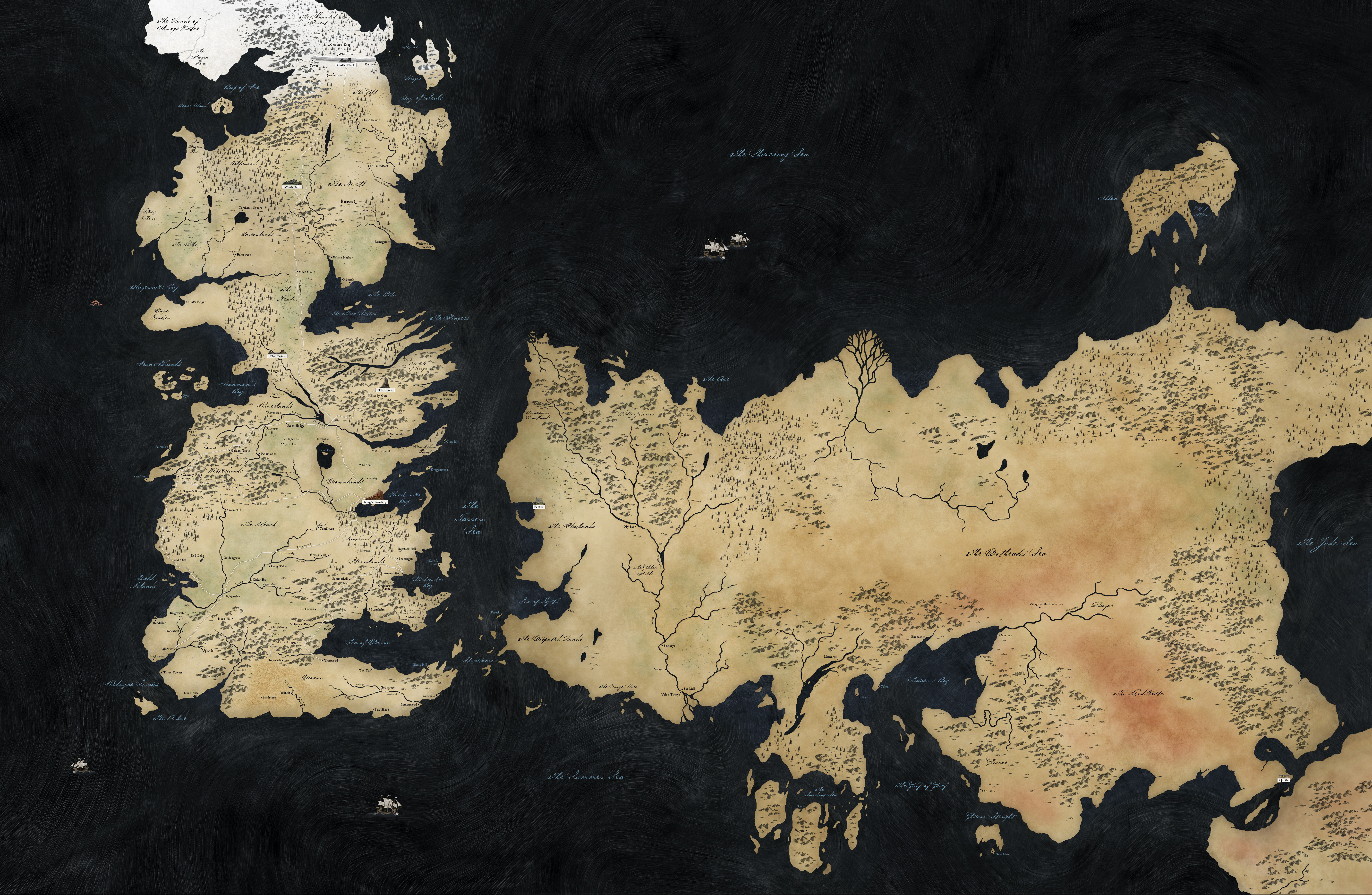
The length of the Wall is 300 miles. How high are the towers on Dragonstone? Anybody want to do some math to figure out if it was possible to miss Euron’s fleet from Dany’s house without gross incompetence?
Shakester makes a good point though about how Euron’s fleet could be out at sea the entire time, and only a single ship would need to sneak in and out of Blackwater Bay to meet with Cersei. They could have made the trip at night and extinguished all lights on board, it would be a lot easier to miss than an entire navy sailing by at noon. So I guess it could work. It’s just a little disappointing that it was handwaved away rather than explained in the show. They used to be a little more detail oriented about stuff like this.
The only real distance in Westeros we know is that the Wall is 300 miles. It looks about right. I just measured (using Google Earth) from Ramsey to Great Yarmouth across the fat part of Great Britain, and it’s also about 300 miles, and looks about the same as the width of the wall in the linked map. I’m not so sure it’s wrong, at least not “by a factor of lots”.
GRRM has always said though that his maps were supposed to be like medieval maps, and therefore fairly inaccurate. So I think we have to take any Westeros map with a grain of salt. The shapes may even be entirely different. For example, here’s a medieval map of Italy (from this page, which has other medieval maps). You can’t even tell it’s a boot. So who really knows what we’re working with regarding the published Westeros maps.
That’s not what we saw when Euron met with Cersei in the first episode of this season. We saw multiple ships sailing towards Kings Landing, although the camera focused on one in particular.
Which was before Dany et al got to Dragonstone. Or it was shown earlier than that in the episode, which means it probably happened earlier. Anyway, my point remains valid; it’s not really a plot hole unless you’re the kind of person that assumes that anything that isn’t explicitly shown is a plot hole.
As some have noted, the writers have been hitting the Skip button to go past prolonged scenes of battle and travel. Given how few episodes are left they obviously have to do that, but it does feel hurried.
The tallest stucture in Westeros is The Hightower, taller than The Wall, at about 800 feet. So <800 feet is how high the towers are.
Made a map assuming The Wall is 300 miles long (included it for scale) from Eastwatch-by-the-Sea to the Shadow Tower and showing a circle around Dragonstone with a 50 mile radius, there’s still plenty of Blackwater Bay. Original map here (warning, it’s big).
Is the Hightower even taller than The Eyrie? How is it easy to march up to Hightower but impossible to do the same to The Eyrie? Not doubting, actually wondering.
If you include The Giant’s Lance, the mountain that The Eyrie is built on the top of, it might be. The drop from the Moon Door is said to be 600 ft, though I don’t know if they said that explicitly in the show. Still looks like a hell of a drop.